Map size in jpg-format: 1051340B
Click to open in high resolution (open in new tab).
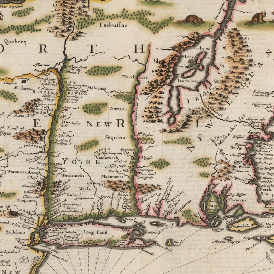
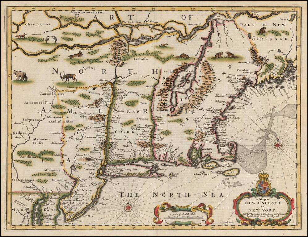
Fine example of John Speed's map of the Northeast, from the 1676 edition of Speed's Prospect of the World.
Speed's map is one of the earliest maps to illustrate dramatic shift from Dutch to English dominance in the Northeast in the latter part of the 17th Century and one of the earliest to use the term New York for both Manhattan (formerly New Amsterdam) and New York State, as well as one of the earliest appearances of New Iarsey (Jersey).
As noted by Michael Buehler, Speed's map shares the traits of many other regional maps of the period: a haphazard depiction of the St. Lawrence, no sign of Lake Ontario, Lake Champlain offset far to the East of its actual location, Cape Cod at essentially the same latitude as New York City, and the Delaware River curving eastward to connect with the Hudson. Many of these errors can be traced far back to early 17th-century prototype maps by Samuel Champlain, Adrien Block and others.
One of only a small group of English maps of New England, prior to 1700. Based on Jansson's map of 1651, it illustrates the territories acquired by the British with the capture of New Amsterdam in 1664, which radically adjusted the landscape of North American politics. While the map's geographical features are largely drawn from Jansson, the map's nomenclature is substantially anglicized, including the first appearance of the name Boston (omitted from the Jansson maps), and the use of the names New York and Cape Cod.
The map is richly embellished with various animals in the interior of the map, two compass roses, two cartouches and a coat of arms. Engraved by Francis Lamb after Speed's death, the map appeared in the 1676 edition of Speed's Prospect of the Most Famous Parts of the World, bearing the imprint of Bassett & Chiswell and was also issued separately, beginning in 1675.
If you are a student, write to us in telegram: @antiquemaps and indicate what material you need and for what work you need a map in high detail. We are ready to provide material on special terms. For students only!
![[The First Maps in a la poupée Printed Color] Cartes en Couleur des Lieux Sujets aux tremblements de Terre Dans toutes les parties du Monde Selon le Sisteme de l’impulsion Solaire](/map/small/52293op.jpg)

