
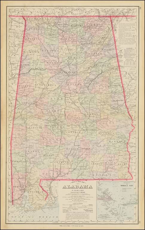
Detailed map of Alabama, colored by counties. Shows towns, township surveys, forts, swamps, lakes, rivers, railroads, roads, post offices, stations, etc. Large inset of the Entrance to Mobile Bay. Includes a table of census populations from 1810 to...
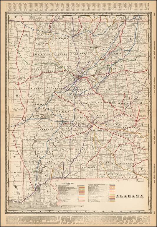
Detailed railroad map of Alabama, showing counties, railroad lines, towns, rivers, township surveys, lakes, mountains, creeks, and a host of other information. The Explanation Key locates approximatley 40 Railroad Lines.
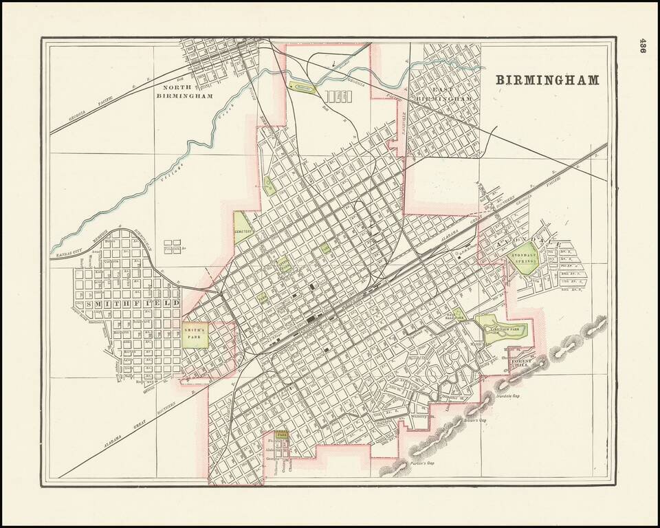
Detailed city plan of Birmingham, Alabama showing streets, buildings, train lines, public places, rivers etc. Cram was one of the pre-eminent American mapmakers of the late 19th century, relying upon a cerographic printing process first applied to...
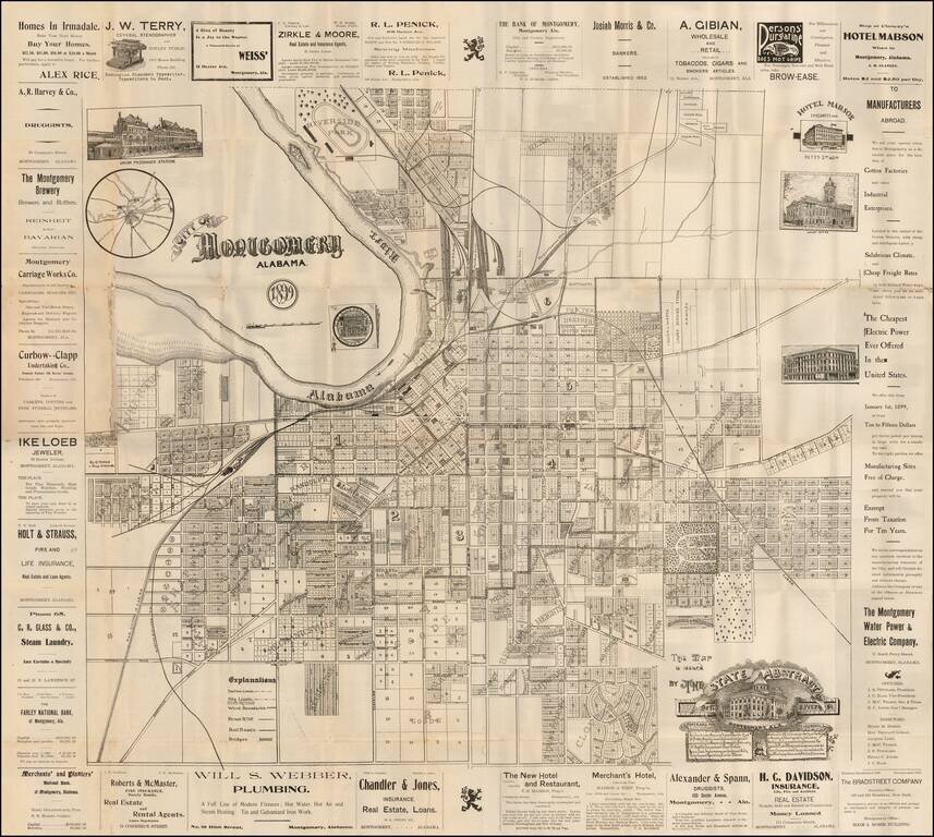
Rare separately issued promotional map of Montgomery Alabama, published by the State Abstract Company. Includes decorative vignettes of the Union Passenger Station, Court House, State Capital Building, and illustrating the town in exceptional detail,...

Restricted World War II Aviation Map Detailed aeronautical map of the Mobile, Alabama area. The chart is a font of information about civil and military aviation during WWII. It was intended for civil aviators flying by visual navigation and so...