
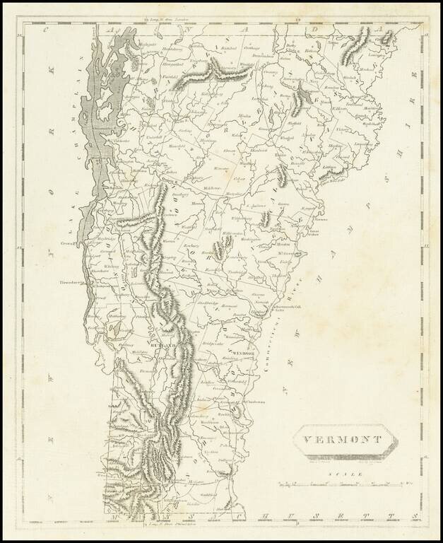
Early engraved map of Vermont from Arrowsmith & Lewis's New & Elegant Atlas, an early collaboration between American mapmaker Samuel Lewis and British mapmaker Aaron Arrowsmith. The map names many towns including Burlington, Montpelier, Stowe,...
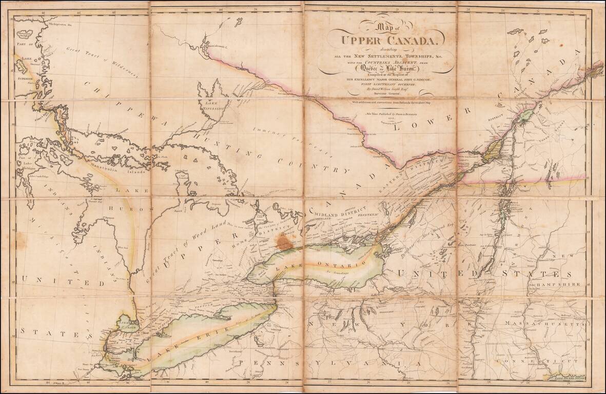
An Early Upper Canada Rarity - Sent To Thomas Jefferson During the War of 1812 Extremely rare separately published map of Upper Canada, Lake Huron, Lake Erie, Lake Ontario and contiguous parts of New York, Michigan, Vermont and Pennsylvania, published...
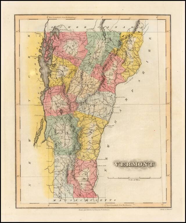
Rare example of Fielding Lucas' fine map of Vermont, which distinguished him as the best publisher of the era. Lucas's maps are printed on a higher quality paper than contemporary maps by Carey & Lea and demonstrate a superior engraving quality...
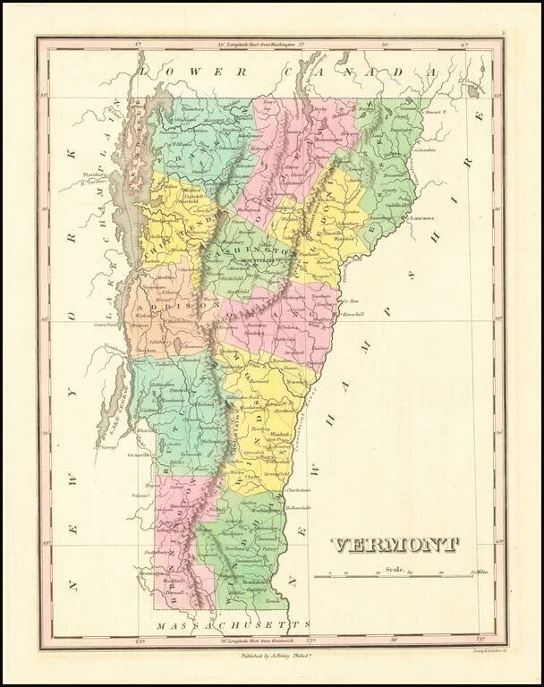
Detailed map of the state of Vermont, from Finley's New General Atlas. The map is hand colored by county, showing towns, roads, railroads, lakes, rivers, mountains, etc. One of the best maps of the state during the period. Anthony Finley was the...
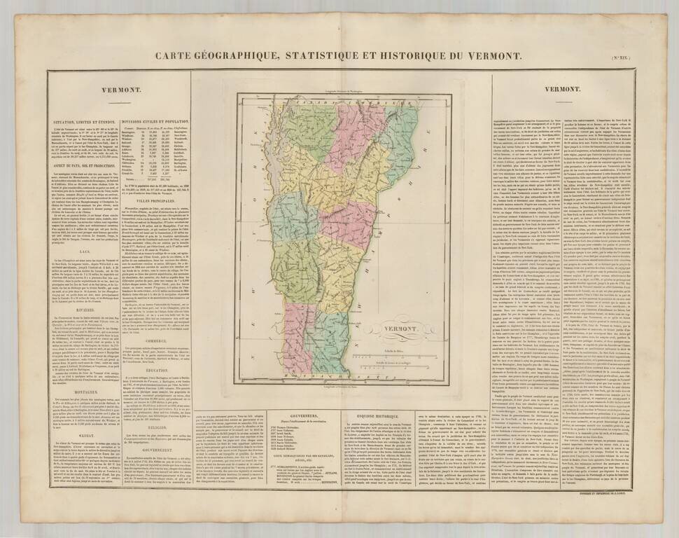
Excellent wide margined example of the French edition of this map of Vermont from Carey & Lea's Atlas. One of the first maps of the state of Vermont published outside of America. Size includes text surrounding map, which includes wonderful...
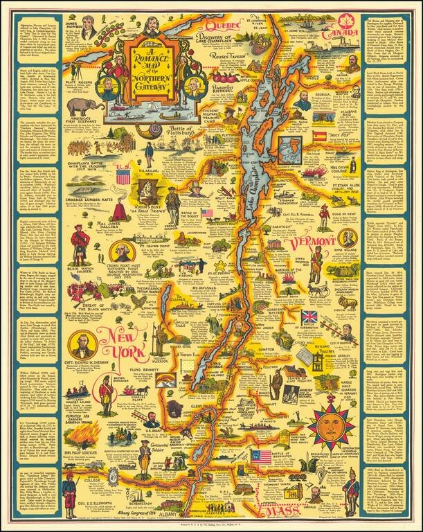
This is the second state of Eleanor Hall's map of the area centered on Lake Champlain, showing the region from northwesternmost Massachussetts to Quebec. The map abounds with pictographs representing historical events, famous figures, industries, and...