
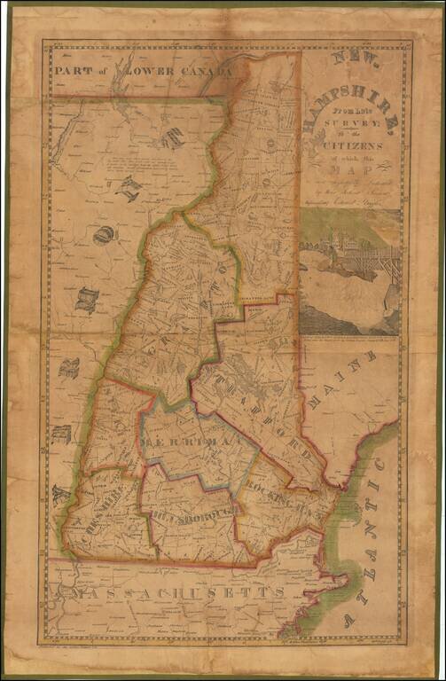
A New Hampshire Rarity—Ruggles’ Pirated Carrigain Map Rare, early wall map of New Hampshire by Edward Ruggles, pirated from the 1816 map by Philip Carrigain, “New Hampshire by Recent Survey.” This is the 1837 "Improved" edition; the first...
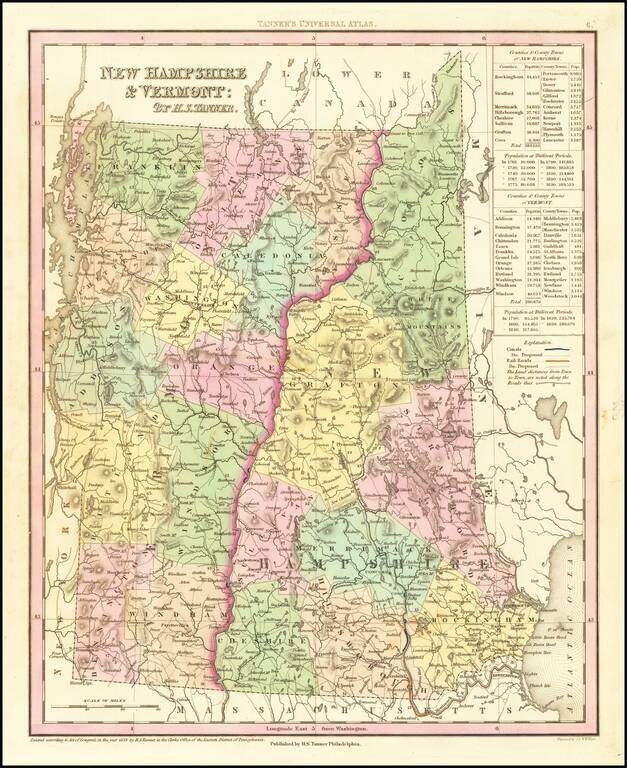
Nice example of Tanner's map of New Hampshire and Vermont, hand colored by counties, and showing towns, roads with distances, railroads, and a host of other details. The key shows counties and towns in each state, with populations, and populations on...
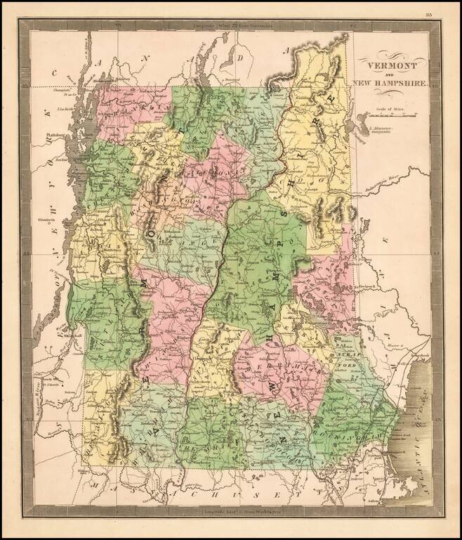
Nice wash color example of Greenleaf's map of Vermont & New Hampshire, hand colored by counties.
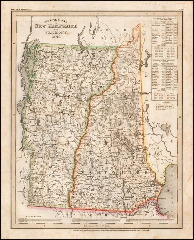
Elegantly engraved & detailed map, taken based upon Tanner's work in the early 1840s. Shows counties, towns, roads, rivers etc.
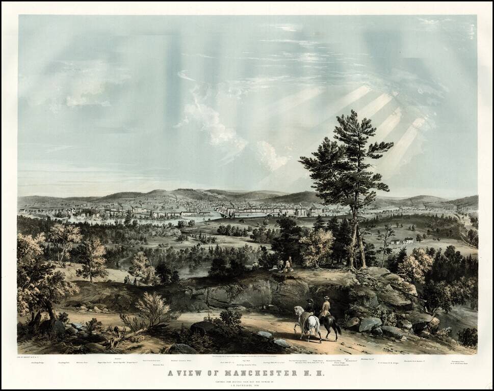
Rare view of Manchester, New Hampshire, published shortly after Bachelder moved to Manchester in 1854. The fore and middleground are occupied by a rolling New England landscape, with a winding road leading to the town in the distance. The town's...
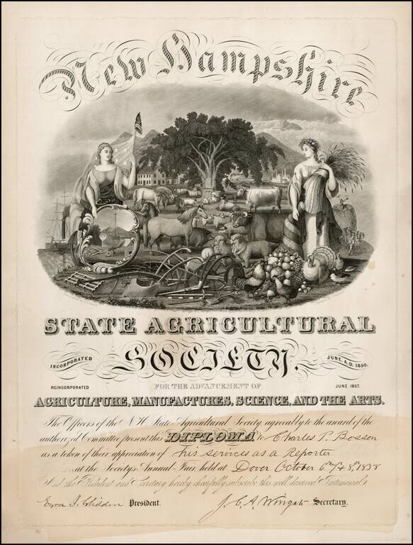
State of New Hampshire Diploma, presented to reporter Charles P. Bosson in 1858. Includes a fantastic decorative vignetter showing the rich diverse livestock of New Hampshire.
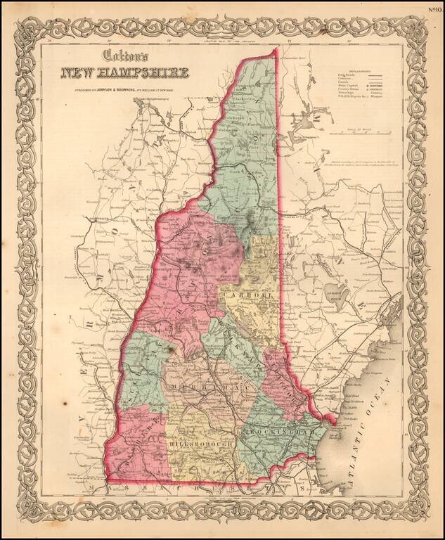
Detailed map of New Hampshire, colored by townships. Shows towns, counties, townships, post offices, depots, rivers, railroads, and substantial additional details. Decorative border. A terrific map from Colton, one of the most prolific American...
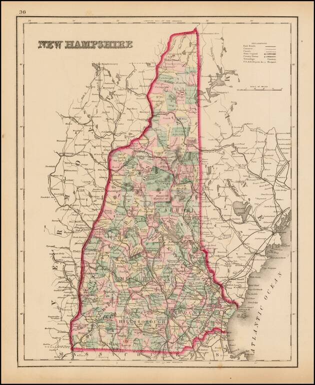
Detailed map of New Hampshire, colored by townships and showing towns, counties, rivers, railroads, and substantial additional details.
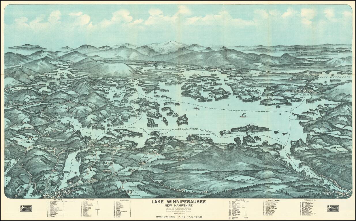
Fine birdseye view style map of Lake Winnipesaukee, published by George Walker & Co, for the Boston & Maine Railroad. The map provides a striking view of the Lake, with major islands, bays and other features named. The key at the bottom of...