
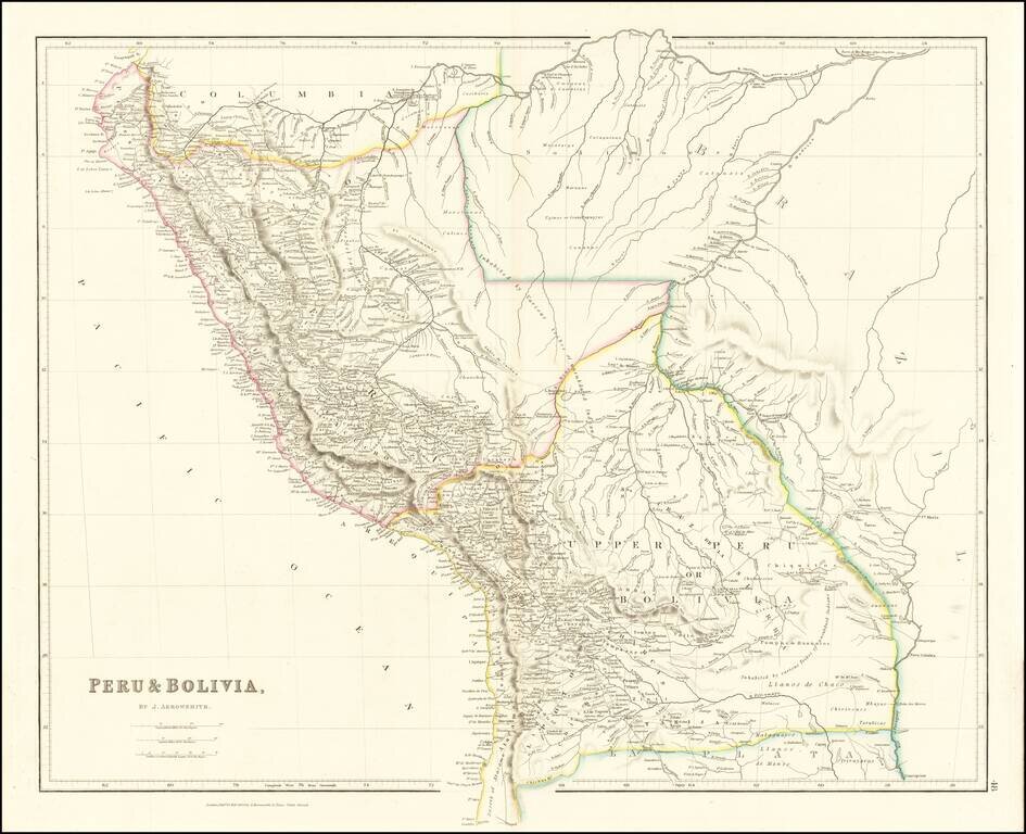
A marvelous highly detailed map of Peru and Bolivia, colored by regions. Arrowsmith's map is perhaps the single most detailed atlas map of the period.

Striking full color example of David Burr's map of Peru and Bolivia, which first appeared in David Burr's Universal Atlas, in 1836. Burr's Atlas was perhaps the most elegant American commercially published atlas of its time, utilizing wonderful wash...
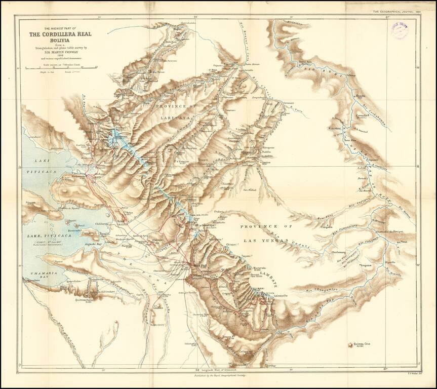
Finely executed map of the area around La Paz and the eastern part of Lake Titicaca, extending north to the Rio Mapiri and Rio Beni regions, published by the Royal Geographical Society. The map illustrates the expedition of William Martin Conway, 1st...