
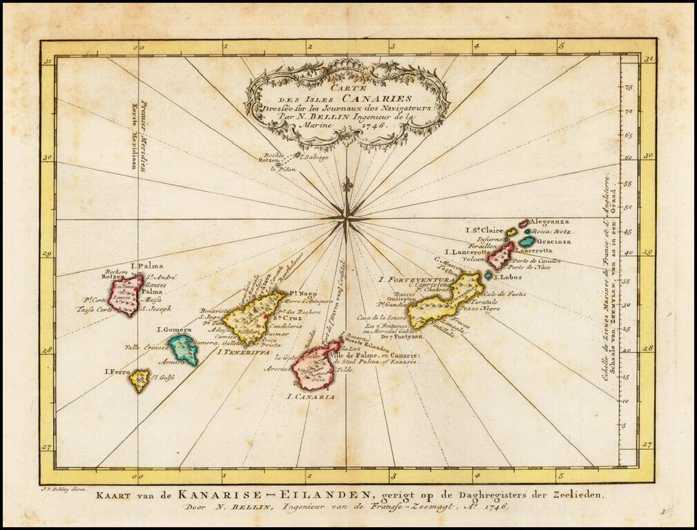
Detailed map of the Canary Islands, originally issued by Bellin and reissued in Dutch in 1770. Nice Cartouche and Compass Rose.
Old color example of Ortelius' map of the Azores, one of the most important destinations of explorers and early commercial mariners in the 16th Century. The size and detail of the map reflects the strategic importance of the Azores during the 16th...

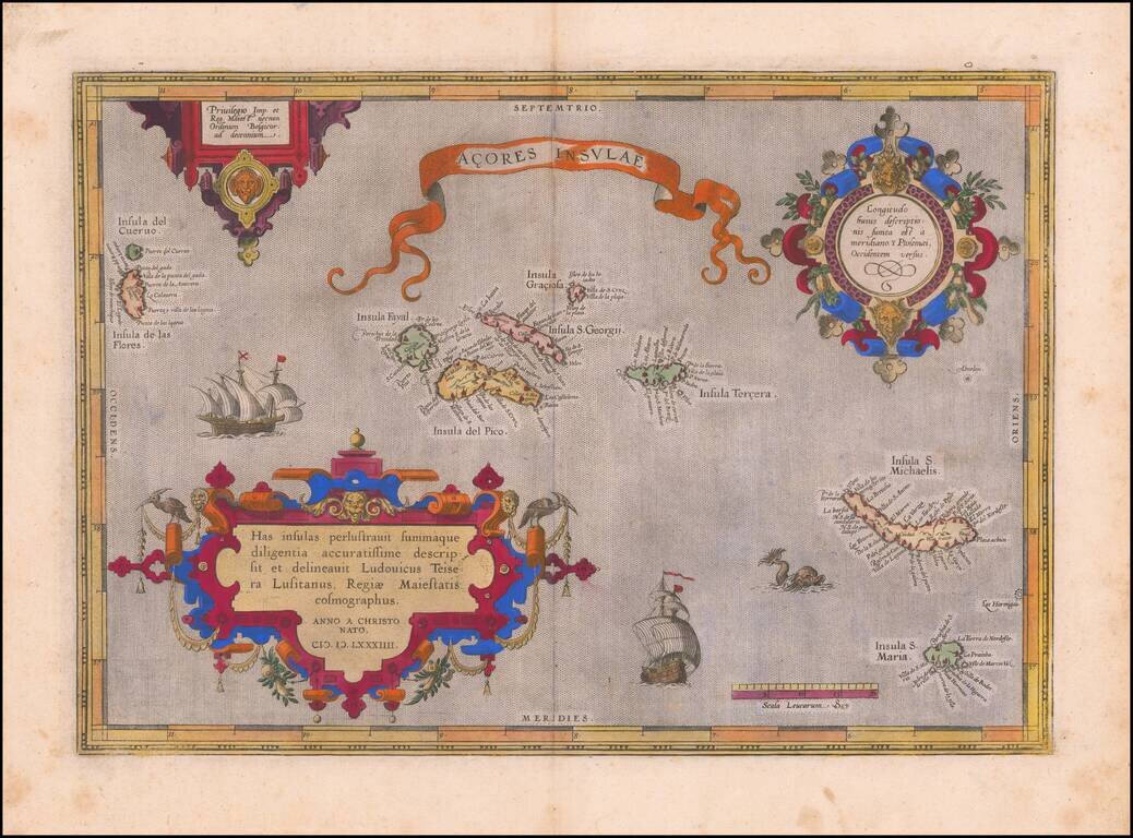
Fine old color example of Ortelius' map of the Azores, one of the most important destinations of explorers and early commercial mariners in the 16th Century. The size and detail of the map reflects the strategic importance of the Azores during the 16th...
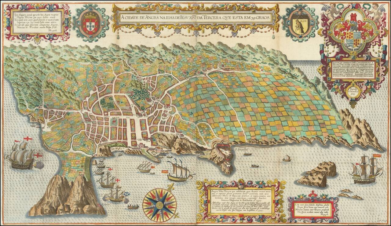
Spectacular birds-eye view of the island of Terceira and the town of Angra. Engraved by Baptista van Deutecum in Amsterdam, for LInschoten's Itinerario. Linschoten's view of Terceira in the Azores is one of the most decorative and recognizable...
![[Angra - Madera - Porto Santo - Sao Miguel] Pascaarte vande Eijlanden van Madera en Port Sancto, vertoonende degelegentheijt vande Reede aldaer en hoese van malcanderen zijn gheleghen . . .](/map/small/62128.jpg)
Early Sailing Chart of the Madeira, Angra and Sao Miguel. Rare sea chart showing the islands of Madeira and Porto Santo, with smaller maps showing Angra and a portion of Sao Miguel. The chart appeared in J Blaeu's Het Licht der Zee-vaert , first...

Fine birds-eye view of the island of Terceira and the town of Angra, based upon Baptista van Deutecum's view of the Island, which appeared in LInschoten's Itinerario. Linschoten's view of Terceira in the Azores is one of the most decorative and...
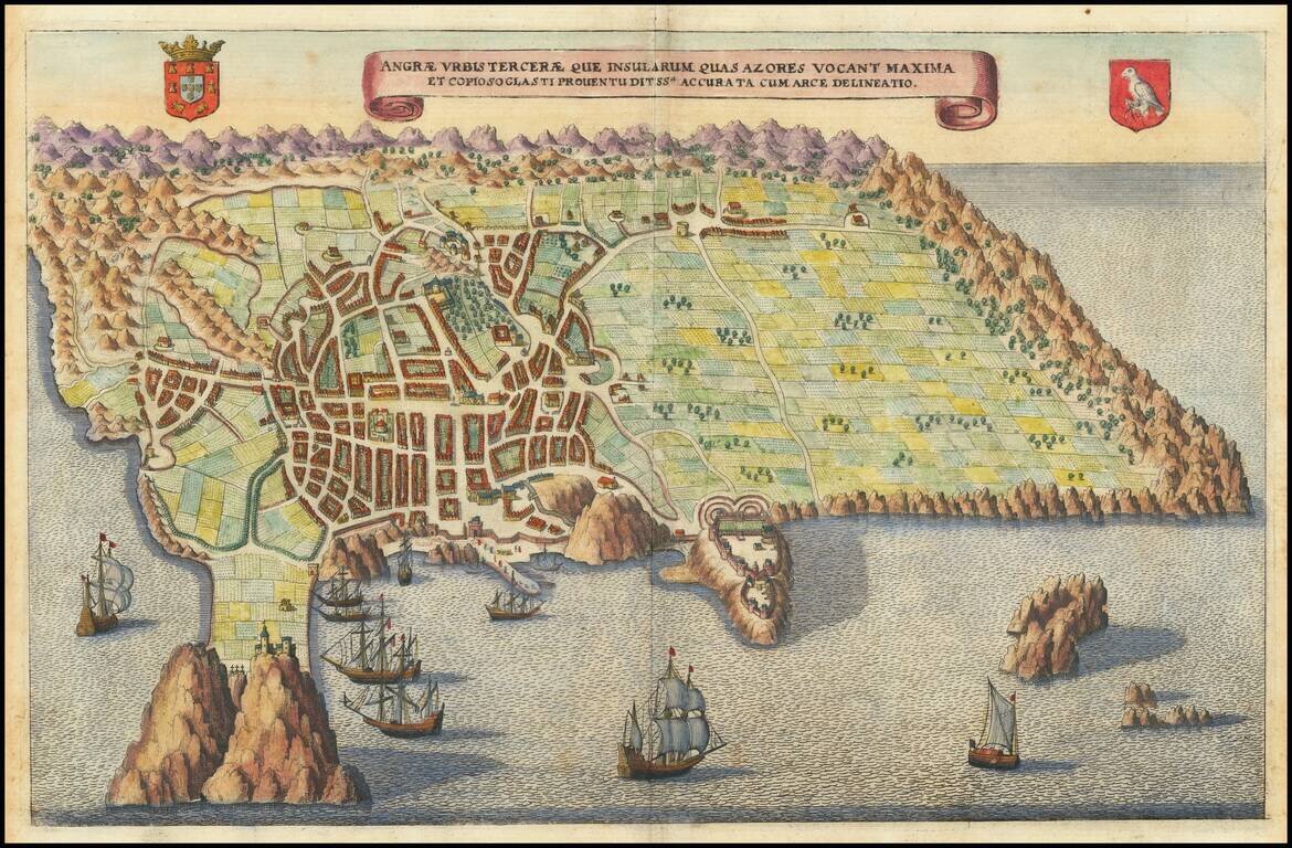
Fine birds-eye view of the island of Terceira and the town of Angra, based upon Baptista van Deutecum's view of the Island, which appeared in Linschoten's Itinerario. Linschoten's view of Terceira in the Azores is one of the most decorative and...
Robert Dudley's Rare Sea Chart of The North Atlantic -- Newfoundland to the Azores Second state of Robert Dudley's fine early sea chart of the North Atlantic, extending from the Grand Banks and Newfoundland to the western Azores, first published in...
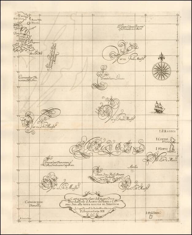
![[Azores & Madera] Carta particolare dell' Isole d'Asores con l'Isola di Madera . . .](/map/small/58784.jpg)
Robert Dudley's Rare Sea Chart of the Azores and Madera and "a Doubtful" Island Important early sea chart of a portion of the Atlantic, centered on the Azore Islands and extending east to Madera, first published in his Arcano del Mare in 1646-47. The...
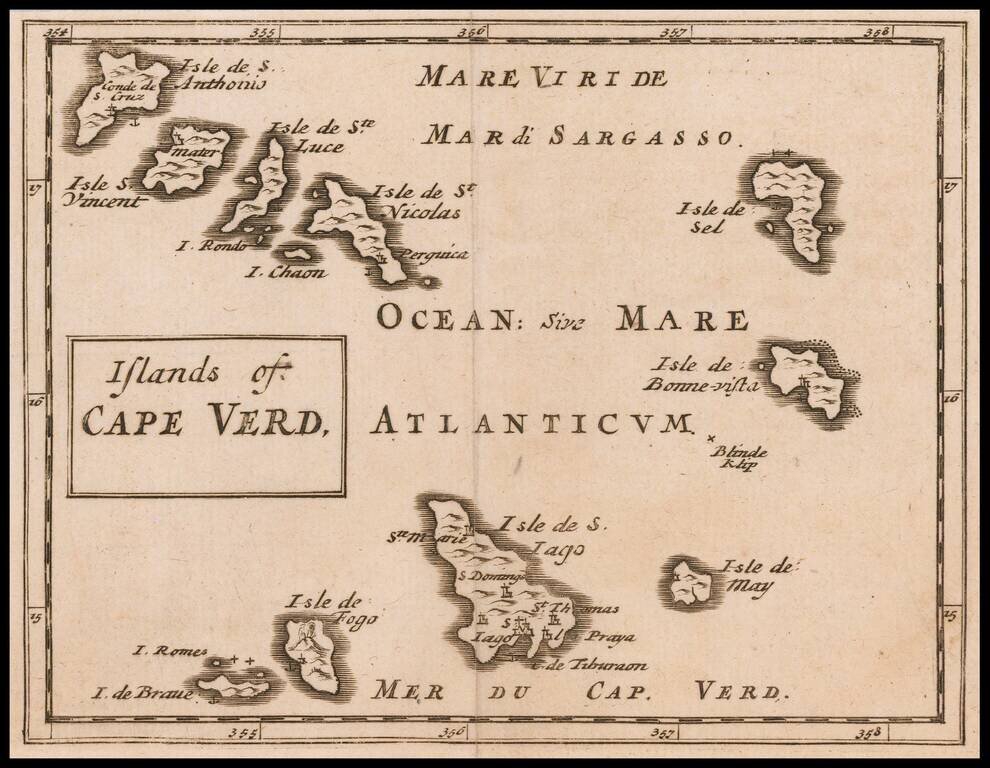
Rare Miniature English Map of the Cape Verd Islands Rare map of the Cape Verd Islands, published by Sir Jonas Moore in London. The map appeared in Moore's A New Geography. Many of the plates in the work were engraved by Herman Moll, who had moved to...
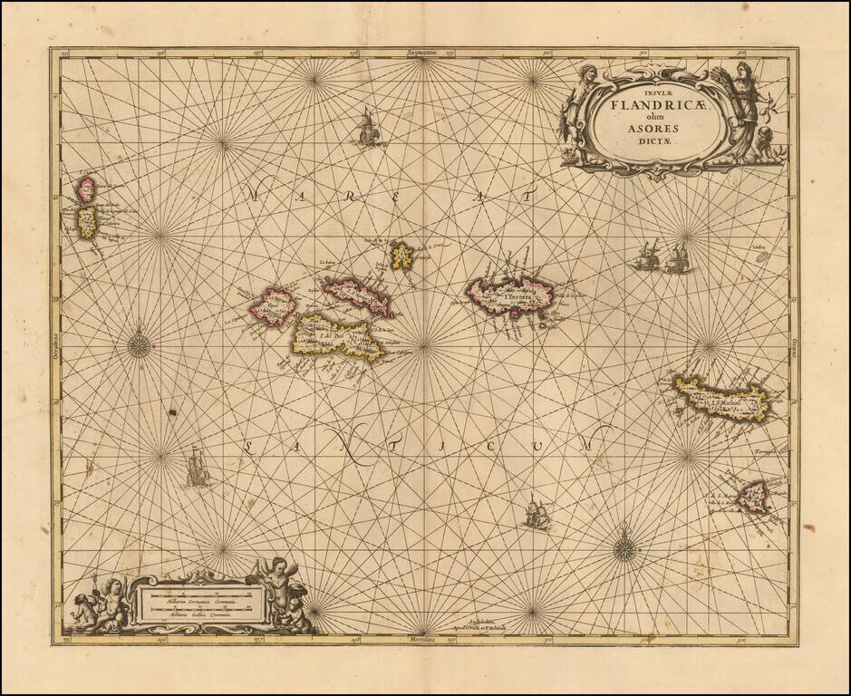
Nice example of Valk & Schenk's scarce sea chart of the Azores, published in Amsterdam in 1690. The map is oriented with north at the top and includes compass roses, sailing ships and 2 decorative cartouches. Each of the islands includes...
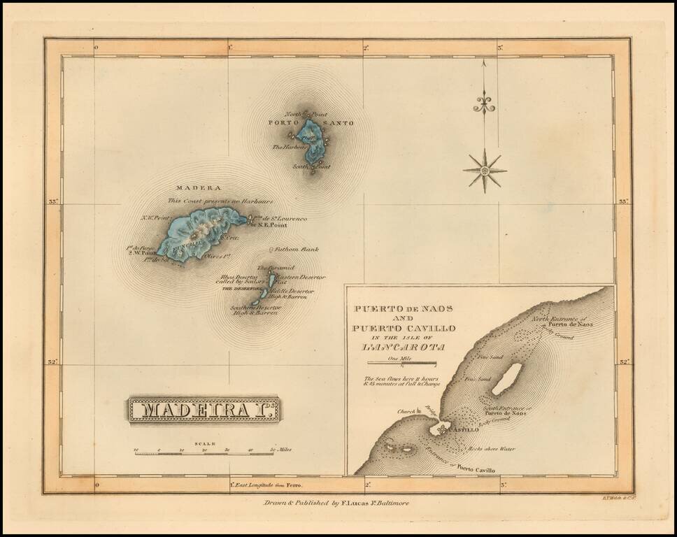
Scarce map of the Madeira Islands (with large inset map of Naos and Cavillo on Lanzarote Island) by Fielding Lucas Jr., which appeared in his General Atlas, as well as his A New General Atlas of the West India Islands. Lucas's map is one of the first...
![Portugalliae et Algarbiae… [with large Regnum Brasiliae…inset]](/map/small/70149jd.jpg)
Portugal and Her Brazilian Colony Decorative map of Portugal with a large inset of Brazil, showing its 12 captaincies. The map is elaborately embellished, with several naval battles, a highly ornate cartouche and other details.
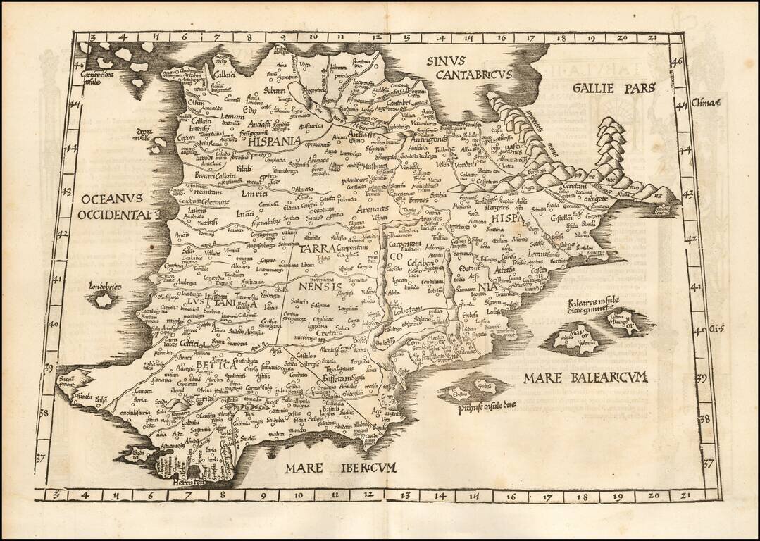
Nice example of Fries map of the Iberian Peninsula. First published in Strasbourg by Johannes Gruninger in 1522, Fries map is based upon Waldseemuller's map of 1513.
Good example of the 1525 edition of Lorenz Fries modern map of the Spain & Portugal. First published in Strasbourg by Johannes Gruninger in 1522, Fries' map is based upon Waldseemuller's map of 1513.
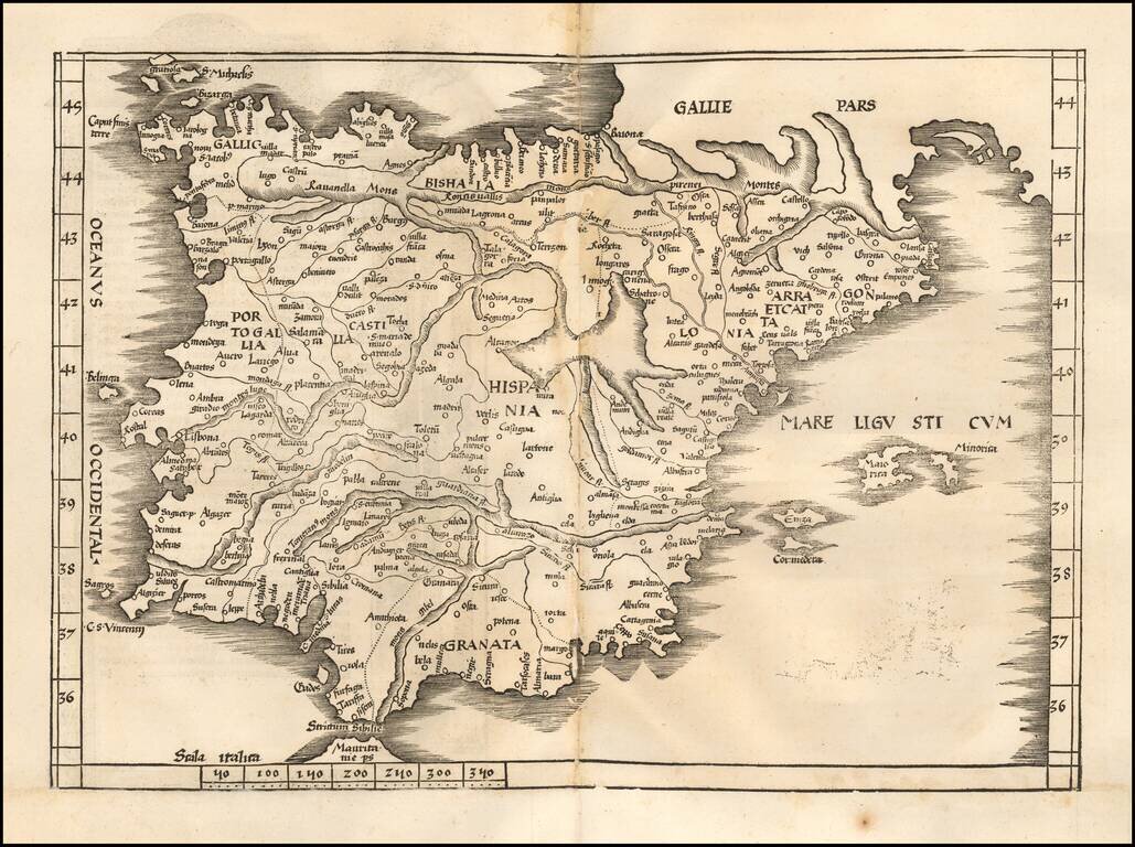
Nice example of Gastaldi's modern map of Spain & Portugal, one of the earliest modern maps of the Iberian Peninsula, from Gastaldi's Geografia di Claudio Ptolemeo Alexandrino . . . , published in Venice in 1548. The map is almost certainly drawn...