
![Tabula Asiae XI [Southeast Asia]](/map/small/60635.jpg)
Rare early example of Munster's map of the Indian Ocean and contiguous regions, extending from Southeast Asia to the Ganges River and north to the Himalayas. The map is based upon the writings of Ptolemy and does not show a passage to the Pacific....
![[India] and [Java Maior]](/map/small/59059.jpg)
Fascinating map of India and map of Java Maior, from Honter's 1561 De Cosmographiae Rudimentis. Honter's maps are based upon modern sources and are among the earliest modern printed maps of the regions shown.
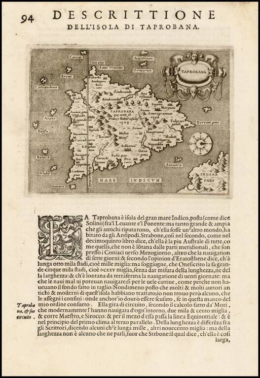
First edition of one of the earliest obtainable maps of Sri Lanka, which appeared in the first edition of Tomaso Porcacchi's L'Isole piu Famose del Mondo.
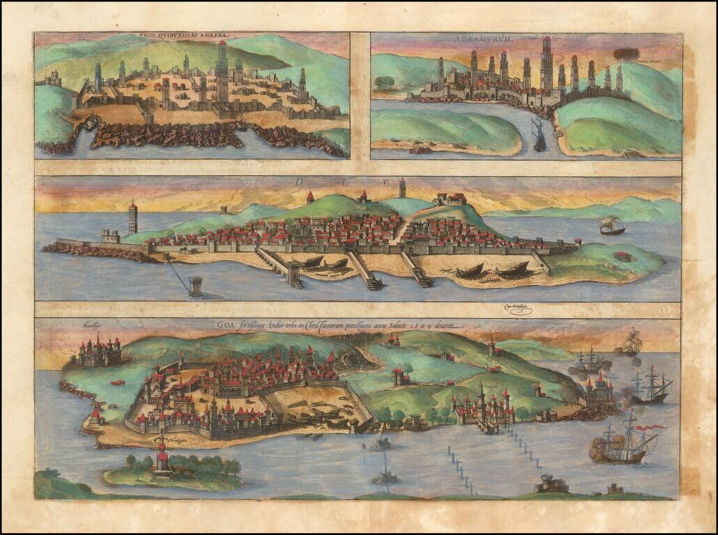
Nice old color example of Braun & Hogenberg's set of Casablanca (Anfa) - Azemmour (Azamor) - Diu - Old Goa (Velha Goa).
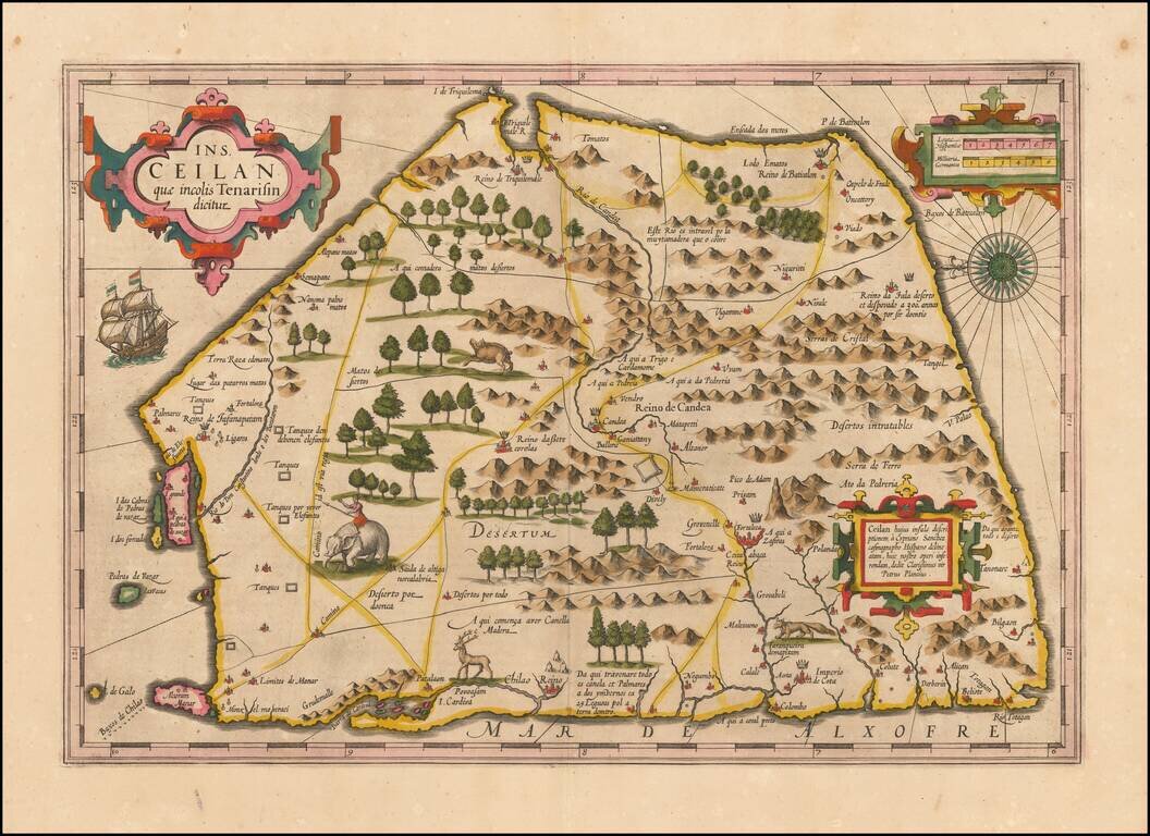
Finely colored example of Ceylon (Sri Lanka), from an early edition of the Mercator Hondius Atlas. The map is oriented with east at the top and includes elephants, gazelles and other animals, sailing ships, compass roses and 3 cartouches. The map...
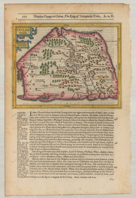
Striking early map of Ceylan with decorative cartouche. From the 1625-26 edition of Purchas His Pilgrims, one of the seminal early 17th Century English Language travel works. On a 13 x 9 inch sheet with English text, front and back.
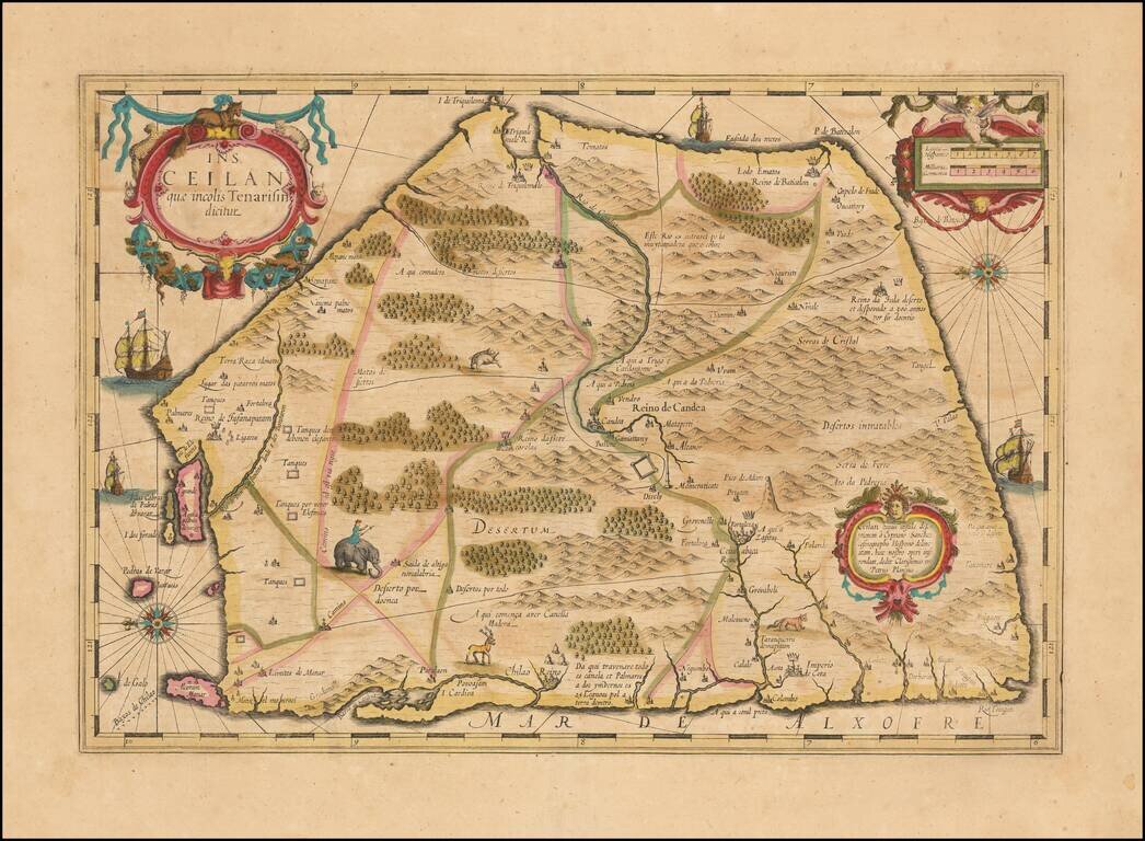
Nice example of Hondius's double-page engraved map of Ceylon (Sri Lanka), from the Mercator Hondius Atlas. The map is oriented with east at the top and includes elephants, gazelles and other animals, sailing ships, compass roses and 3 cartouches. A...
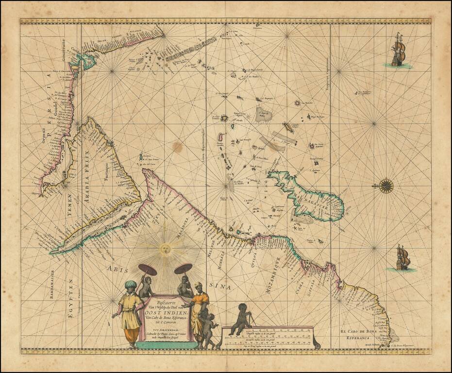
Charting the Western Indian Ocean Decorative sea chart of the Indian Ocean, orientated with the north to the left. The highly decorative chart shows the East African coast, Arabia, Madagascar and the islands of the Indian Ocean with the Seychelles...
![[Southeast Asia, Philippines & India] Nova Delineatio particularis Apostolicarum Peregrinationum noni Indiarum Apostoli in India Orientali](/map/small/51679.jpg)
Rare map of India, Southeast Asia and the Philippines, illustrating the travels of the earliest Jesuit Missionaries. The map includes a key locating the earliest Jesuit Missions in the region. The map was published to illustrate a book on the life of...
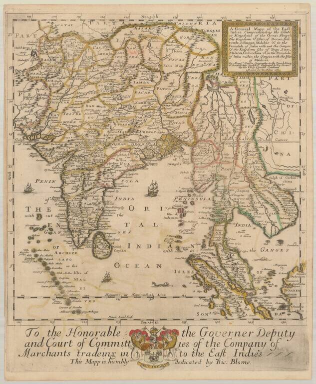
Old color example of the first state of Richard Blome's scarce map of India and Southeast Asia, the earliest folio sized map of the region to be engraved in England. While Speed's atlas was published prior to Blome, Speed's plates were engraved and...
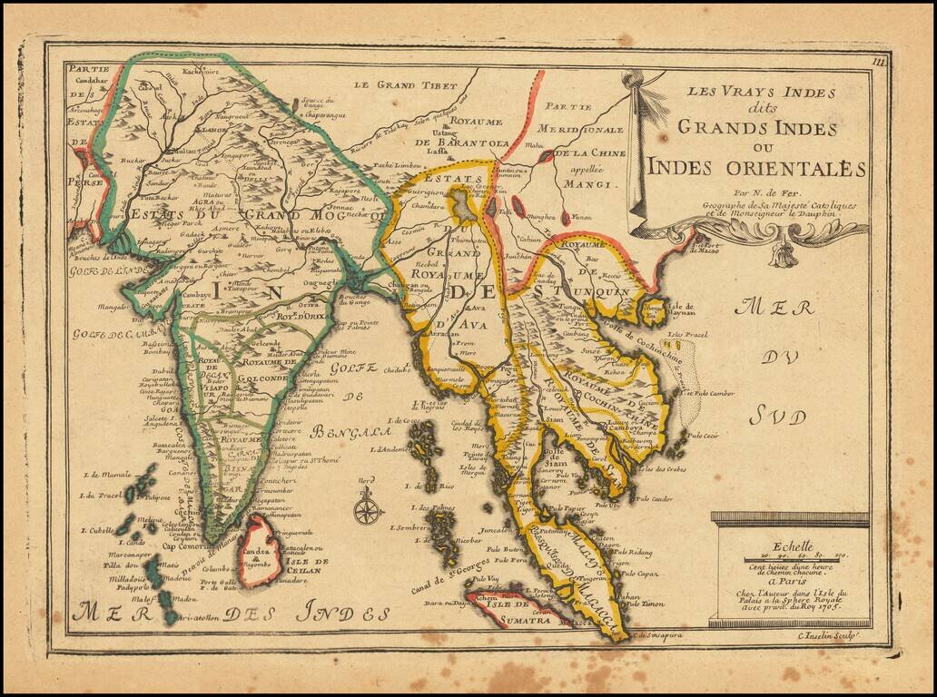
Striking map of India and the Malaysian Peninsula, showing excellent detail throughout. From De Fer's Atlas Curieux. Nice wide margins and decorative cartouche.
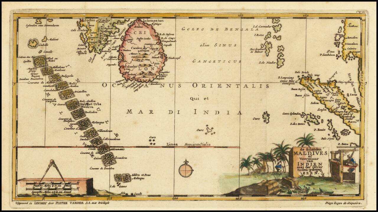
Interesting early map of the Maldives, Ceylon and parts of Malaysia and Sumatra, illustrating the travels of Diego Lopez de Sequeira. In the early 18th Century, Vander Aa reproduced a number of rare manuscript and printed accounts of 16th Century...
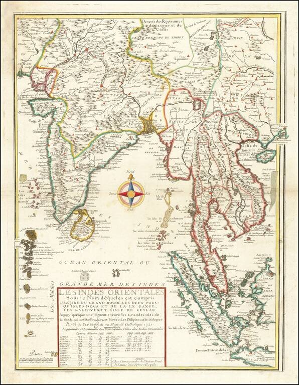
Second edition of De Fer's rare map of the region extending from Hong Kong and Macao in the east to the Indus River and Maldives in the west, bearing the imprint of his son-in-law and successor, Guillaume Danet. This fascinating map includes...
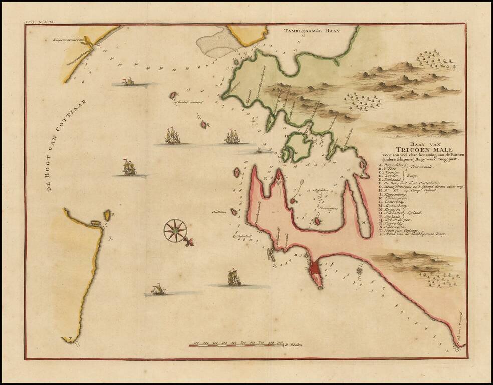
One of the earliest printed maps of Trincomalee Bay, from Valentyn's Oud en Nieuw Oost-Indien. Finely detailed map of the Trincomalee Bay in Sri Lanka. Valentijn was born in 1666 in Dordrecht, Holland, but spent significant time in the tropics,...
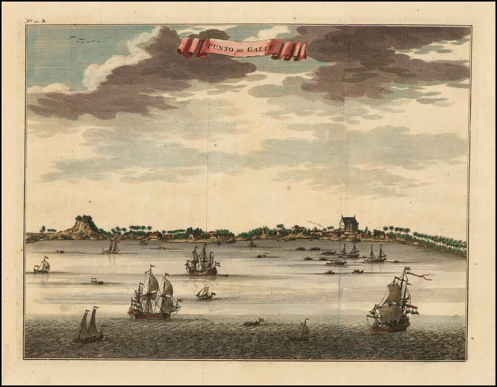
Fine early view of Colombo, Sri Lanka, including a number of buildings along the coast and the Indian Ocean teeming with vessels. Francois Valentijn Francois Valentijn was born in 1666 in Dordrecht, Holland, but spent significant time in the tropics,...
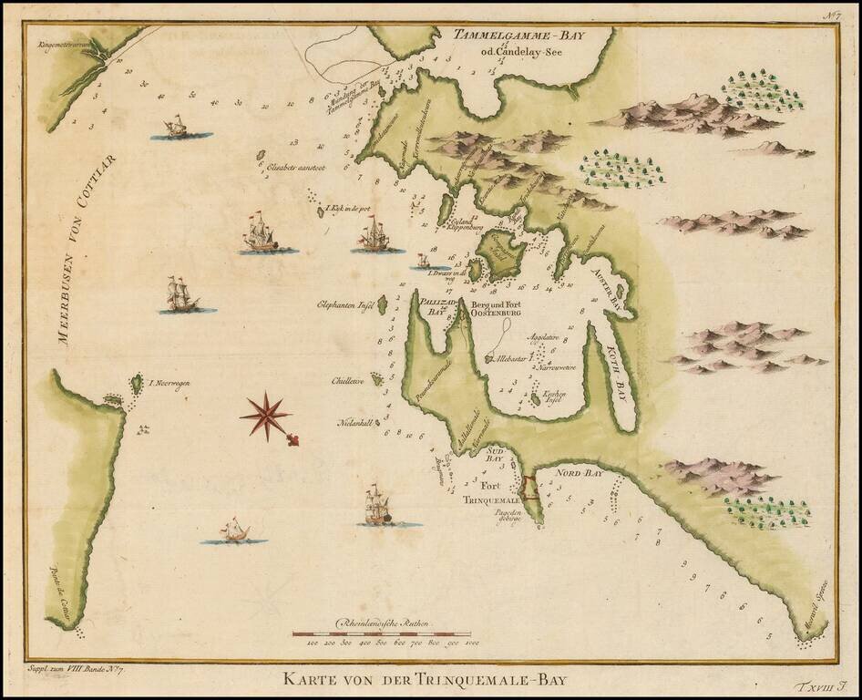
Fine early view of Trincomallee Bay, Sri Lanka, with soundings, compass rose and other details. The map is oriented with Southwest at the top. Francois Valentijn Francois Valentijn was born in 1666 in Dordrecht, Holland, but spent significant time in...