
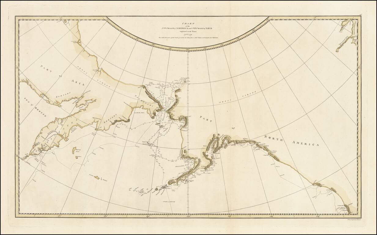
Striking Map of the North Pacific From Cook’s Third Voyage Account Fine example of the map of the Northern Pacific and contiguous coasts of America and Asia, from the official account of Captain James Cook’s third voyage, published in London in...
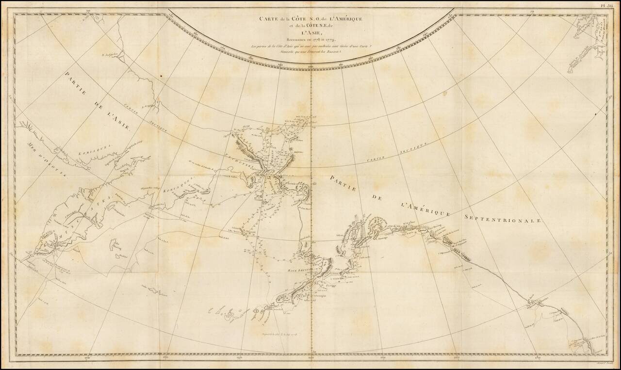
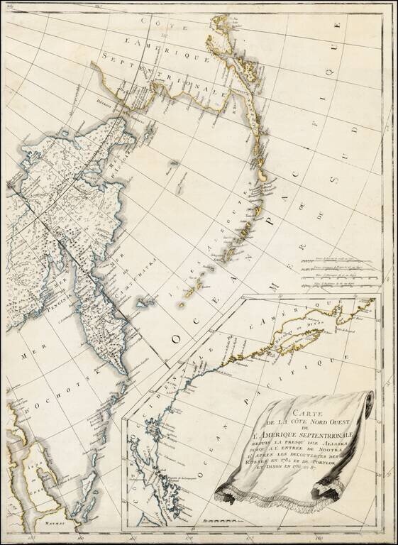
Finely engraved map of the North Pacific and contiguous coastlines of Alaska and Russia, published in the first French edition of the official account of James Cook's Third Voyage. The present map is of the utmost importance in the cartographic...
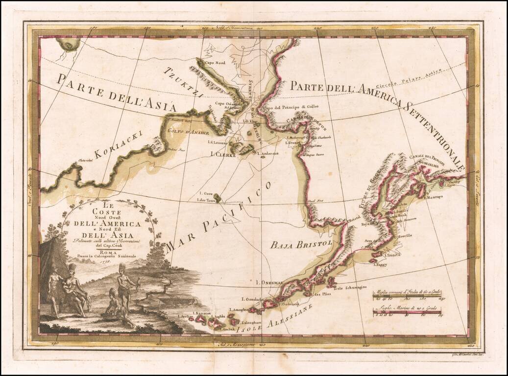
Nice old color example of Cassin's map of the Northwest Coast of America and Northeast Coast of Asia, showing Captain James Cook's tracks through the region. This is without doubt the most decorative map of the period covering this region. It also...
![La Parte Orientale della Russia Asiatica Delineata…1796 [Includes Alaska]](/map/small/23720.jpg)
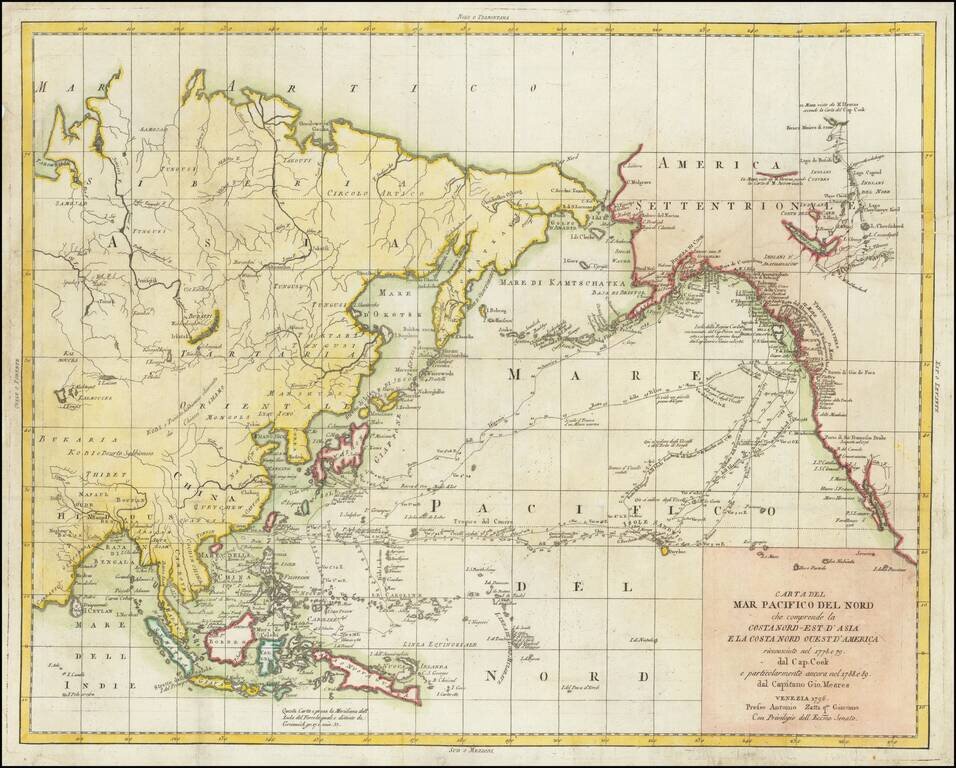
Decorative map of Siberia and Alaska from this scarce and highly decorative 18th Century atlas.
Scarce Italian published map of Alaska and the Northwest Coast of America and Northeast Coast of Asia, engraved to illustrate the Italian edition of the account John Meares Voyages to the Region. The map tracks both the journeys of Captain James...
Eastern sheet Wilbrecht's a rare 3-sheet map of the Russian Empire, depicting Alaska, the Northwest Coast of America and the West Coast of Canada, prior to the discovery of Vancouver Island, along with Kamchatka, Northeast Russia and Iezo. The map is...
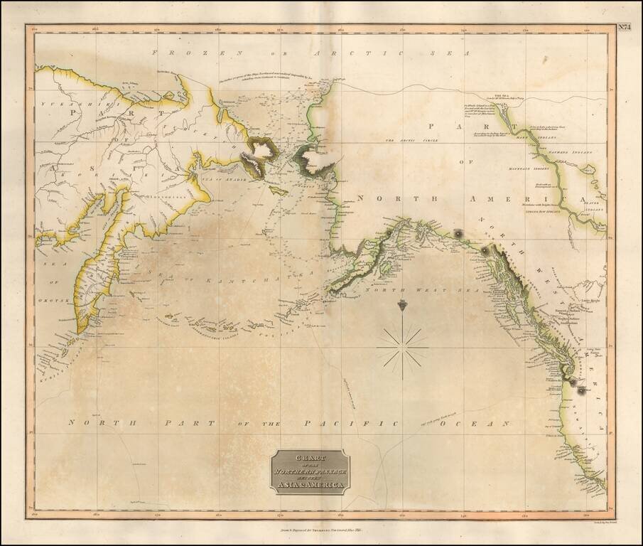
Scarce map of the NW Passage, the NW Coast of America and NE Coast of Asia. The map extensively tracks the voyages of Captain James Cook beyond the Bering Straits on a nearly daily basis in 1778 and 1779. In the Arctic Sea, a note regarding McKenzie's...
![[Map of Russian Possessions in North America] Карта Российскаго Владѣнія въ Сѣверной Америкѣ](/map/small/66569.jpg)
Extremely Rare Russian-Language Map of Russian America (Alaska). Detailed engraved map of Alaska, labeled "Russian Possessions", published in Saint Petersburg in 1836. This is one of very few contemporary Russian maps to focus specifically on Russian...
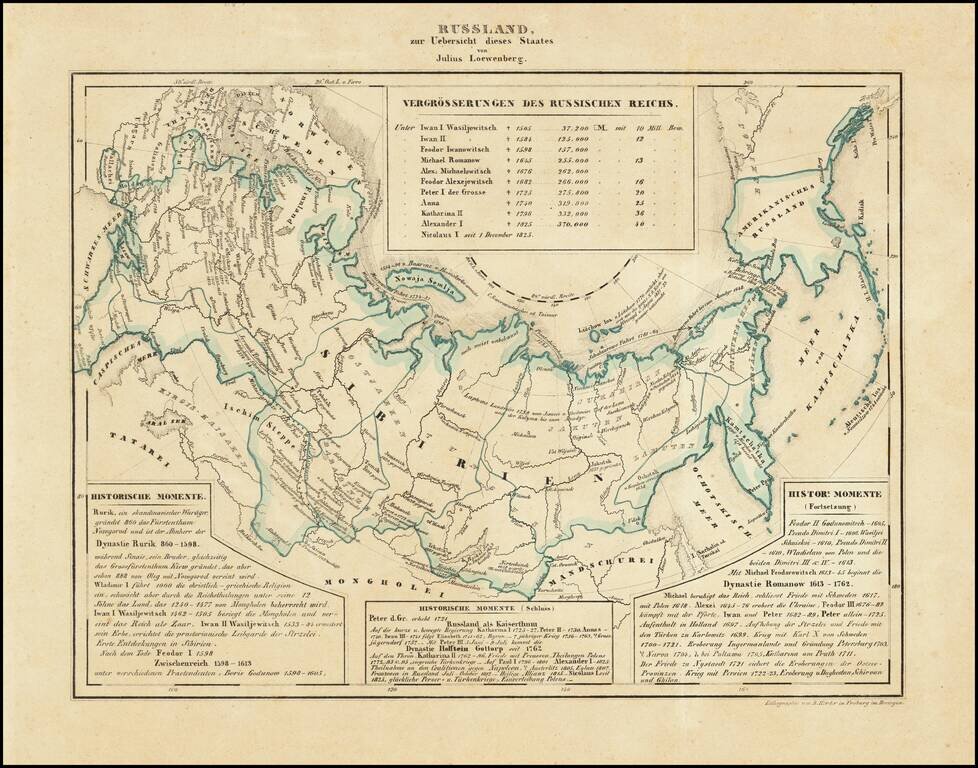
Interesting map of Russia, including Russian America, published in Freiburg in 1839. Includes historical text below the map, covering the history of Russia.
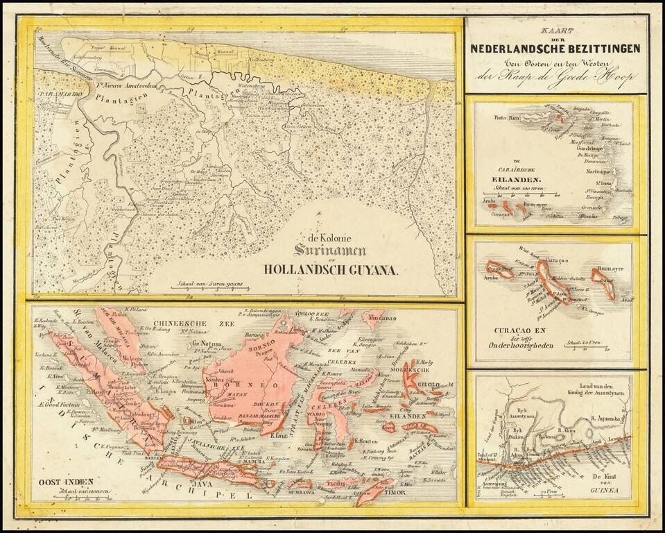
Interesting Map of the Dutch Colonies. The map consists of 5 separate maps, entitled: The Caribbean Islands Curacao and Dependencies The Suriname Colony The Coast of Guinea in Africa East Indies The map appeared in Nieuwe Atlas van het...
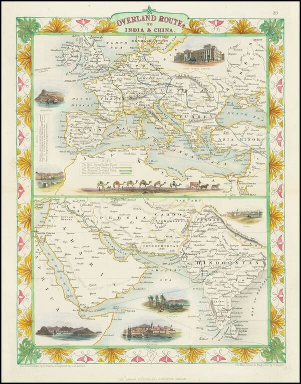
Striking full color example of this fascinating map, showing the various trade routes to Europe, with a larger map of Europe and the Mediterranean at the top, and a detailed regional map of the Middle East and Western India at the bottom. Decorative...
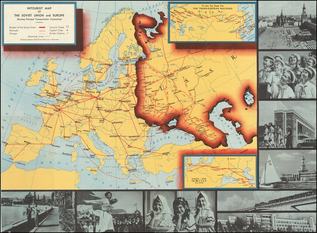
Interesting pictorial map of Europe an the Soviet Union, published by Intourist, promoting tourism in the Russia. The map shows major transit lines and charming monochromatic photos, with the verso giving different travel itineraries and general...
![[Cultural Revolution Maps - Map of France / A Sketch Map of Events of May 1968] [Fagu di tu - Faguo ren min ge ming dou zheng yi tu]](/map/small/65576.jpg)
Chinese Reporting on the May 1968 Uprising in France Two Chinese cultural Revolution Maps printed on a single sheet (back to back), published following hte May Uprising in France in 1968. The map illustrates France as dominated by the worker's...
![[Ottman Empire] Partes confines Trium Magnorum Imperiorum Austriaci Russici et Osmanici Foliis VI compreshensa ex novissimis observationibus, dimensionibus optimisque tabulis geographicus descripta . . . Anno MDCCLXXXV](/map/small/52715.jpg)
Three Empires At War -- Austrian, Russian and Ottoman Fine 6 sheet map published in Berlin in the midst of the Austro-Turkish and Russo-Turkish wars, between the Austrian, Russian and Ottoman Empires. Centered on the Black Sea, the map shows the...
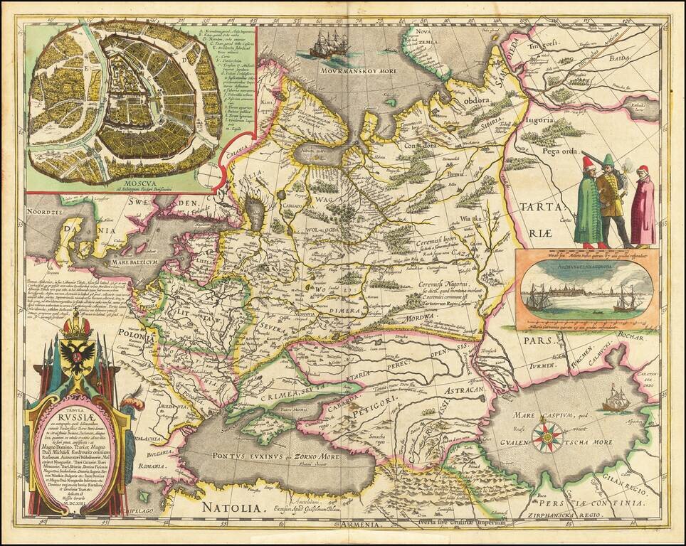
Decorative hand-colored example of Hessel Gerritsz's map of Russia, with the large inset of Moscow and plan of Archangelsckagoroda. Hessel Gerritsz's map of Russia, first issued 1613, was published by Blaeu after he acquired the plate following...
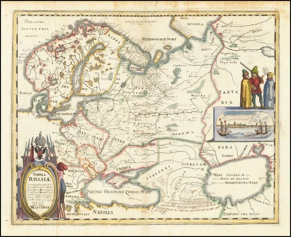
Nice example of the Merian edition Hessel Gerritsz's map of Russia, with view of Archangelsckagoroda. The map was compiled from manuscript maps and work brought back by Isaac Massa. Includes a decorative birdseye view. Richly decorated a large title...