
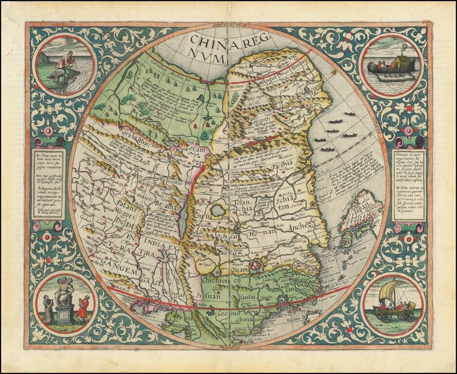
The Rarest and Most Coveted Map of China Published in the Sixteenth Century Striking example of De Jode's map of China, one of the earliest maps of China printed in Europe and the first map to begin to show the emergence of Korea on a printed map....
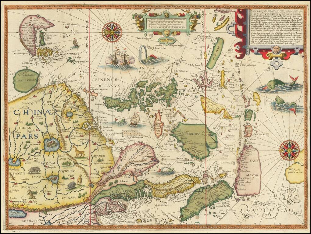
Linschoten's Important Regional Map of China and Southeast Asia Splendid, ornate, sixteenth-century map of China, Japan, Korea, Southeast Asia, the Philippines, the Straits of Malacca, Borneo, Java, and Beach, engraved by Henricus Van Langren for...
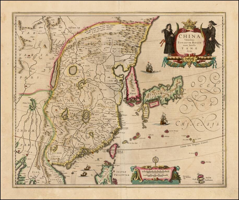
Decorative map of China, Japan and Korea and includes the north portion of the Philippines from Jansson's Novus Atlas. The map depicts the eastern part of China (bounded in the west by the Great Wall), Korea as an island and the three main islands of...
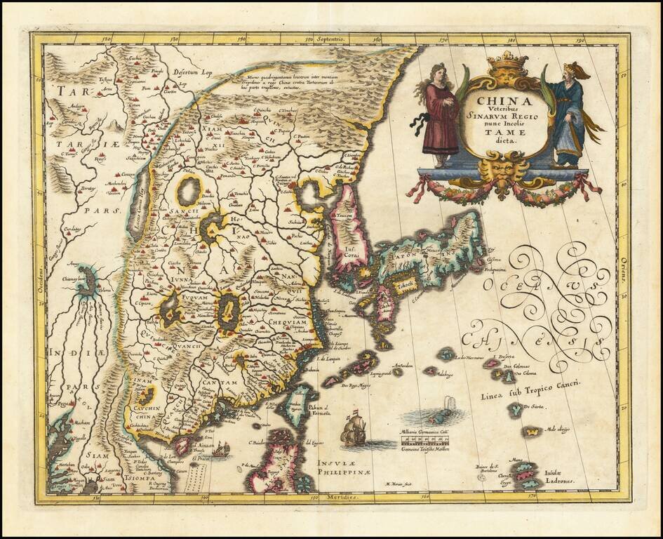
Decorative map of China, Japan, the Island of Korea, and the northern part of Luzon. Notes Pakan al I. Formosa Sailing ships and decorative cartouche. A very detailed and highly decorative map, based upon Blaeu's map of the same title.
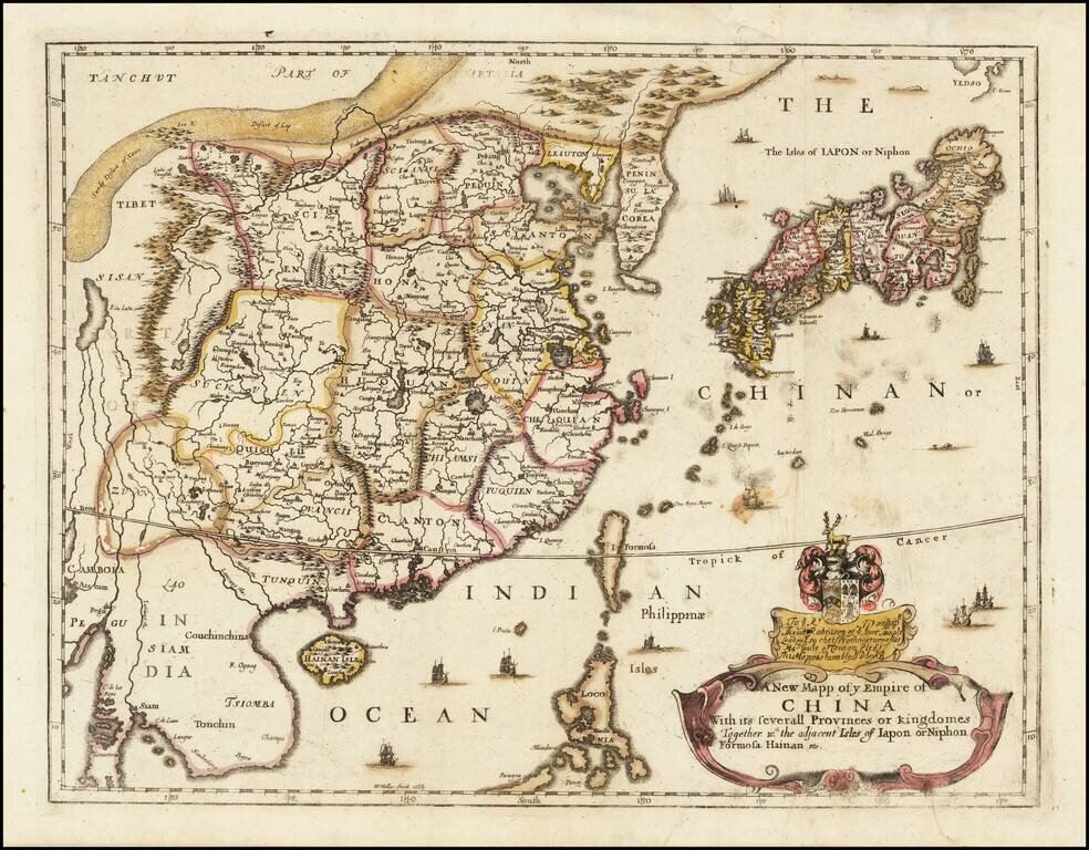
Rare Second State of Richard Blome's Map of China. Finely colored example of Richard Blome's scarce early map of China, with coat of arms and dedication to the London Lawyer Thomas Robinson. Unlike most of Blome's maps, the present map is based upon...
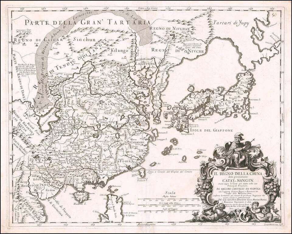
Rare 17th Century Italian Map of China Finely colored example of this rare early map of China, Japan and Korea, along with neighboring regions, by Cantelli da Vignola and published in Rome by Rossi. The map was engraved by Giorgio Widman for Rossi's...
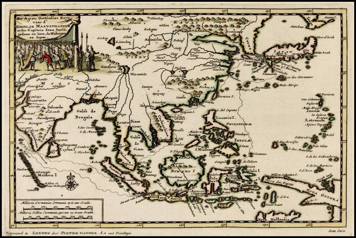
Decorative map of the region from India to Southeast Asia and north to Japan and Korea, including an illustration of the Great Wall of China, illustrating the Dutch translation of the account of the voyage of John Saris, Captain of the first English...
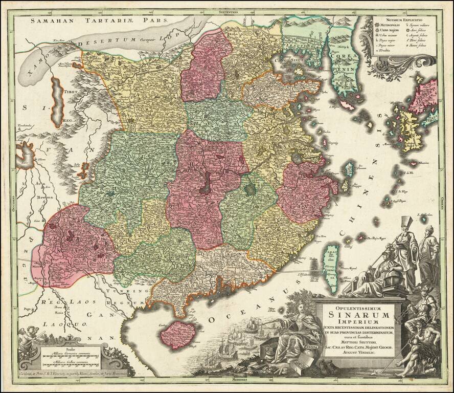
Striking and highly detailed map of China, colored by provinces, published by Seutter in Augsburg, circa 1730. The map extends from southern China to Korea, which is shown as a peninsula and includes southern Japan and Taiwan. The elaborate cartouch...
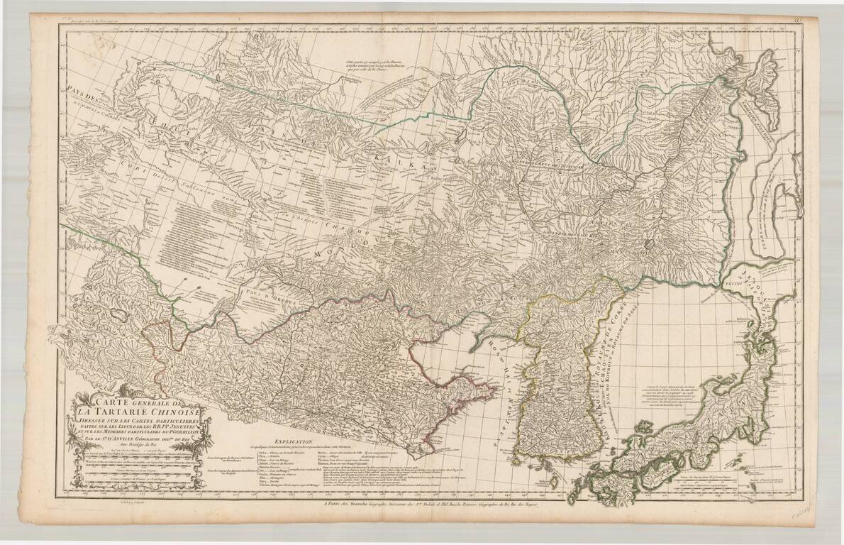
Fine example of the rare JA Dezauche edition of D'Anville's map of the region from Japan to the Gobi Desert, centered on Mongolia and Korea, from D'Anville's Atlas of China. Includes a nice treatment of Korea, Japan and China, along with a detailed...
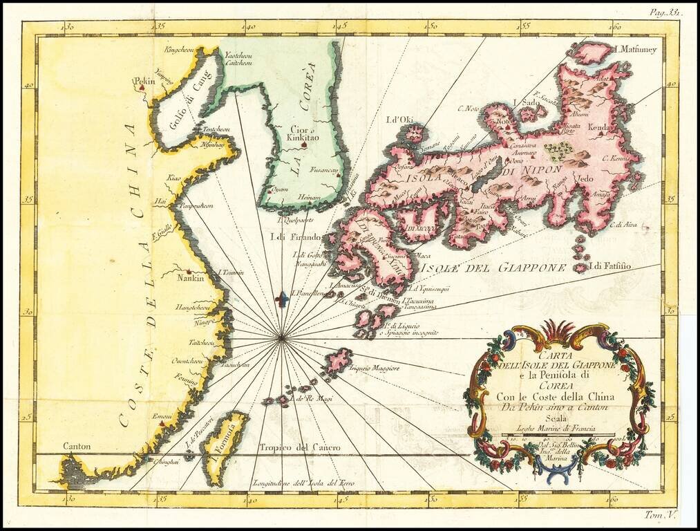
Italian edition of Bellin's regional map, showing Japan, the Korean Peninsula and China, including Canton and the Island of Formosa. Decorative cartouche and Rhumb lines.
Detailed map of China, Korea and the Islands of Japan, showing the Provinces, towns, mountains, rivers, lakes, islands, published in Paris by Jean Lattre. The map is drawn from D'Anville's atlas of China, the first modern atlas of China and a work...
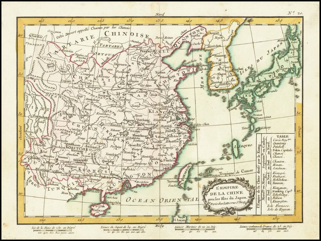
Detailed map of China, Korea and the Islands of Japan, showing the Provinces, towns, mountains, rivers, lakes, islands, published in Paris by Jean Lattre. The map is drawn from D'Anville's atlas of China, the first modern atlas of China and a work...
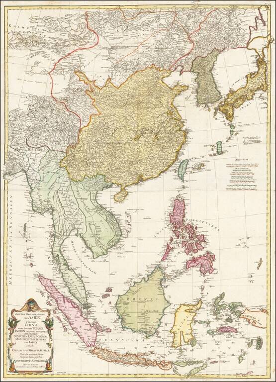
Detailed map of East Asia, extending from China and Korea to Java, published in Vienna in 1786. The map is centered on the Philippine Islands and provides a nice detailed overview of the region.
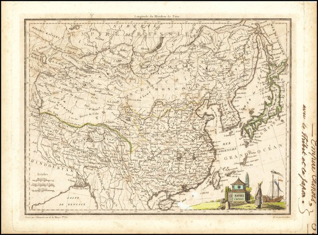
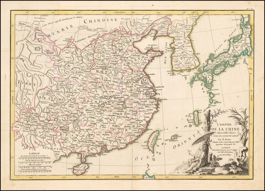
Detailed map of China, Korea and Japan, showing provinces, towns, rivers ports, islands, etc. Includes Formosa and Hainan Islands. Decorative vignette.
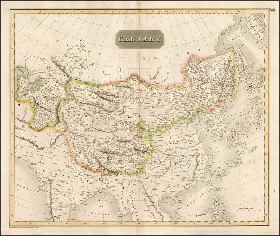
Detailed large format map of Tartary, extending from China, Japan and the Northeastern Russian Regions of Asia to Hindoostan and Beloochistan. One of the most detailed and interesting large format maps of the early 19th Century. A fine example with...
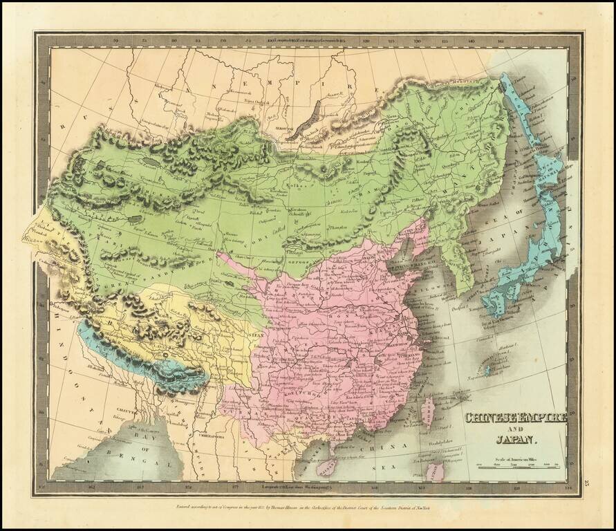
Striking full hand-color example of Burr's map of China, which first appeared in David Burr's Universal Atlas, in 1836. Burr's Atlas was perhaps the most elegant American commercially published atlas of its time, utilizing wonderful wash colors and...