
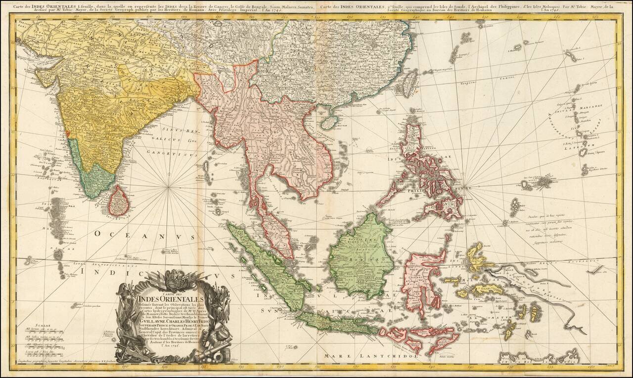
Highly detailed map of the region between India and the Philippines, centered on the Malaysian Peninsula. Extends north to China. Includes rhumblines and a highly ornate cartouche.
![[Pacific Whaling] A New Chart of The Pacific Ocean, Exhibiting The Western Coast of America from Cape Horn to Beerings Strait, The Eastern Shores of Asia Including Japan, China . . . according the most Modern Surveys . . . Additions to 1836 (Large Insets](/map/small/56007.jpg)
With Manuscript Tracks Showing the Course of An American Whaler in the Pacific. Fine example of Norie's monumental sea chart of the Pacific Ocean. The chart is noteworthy for the large insets maps of San Francisco, San Diego, Hawaii, Honolulu and...
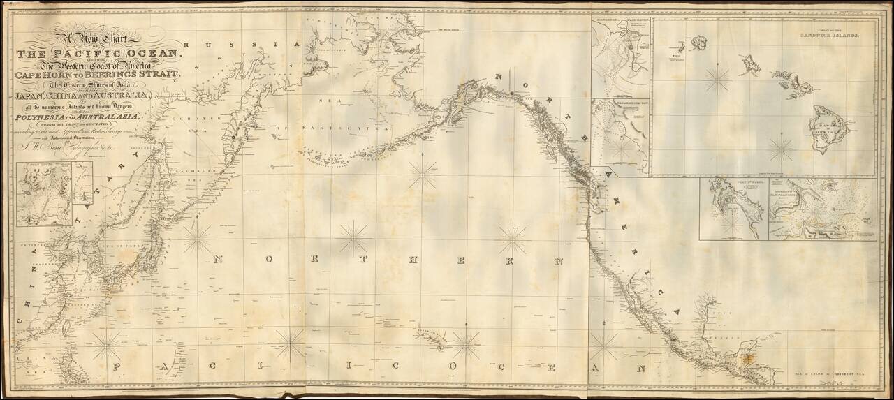
Fine example of Norie's monumental sea chart of the northern part of the Pacific Ocean. The chart is noteworthy for the large inset views of San Francisco, San Diego, Hawaii, Honolulu and Karakakoa Bay in Hawaii. Issued with revisions up to 1844,...
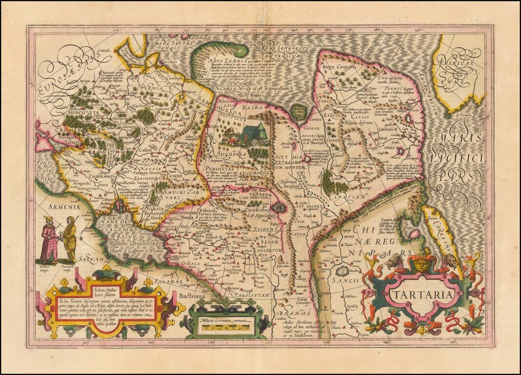
Nice example of Hondius' map of Tartary, China, Korea and adjacent regions. Shows the Great Wall of China, Corea as an Island, a very early example of the northwest coast of America, naming Cape de Fortuna and the Straits of Anian (overlooked by...
![La Parte Orientale della Russia Asiatica Delineata…1796 [Includes Alaska]](/map/small/23720.jpg)
Decorative map of Siberia and Alaska from this scarce and highly decorative 18th Century atlas.
![[Cultural Revolution Maps - Map of France / A Sketch Map of Events of May 1968] [Fagu di tu - Faguo ren min ge ming dou zheng yi tu]](/map/small/65576.jpg)
Chinese Reporting on the May 1968 Uprising in France Two Chinese cultural Revolution Maps printed on a single sheet (back to back), published following hte May Uprising in France in 1968. The map illustrates France as dominated by the worker's...
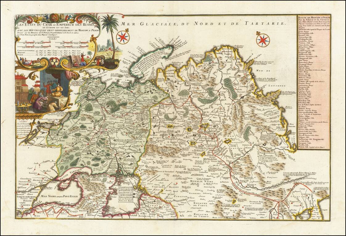
Rare large format map of Imperial Russia, extending from the Baltic and the Black Sea to China, prepared by Nicolas De Fer. De Fer's map is based upon the reports of Nicholas Witsen, Evart Esbrand (Evert Ysbrandzoon Ides) and Philippe Avril. Adam...
![[Book with map] Nova Descriptio Geographica Tattariae Magnae tam orientalis (with Das Nord =und Ostliche Theil von Europa und Asia . . . )](/map/small/68134.jpg)
First Edition of Strahlenberg's Seminal Work on Russia, bound with an English Edition of the Map Nice example of the London edition of Strahlenberg's map of Russia, one of the most important maps of Russia published in the 18th century, bound with the...
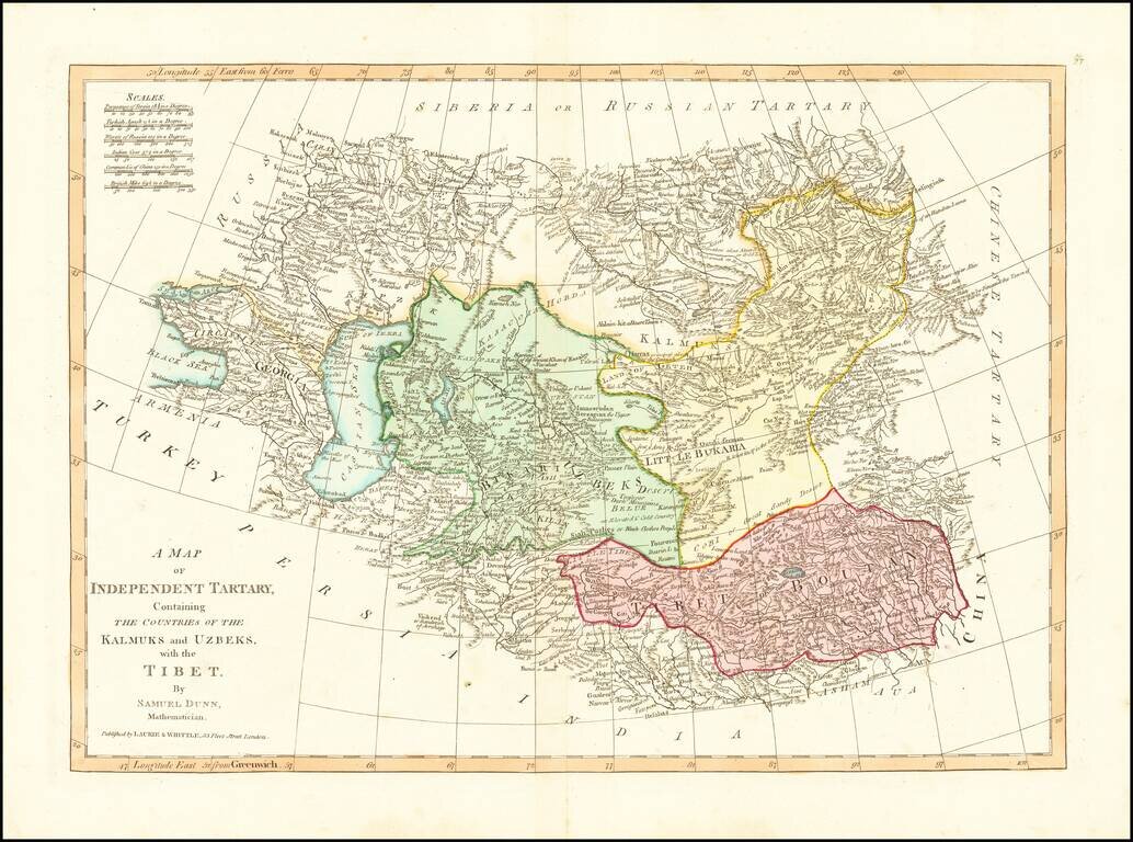
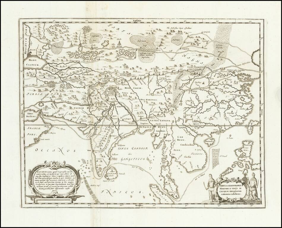
Detailed regional map, extending from European Russia and the Caspian Sea to Chinese Tartary. Nice detail in Tibet, Bukaria, and the Mountainous regions of western China. From Dunn's New Atlas or Mundane System of Geography.
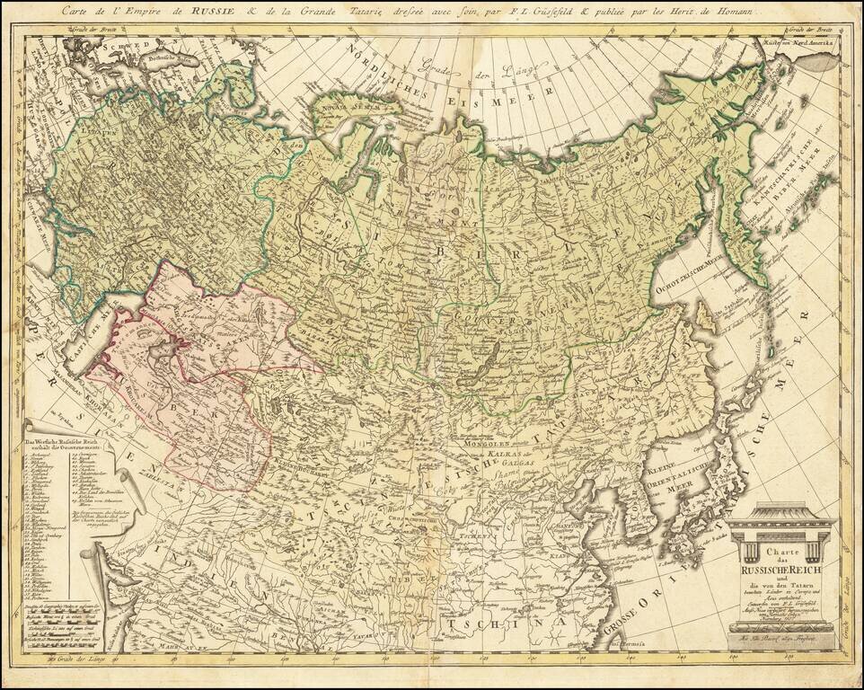
Rare late edition of this detailed map of the whole of Russia and parts of China and Central Asia. Interesting and highly detailed. This is the first time we have seen this state of the map.
![(Russian Adventurism in China) Карта Средней Азии Составлена К. Веберомъ... 1871. [Map of Central Asia Compiled by K. Weber... 1871.]](/map/small/58597.jpg)
The Russian Empire Eyes Western China. Important manuscript map of northern and western China and Mongolia prepared by K. Weber, Beijing, 1871, and copied by L. Brosse in St Petersburg. The map was the product of a major Russian expedition in China...
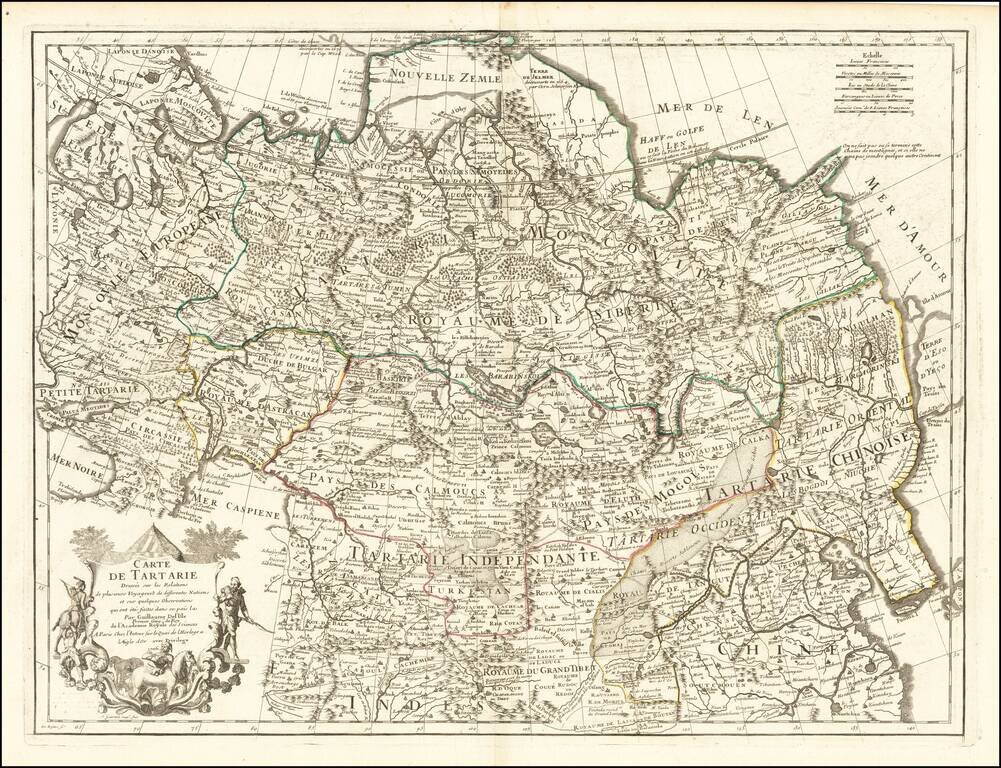
Nice example of this detailed map of Tartary, consisting of the Eastern part of Russia, Central Asia, China and Korea, first published by Nicholas De L'Isle in 1706. The map extends from the Peninsula of Korea in the east to the Caspian and Black...
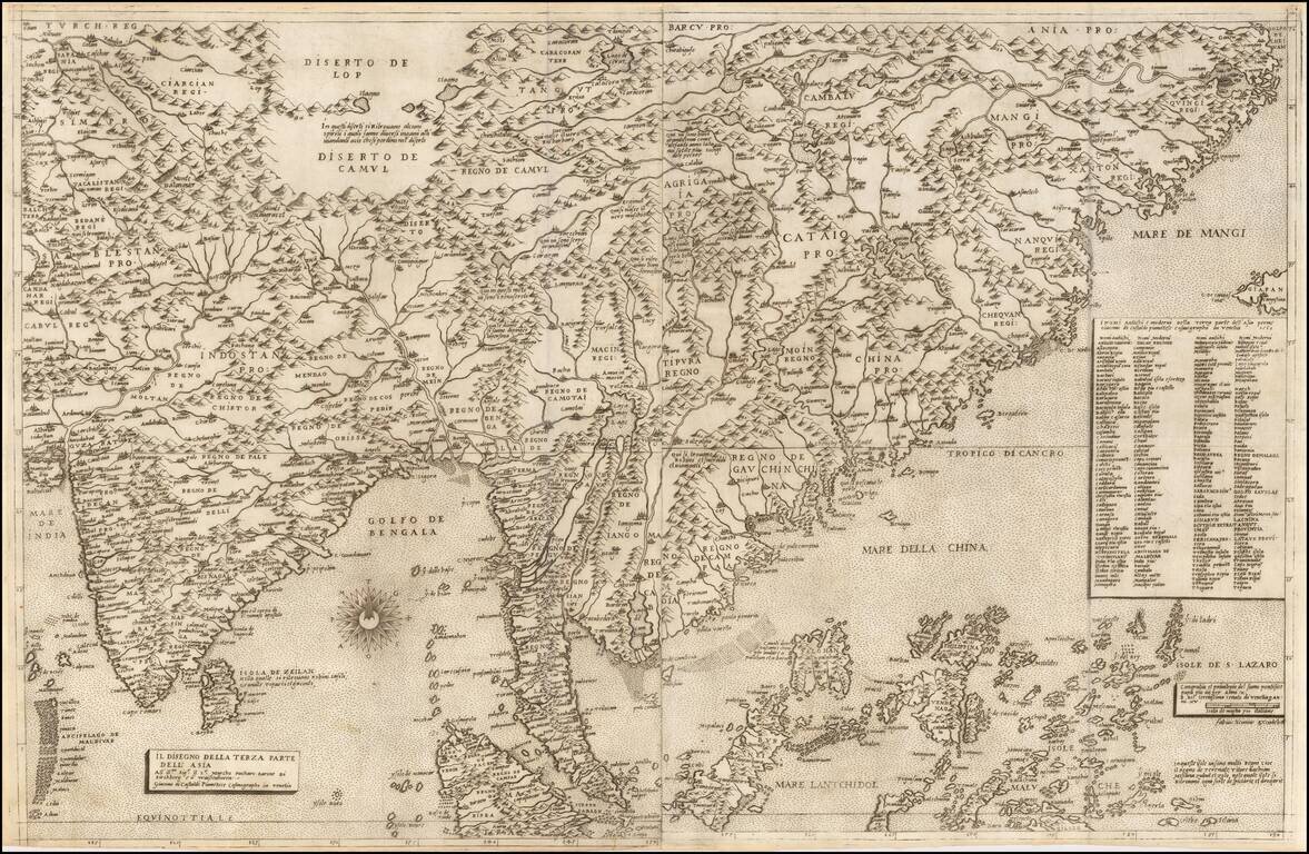
First State of the Most Influential Map of Eastern Asia Published in the Sixteenth Century Rare and highly influential map of India, China, and Southeast Asia by Giacomo Gastaldi, one of the most celebrated Italian cartographers of the sixteenth...
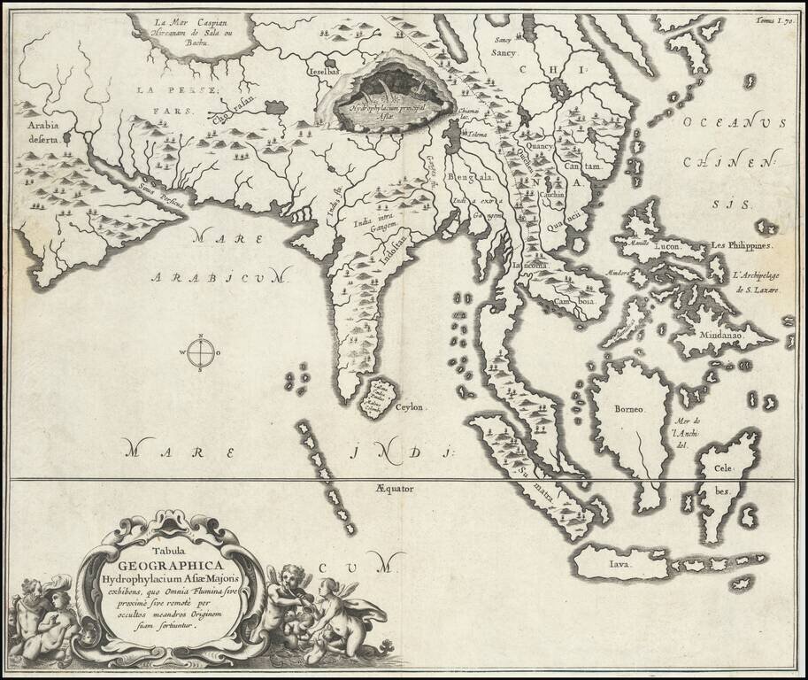
Fine, Distinctive Map of Asia by Polymath Athanasius Kircher Fascinating map of Asia, illustrating the theories of the Jesuit scholar Athanasius Kircher, from his Mundus Subterraneus. It was one of the earliest thematic maps. This very unusual map...
Antique engraved map of Asia, from Persia to China, illustrating various routes of travel across the continent. The map was published in Kircher's China Illustrata in 1667. The sea route from Goa to Macao is depicted. Many overland routes are also...
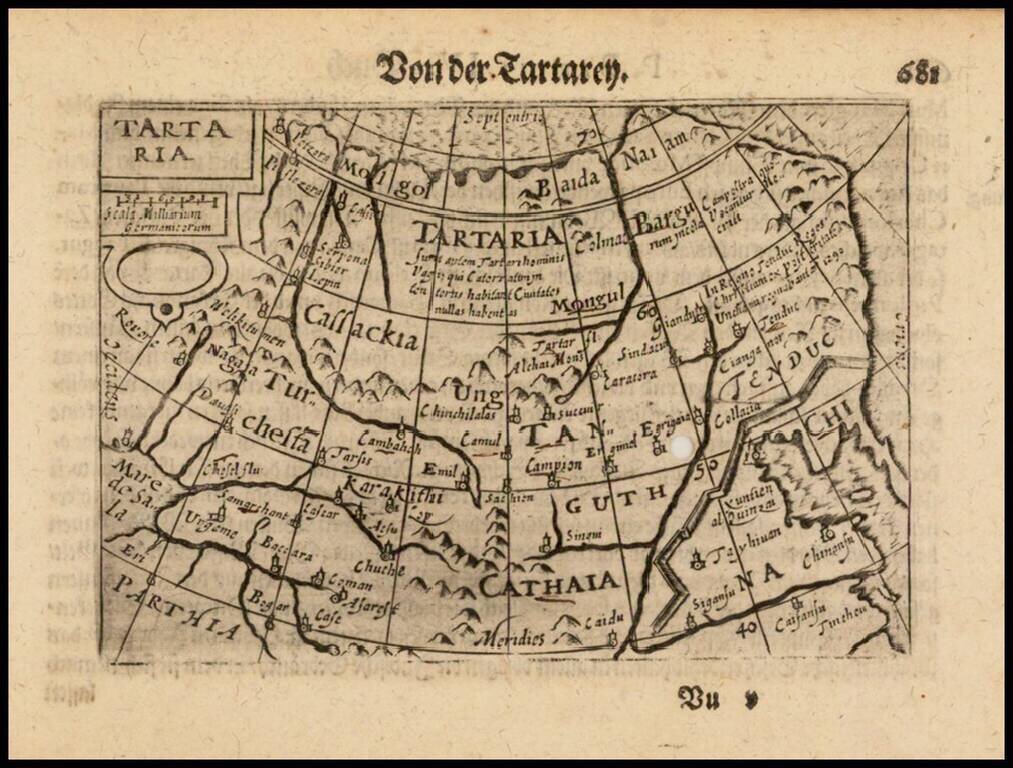
Nice example of this early state of Barent Langenes's map of Tartaria, which first appeared in the 1598 edition of Langenes's Caert-Thresoor, published in Middelburg. Langenes's map was first issued in his Caert-Thresoor and later re-published by...