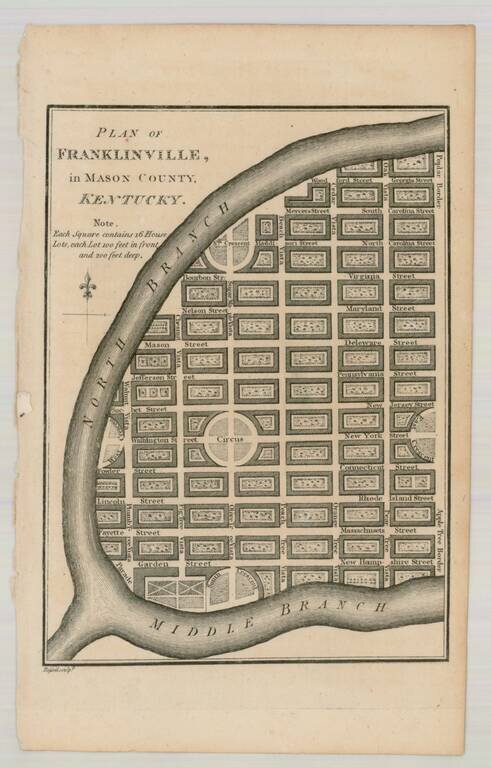
Interesting pair of maps showing towns that were never built in the present-day state of Kentucky. Franklinville located in Mason County, was formed on paper in 1794 by a group of London speculators. The town was to be built beside the North Fork of...
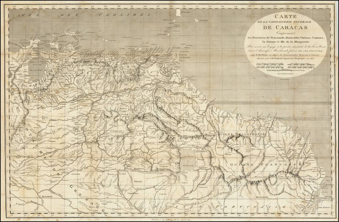
A Rare Early New York Imprint -- Includes A Reference To El Dorado Scarce and highly detailed map of the Captaincy of Caracas, published by I Riley & Co, April 1807. The map covers the area from Maracaibo and Curacao to the mouth of the Amazon...