Emanuel Bowen (1694?-1767) was a British engraver and print seller. He was most well-known for his atlases and county maps. Although he died in poverty, he was widely acknowledged for his expertise and was appointed as mapmaker to both George II of England and Louis XV of France. His business was carried on by his son, Thomas Bowen. He also trained many apprentices, two of whom became prominent mapmakers, Thomas Kitchin and Thomas Jeffreys.
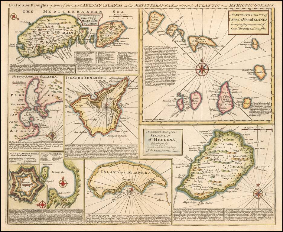
Detailed set of 8 maps, including a large and detailed Malta, the Bay of Agoa de Saldanha, Teneriffe, the Dutch Fortress at the Cape of Good Hope, Table Bay, Madera, St. Helena and the Cape Verde Islands, all with extensive annotations.
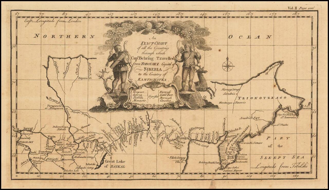
Nice example of the first English language map to show Vitus Behring's Route. In December 1724, Czar Peter the Great ordered the Danish-born Captain-Commander Vitus Bering (1681-1741) to lead the First Kamchatka Expedition (1725-30), in an effort to...
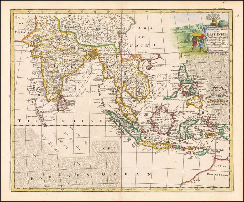
A decorative and highly detailed map, extending from Australia, the Philippines and the Carolines in the east to India, the Maldives and Afghanistan in the west. Includes information regarding the course of the flow of the Ocean in the Indian Ocean...
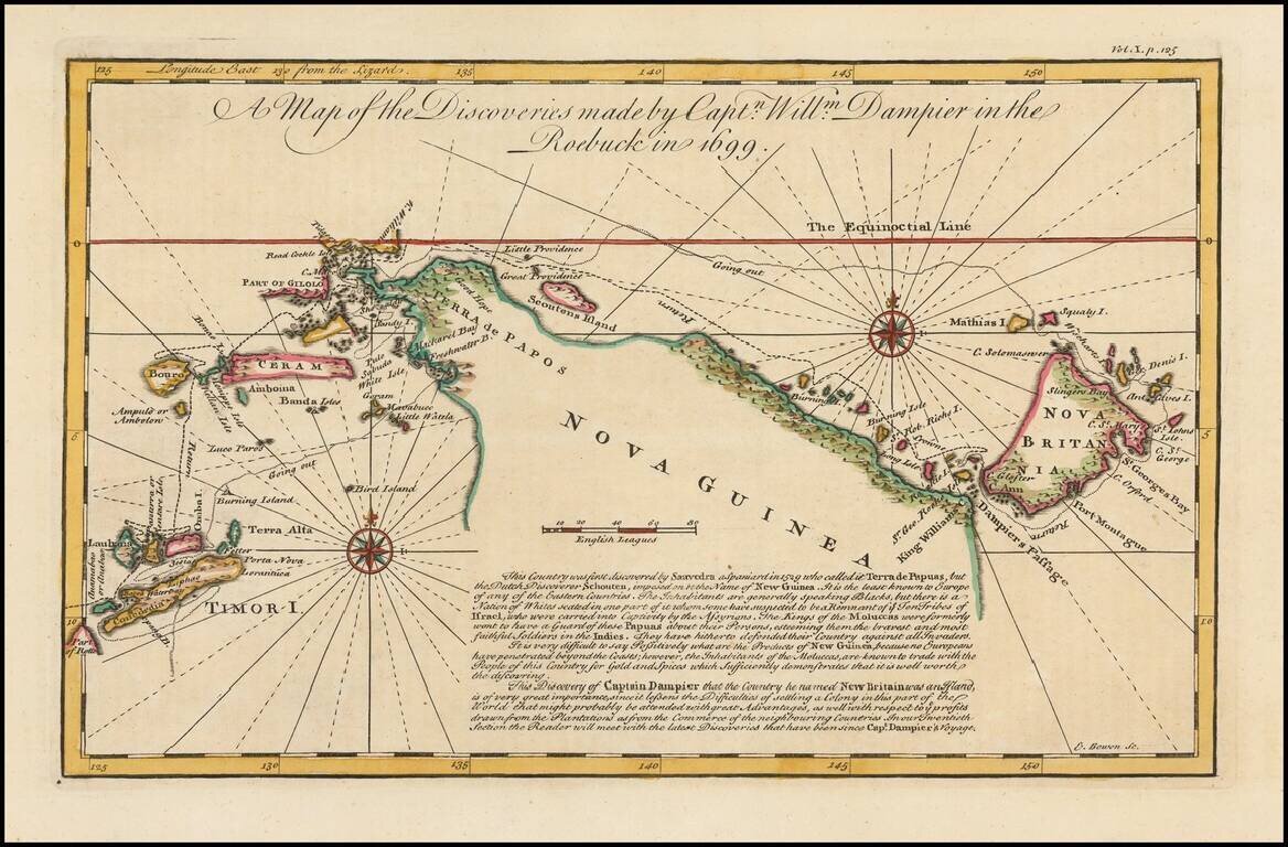
Detailed map of New Guinea as seen by William Dampier, first man to circumnavigate the world three times and first naturalist afloat This is a map of William Dampier's tracts aboard the Roebuck in 1699, included in the re-issue of John Harris'...