logo

Peter Maverick

Peter Maverick


1

1803 - A Map shewing the relative situation of a tract of Land belonging to I.B. Church Esqr. / . This Tract of Land contains 100,000 Acres, and is situated on the Geneseo River; 22 Miles South of Williamsburgh, 100 East of Presque-Isle, 8 North of the Pennsyl

  • $14.99

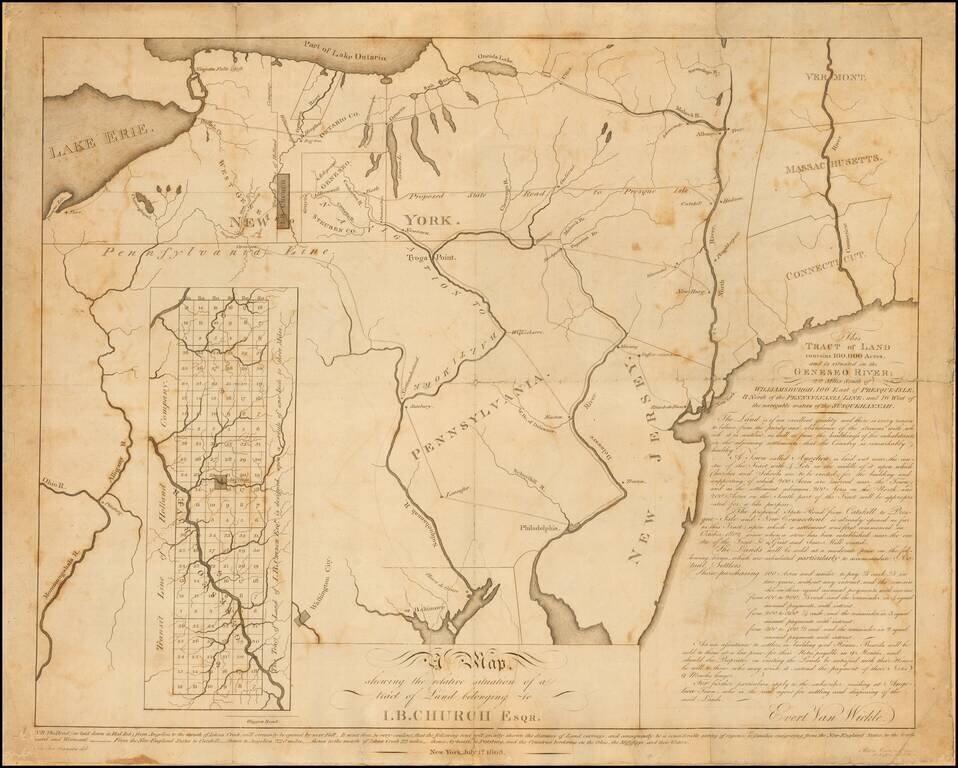
Rare early 19th Century map relating to the early settlement of western New York. This undeveloped 100,000-acre tract on the Genesee River in western New York had been used to repay a debt to John Barker Church from financier Robert Morris. Church was...


2

1805 - Carte de la Capitainerie Generale De Caracas Comprenant les Provinces de Venezuela, Maracaibo, Varinas, Cumana, la Guiane, et Isle de la Margeurite, Pour servir au Voyage a la partie oriental de la Terre Ferme dans l'Amerique Meridionale fait en 1801, 180

  • $14.99

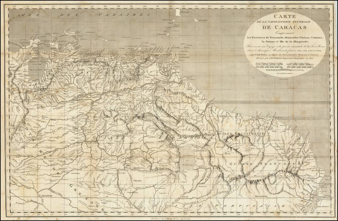
A Rare Early New York Imprint -- Includes A Reference To El Dorado Scarce and highly detailed map of the Captaincy of Caracas, published by I Riley & Co, April 1807. The map covers the area from Maracaibo and Curacao to the mouth of the Amazon...