Johann Baptist Homann (1663-1724) was a mapmaker who founded the famous Homann Heirs publishing company. He lived his entire life in Bavaria, particularly in Nuremberg. Initially, Johann trained to become a priest before converting to Protestantism and working as a notary.
In 1702, Johann founded a publishing house that specialized in engravings. The firm flourished, becoming the leading map publisher in Germany and an important entity in the European map market. In 1715, Johann was named Imperial Geographer to the Holy Roman Empire by Charles VI and made a member of the Prussian Academy of Sciences. Most importantly for his business, his reputation and contacts gained him imperial printing privileges which protected his publications and recommended him to customers. Johann is best known for this Grosser Atlas ueber die ganze Welt, or the Grand Atlas of the World, published in 1716.
After Johann died in 1724, the business passed to his son, Christoph (1703-1730). Upon Christoph’s early death, the company passed to subsequent heirs, with the name of the company changing to Homann Erben, or Homann Heirs. The firm continued in business until 1848.
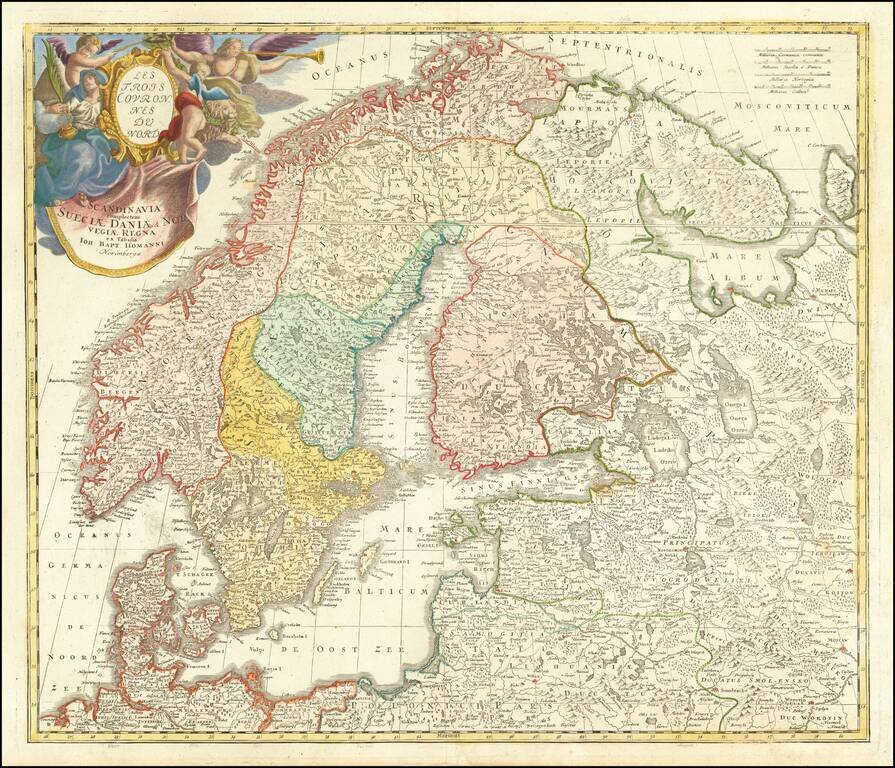
Nice example of Homann's first map of Scandinavia, pre-dating his privilege, where he reworks the map to include a different title and cartouche. Provides excellent detail throughout the region.
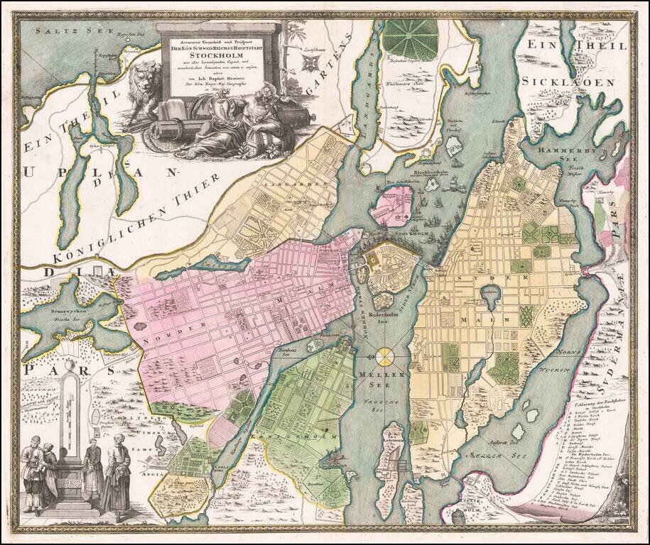
Detailed plan of Stockholm, by one of the leading German map makers of the early part of the 18th Century. Includes an elaborate plan, 2 cartouches and a key showing 28 places.
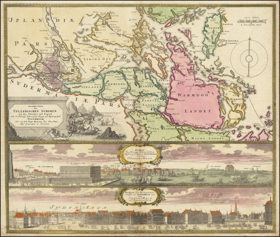
Decorative map and pair of views, focusing on Stockholm and its environs. The map shows Stockholm and the area around it, focusing on the approach from the sea. The two views below show the two major parts of Stockholm, Sydermalm and Nordermalm.
![Imperii Persici In Omnes Suas Provincias . . . [includes Cyprus]](/map/small/64524.jpg)
Detailed map of the Persian Empire, published by Homann. The maps extends from the Black Sea, Khasikstan and Turkistan in the North to the Red Sea, Persian Gulf, Euphrates and the Mediterranean in the South, showing almost all of Cyprus. Decorative...
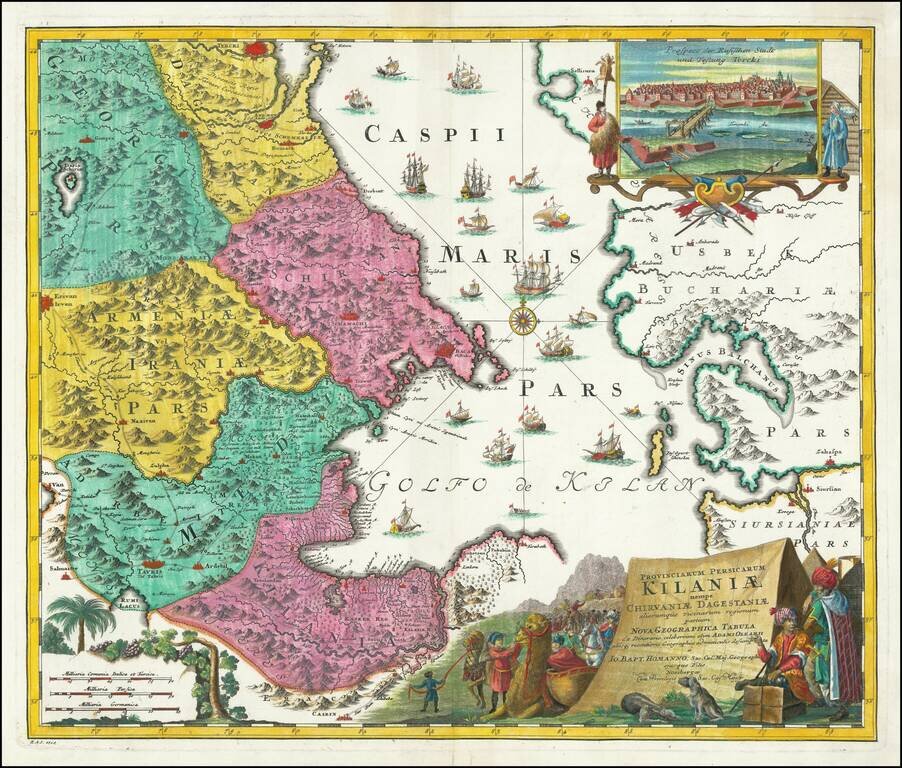
Decorative Map of Northern Iran, Part of Azerbaijan, Armenia and Turkmenistan -- Caspian Sea Region Gorgeous map of parts of Georgia, Armenia Kilani, Dageston, Schirvan and the southern part of the Caspian sea with Caucasus and Turkmenistan....
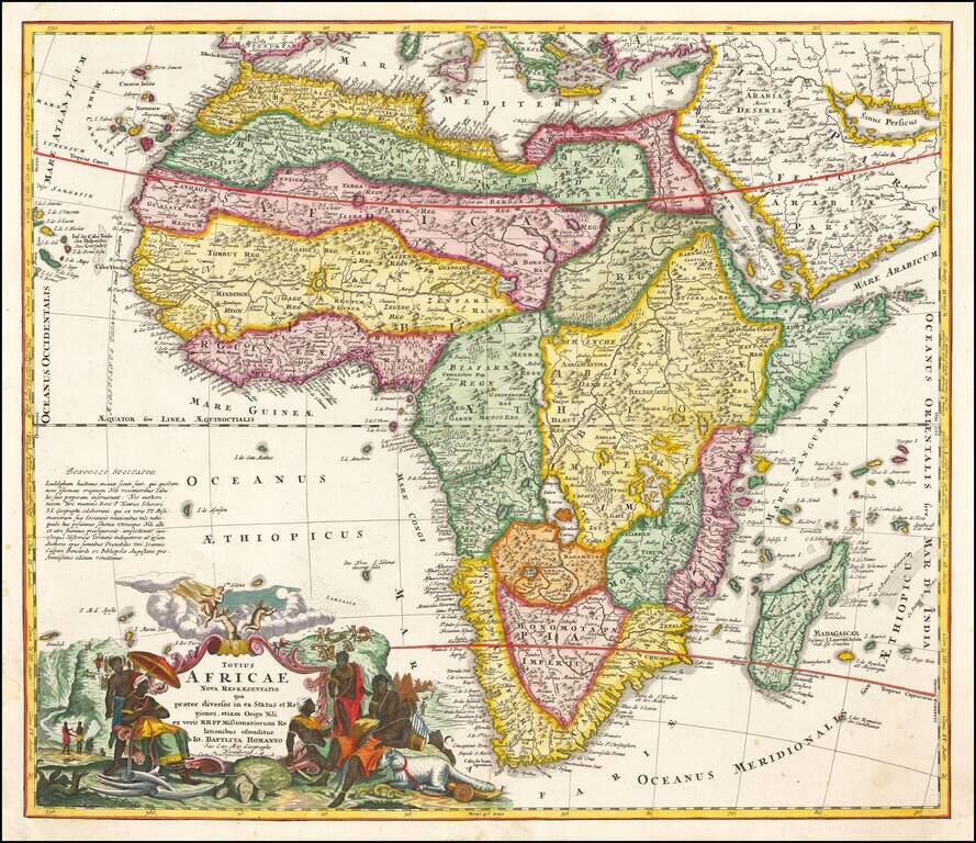
Striking example of Homann's first map of Africa. The map includes an extensive note on the accuracy of the Nile, the first map to have such a note. A highly innacurate map, both in shape and nomenclature. Shows both real and fictitious St. Helena...
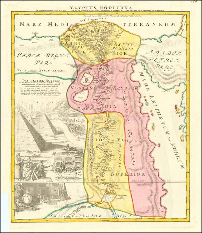
Nice full color example of Homann's decorative map of Egypt. Homann's map of Egypt is focused on the Nile River Valley from the Mediterranean to below the first cataract at the confluence of the White and Blue Nile. Nearly a third of the map is...
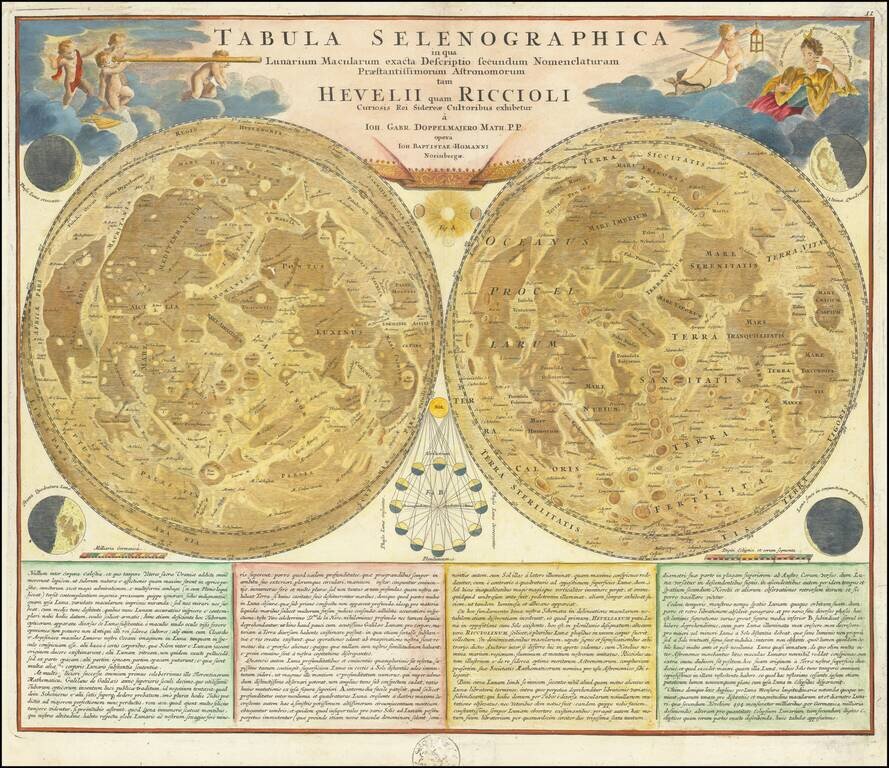
Mapping the Moon in the Early 18th Century Striking pair of maps depicting the surface of the moon, based upon the models of Johannes Hevelius and Giovanni Battista Riccioli. The two spheres of the moon provide a comparative analysis of the...