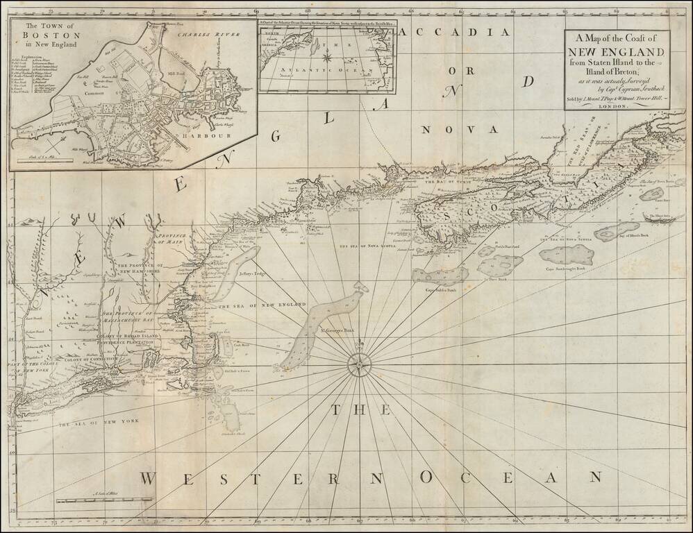
Navigating The Northeastern Seaboard Detailed coastal chart of the Northeastern part of the United States and part of Canada, reduced from Cyprian Southack's seminal 8 sheet chart that made up The New England Coasting Pilot, one of New England's...
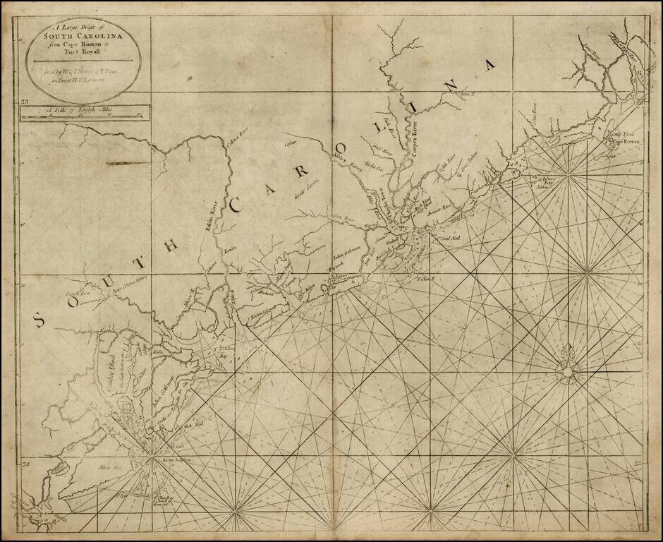
Fine example of this scarce map of the coast of South Carolina from the English Pilot, Fourth Book, including fascinating 18th Century provenance. Nice example of the third state of this fine chart of South Carolina, updated by Mount & Page just...
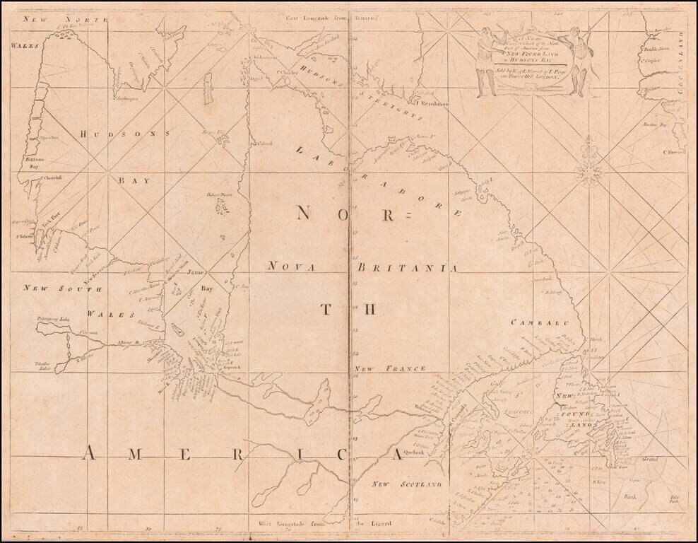
A Fine Mount & Page edition of John Thornton's important sea chart of Hudson's Bay and Eastern Canada. This fascinating sea chart embraces all of eastern Canada, from the southern part of Baffin Island down to include the Canadian Maritimes,...
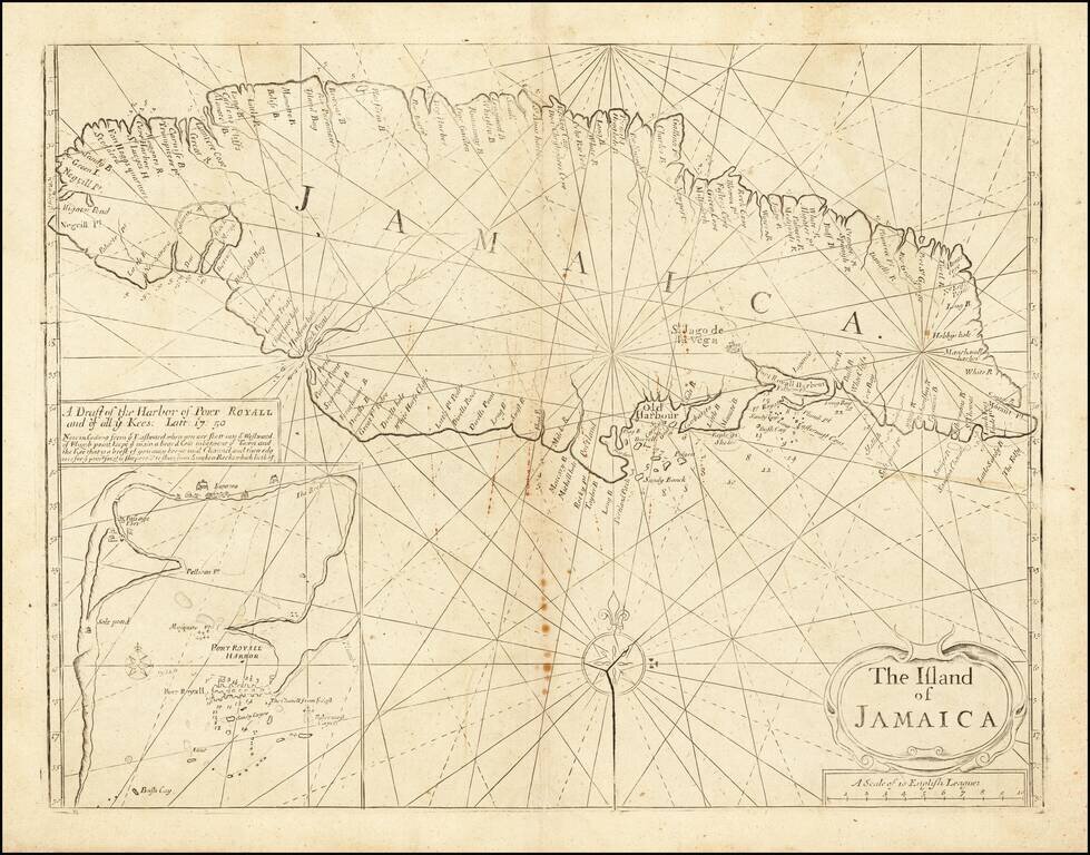
Late state of Mount & Page's sea chart of Jamaica, from the Fourth Book of the English Pilot. The chart was perhaps the single most widely utilized English sea chart of Jamaica during the first half of the 18th Century, as the success of the...
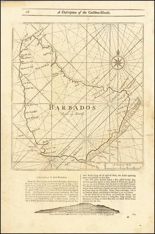
Detailed coastal map of the Island of Barbados, from Mount & Page's English Pilot, Fourth Book. The map includes a number of bays, harbors and other coastal feature, with sailing directions and a profile view below and on the verso.
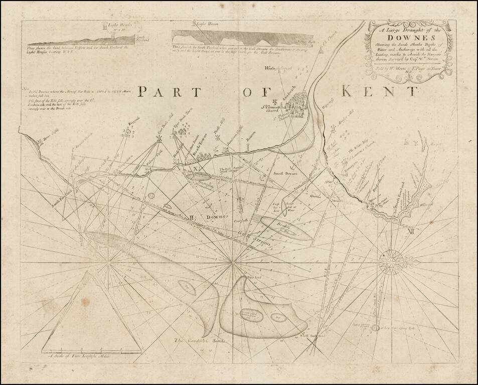
Detailed sea chart showing a portion of the Coast of Kent, from Dover Castle to North Foreland, published by Mount & Page. The chart shows leading marks to Sandwich, Deal and Ramsgate. It contains two coastal elevations and pictorial...
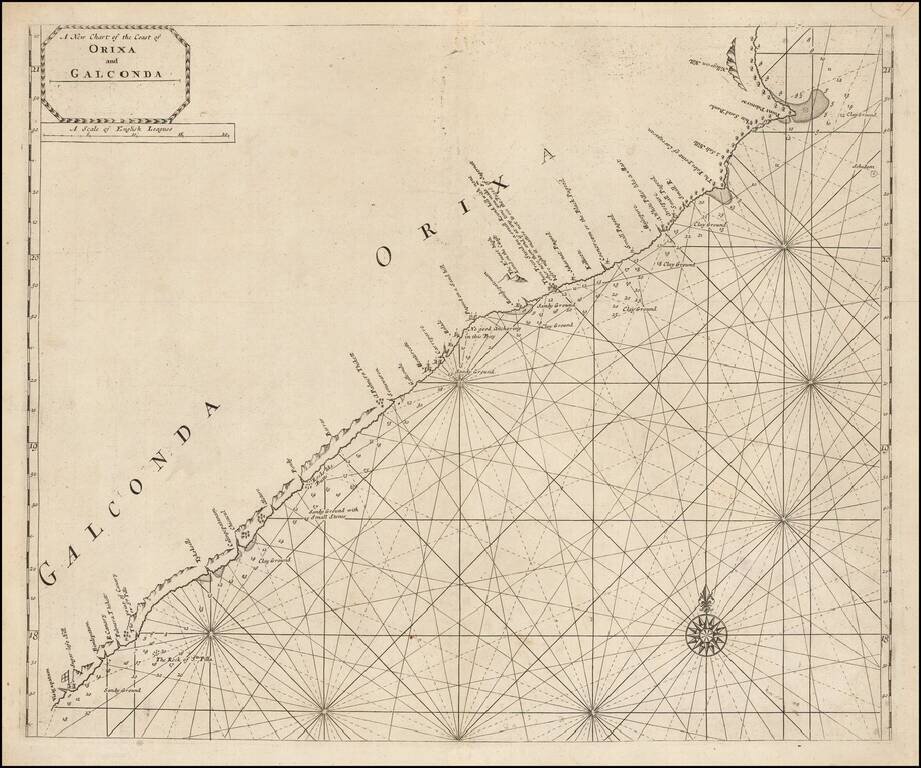
Scarce engraved sea chart of the coast of India, northeast from Vizagapatam (Visigapatam on the map). The map includes details along the coast that suggest the firsthand surveying that went into its production. Soundings are given from harbor to...
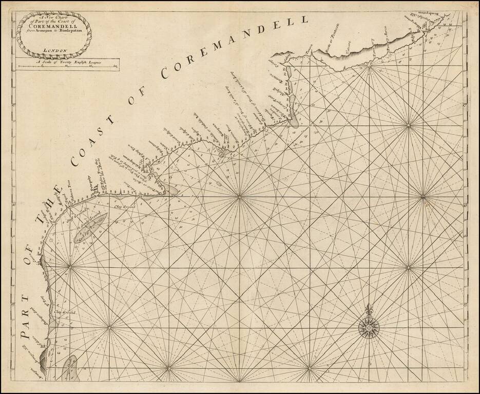
Scarce engraved sea chart of the Coromandel coast in southeast India covering the state of Andhra Pradesh from Bheemunipatnam (Bimlepatnam) near Visakhapatnam to Armegon. The map includes details along the coast that suggest the firsthand surveying...