Joan, or Johannes, Blaeu (1596-1673) was the son of Willem Janszoon Blaeu. He inherited his father’s meticulous and striking mapmaking style and continued the Blaeu workshop until it burned in 1672. Initially, Joan trained as a lawyer, but he decided to join his father’s business rather than practice.
After his father’s death in 1638, Joan and his brother, Cornelis, took over their father’s shop and Joan took on his work as hydrographer to the Dutch East India Company. Joan brought out many important works, including Nova et Accuratissima Terrarum Orbis Tabula, a world map to commemorate the Peace of Westphalia which brought news of Abel Tasman’s voyages in the Pacific to the attention of Europe. This map was used as a template for the world map set in the floor of the Amsterdam Town Hall, the Groote Burger-Zaal, in 1655.
Joan also modified and greatly expanded his father’s Atlas novus, first published in 1635. All the while, Joan was honing his own atlas. He published the Atlas maior between 1662 and 1672. It is one of the most sought-after atlases by collectors and institutions today due to the attention to the detail, quality, and beauty of the maps. He is also known for his town plans and wall maps of the continents. Joan’s productivity slammed to a halt in 1672, when a fire completely destroyed his workshop and stock. Joan died a year later and is buried in the Westerkerk in Amsterdam.
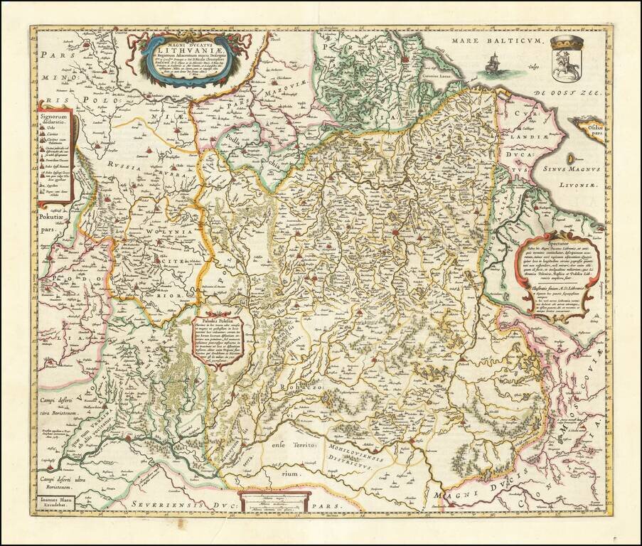
Nice example of Blaeu's rare map of Poland, Lithuania, etc., which first appeared in the 1662 edition of Blaeu's Atlas Maior. This is Blaeu's second map based upon Radizwill's early map, originally engraved by Hessel Gerritsz. The Radziwill map is one...
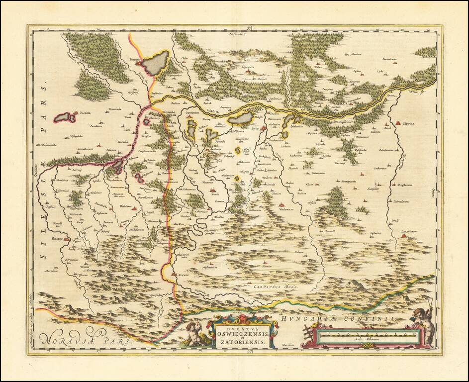
An attractive antique map of southwestern Poland, which appeared in Blaeu's Atlas Maior. Focused on the border between the historical regions of Silesia and Lesser Poland, the map preserves a detailed layout of the area. While the map is named after...
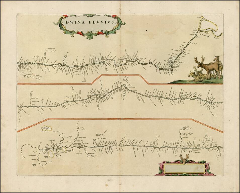
Rare late edition of Blaeu's map showing the course of the Dvina River in three separatre panels. The headwaters are at bottom left, with the mouth at Archangelsk at upper right. The map is decorated with a superb title cartouche surrounded by putti...
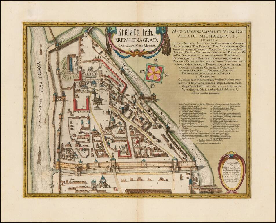
Refined, Intricate Plan of the Kremlin, from Blaeu’s Atlas Maior Fine, old-color example of Blaeu's rare plan of the Kremlin, which appeared only in his monumental Atlas Maior. The plan shows in exceptional detail the heart of Moscow's inner walled...
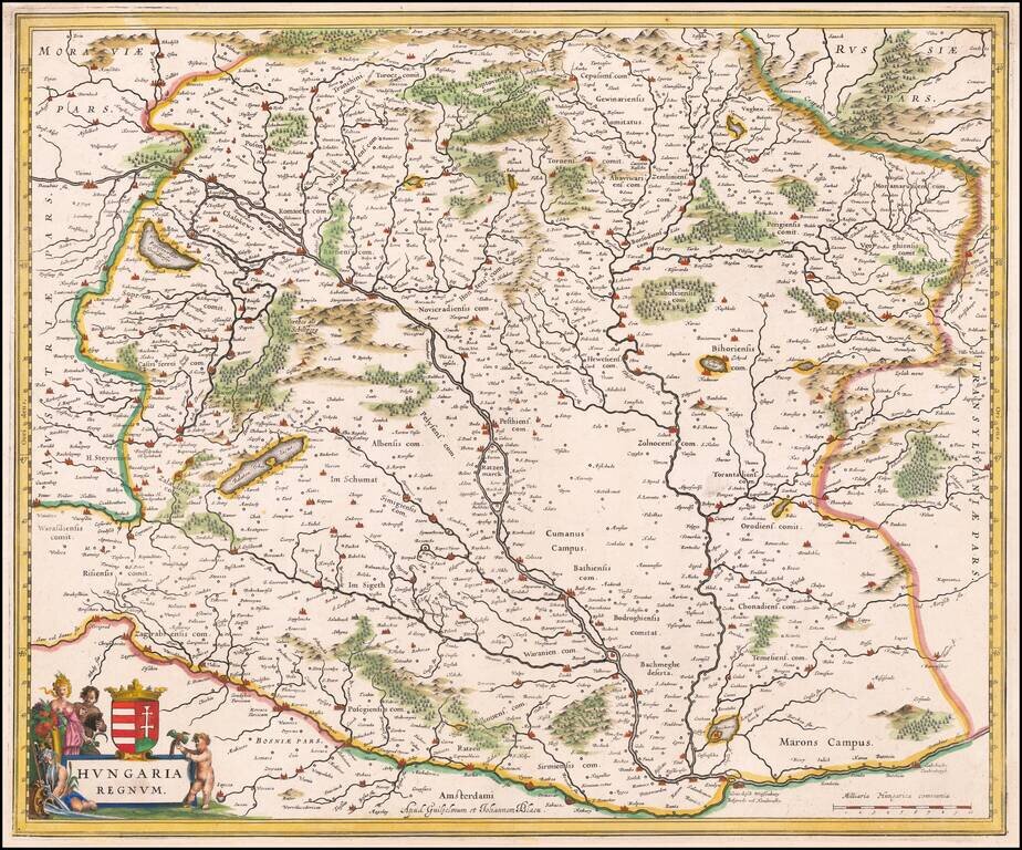
Striking example of Blaeu's map of the Kingdom of Hungary. Includes decorative cartouche, coat of arms, etc.

Finely engraved view of Pisa, originally published by Johannes Blaeu for Blaeu's town books of Italy. Includes a key at the bottom locating 97 places, including of course, the famous leaning tower of Pisa at the top center. The present example was...
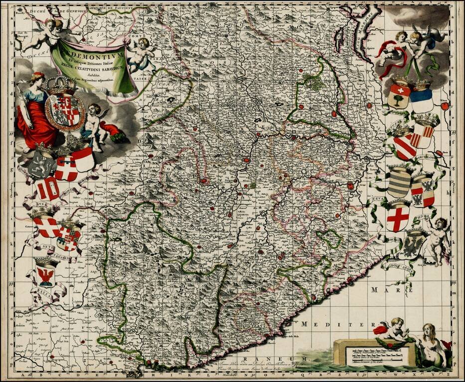
Nice old color example of Johannes Blaeu's map of the Pedemonte region, from Blaeu's Theatrum Sabaudiae, first published in 1680. The map includes 16 coats of arms of various regions depicted on the map. The map was engraved by J. de Broen and is...
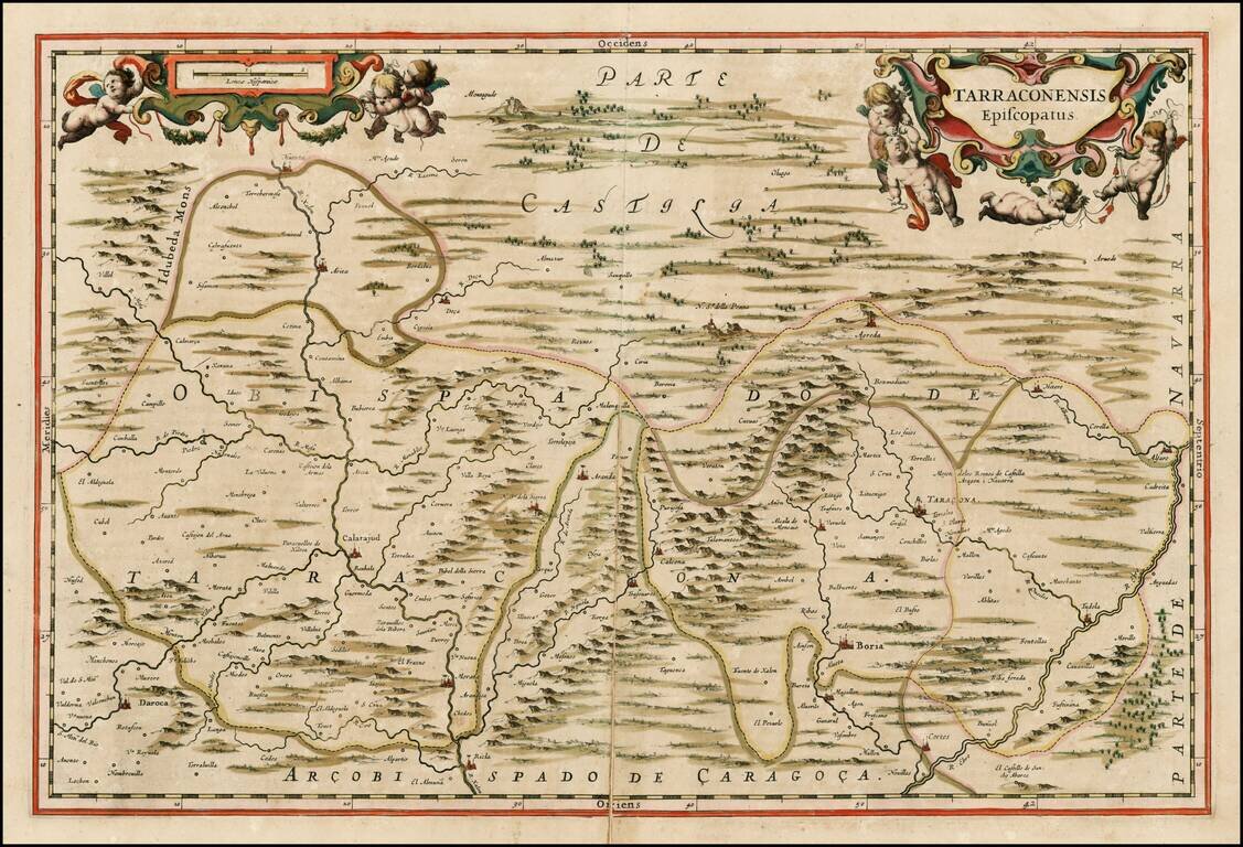
Scare regional map of Spain, which appeared only in the late editions of Blaeu's Atlas Maior. Fine old color example.
![[Heightened with Gold Leaf!] Episcopatus Balbastrensis, Ribagorca Comit et Sobrarbe cum Adjecentibus](/map/small/69195.jpg)
Fine old color, gold heightened example of Blaeu's map of the Spanish Pyrenees Mountains, Huesca etc. The map is oriented with west at the top, and is centered on the town of Barbastro, in Huesca.
![[Sweden] Gothia Auctore Andrea Bareo Sueco](/map/small/0209ops.jpg)
Fine old color example of Blaeu's map of Lapland. The present example is a late state of the map, with credit to Andrea Bareo for the map and an elegant dedication carouche at the left corner, both of which are added to the map after its original...
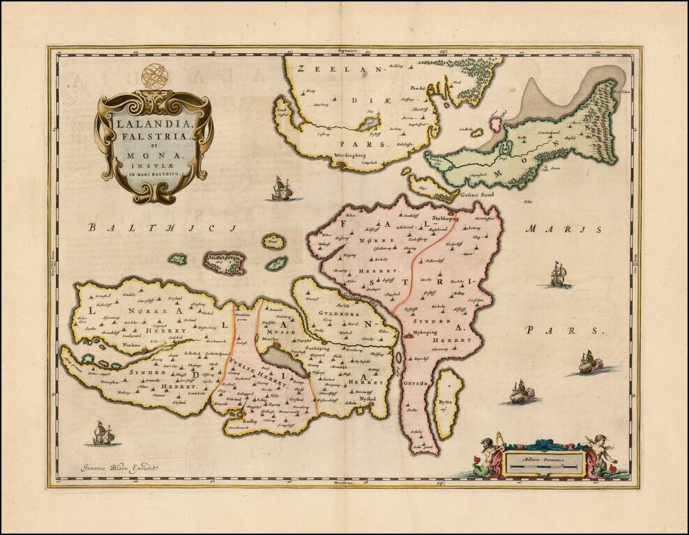
Scarce map of the Danish islands of Lolland, Falste and Mon, which first appeared in Blaeu's Atlas Maior. Also included are the southern portion of Zealand (Sjaelland), as well as the numerous adjacent smaller islands. The cities of Praesto,...
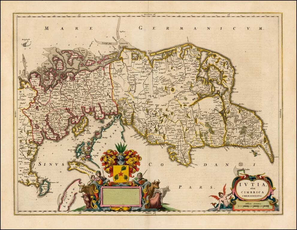
Fine example of Blaeu's map of Jutland, which was issued only in the Atlas Maior.

The First European Printed Map of Hong Kong Region -- Guangzhou, & Macao Fine example of Blaeu's map of the Canton or Guangdong Province, including Hong Kong, Guangzhou and Macao. Includes the Pearl River Delta and the Island of Hainan. The map...
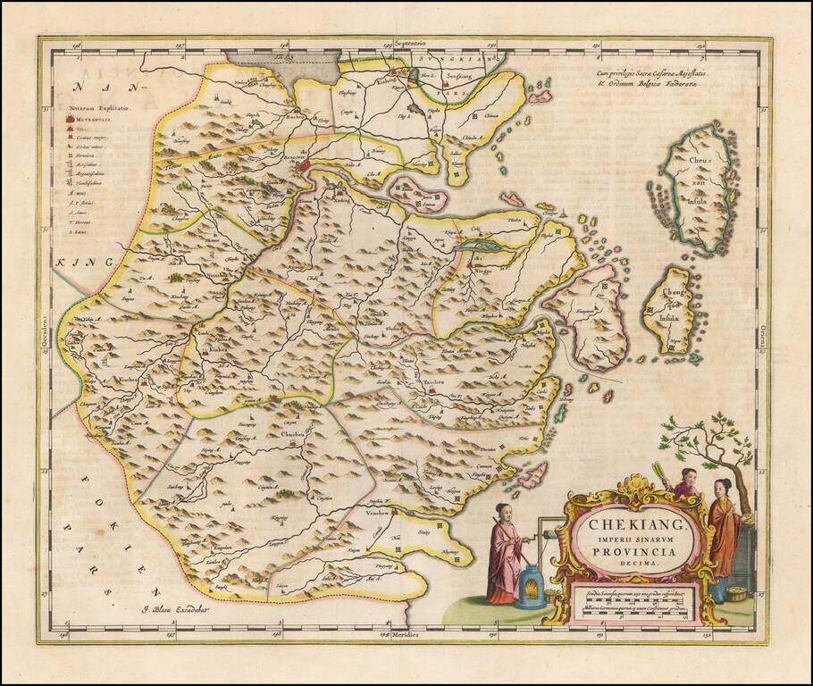
Nice old color example of Blaeu's map of the Chekiang region, including the cities of Shanghai, Hangzhou and Ningpo and the sacred islands. Decorative map of the province, based on the maps of Jesuit missionary Martino Martini, the map features many...
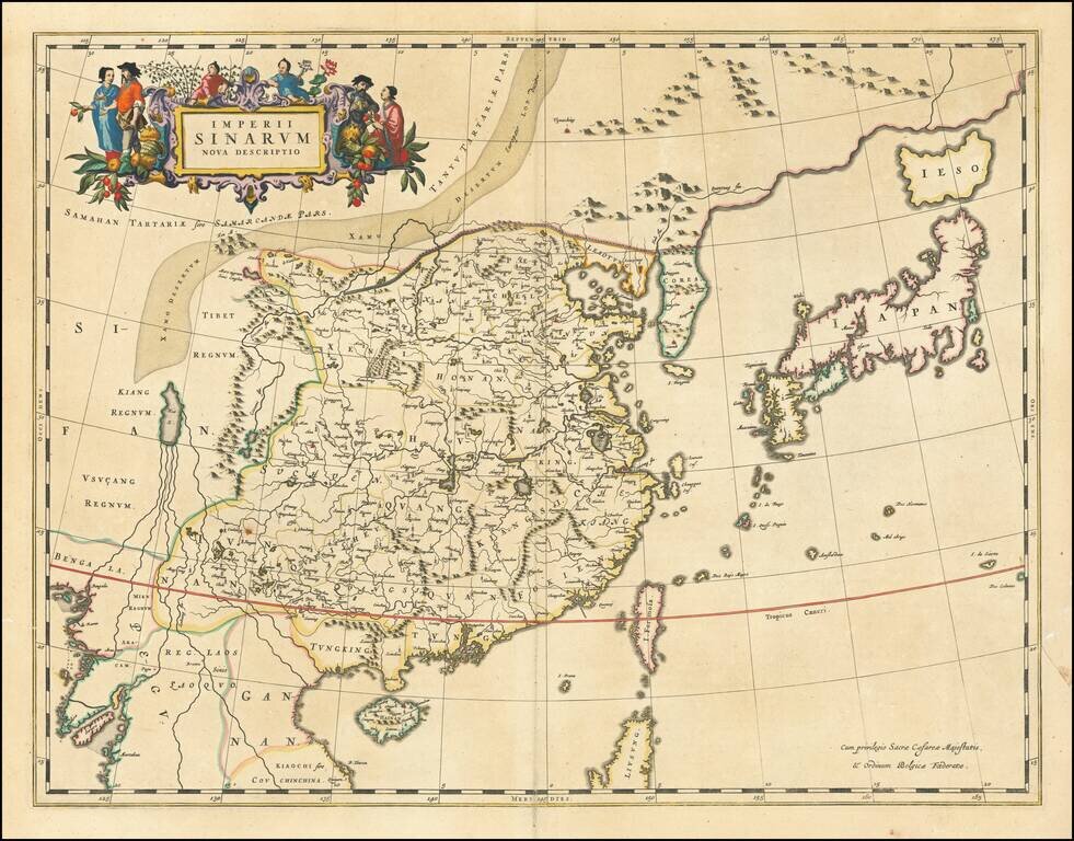
Nice example of Blaeu's map of China, from the Atlas Sinensis. A important general map of China, Korea and Japan, published by Joan Blaeu in the Jesuit Martino Martini's Atlas Sinensis , the first western atlas of China. The map Incorporates the...
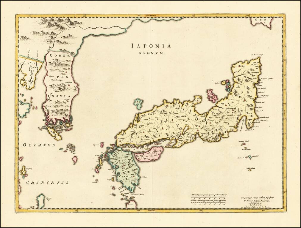
Striking Blaeu Map of Japan, Showing Korea as a Peninsula Fine, old-color example of Joan Blaeu's map of Japan and Korea from his renowned Atlas Sinensis. While titled as a map of Japan, perhaps the single most noteworthy feature of this map is that...