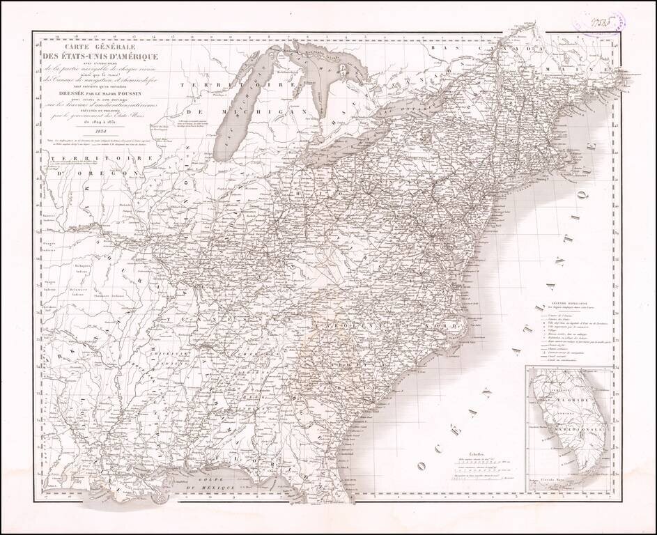
General map of the United States, illustrating the nation at the time the French Engineer Guillaume Tell-Poussin was working in America as one of its leading canal engineers. The map appeared in the Travaux d'ameliorations interieures projetes ou...
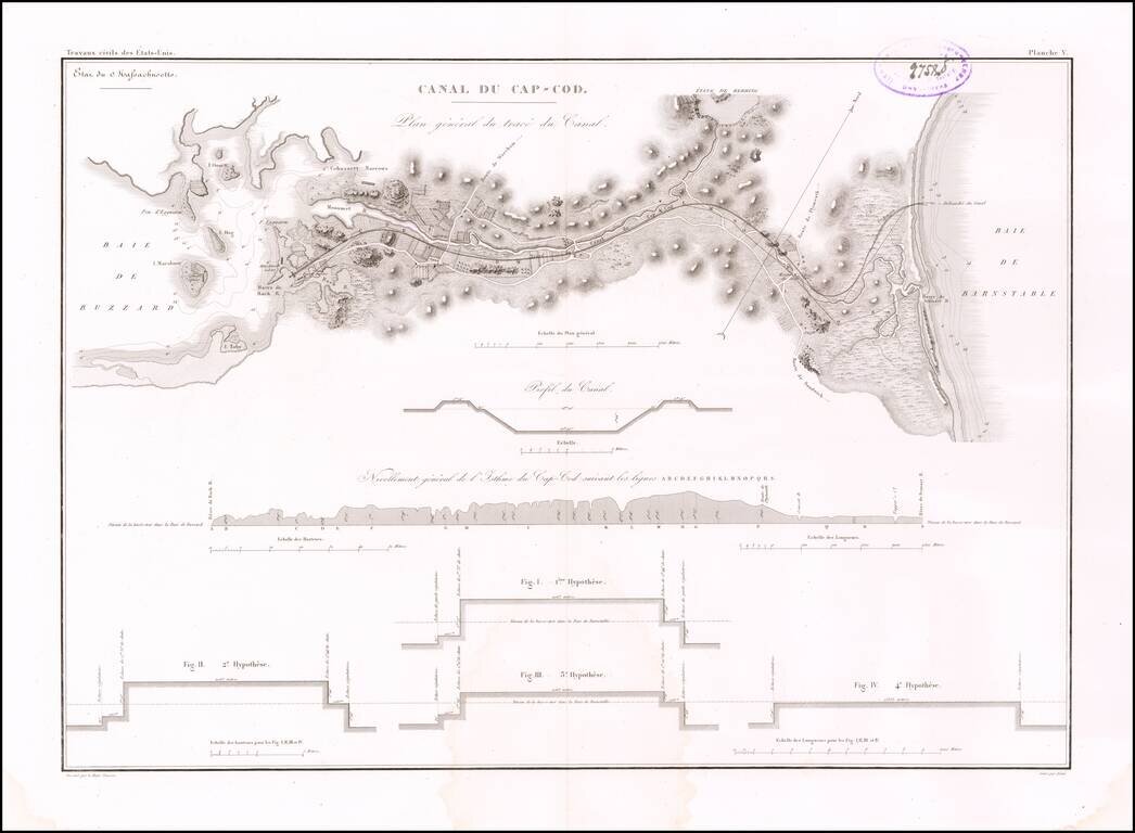
Early Plans for the Cape Cod Canal Detailed map illustrating the course and profiles for the Cape Cod Canal, from Buzzard Bay to Barnstable Bay. The eminent French engineer, Major William Tell Poussin, who worked for some time in the United States,...
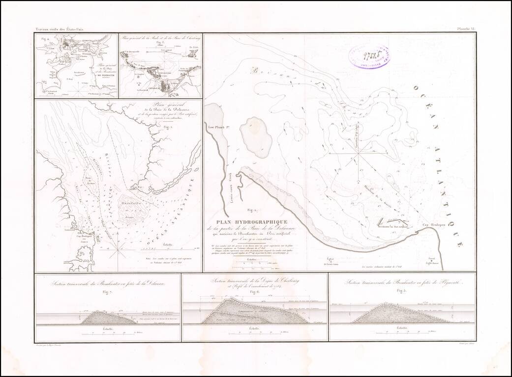
Building the First Breakwater and Artificial Port of Its Kind in America. Rare engraved map by Guillaume-Tell Poussin, related to the construction of the Delaware Breakwater in the Delaware Bay in the 1820s. The sheet features a map of the mouth of...