
Intereting publication and maps focused on the special methods of air navigation in the Polar regions. The maps cover the north and south Polar regions.
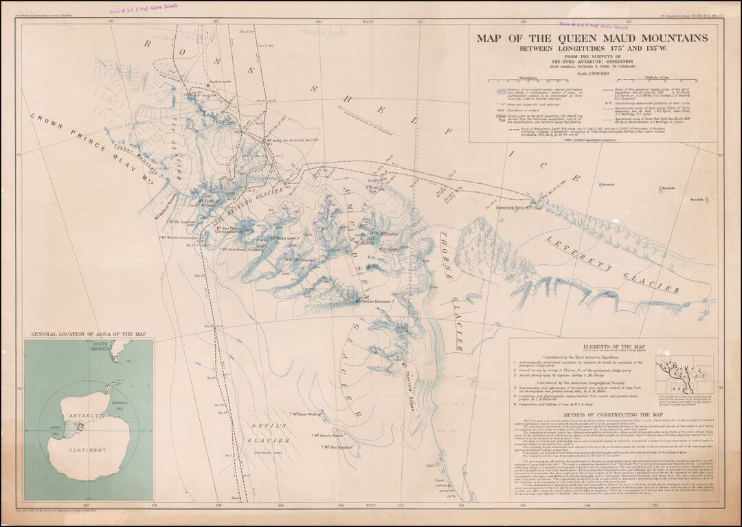
Owned By A Famous Italian Geography and Geologist The Queen Maud Mountains are a major group of mountains of the Transantarctic Mountains, lying between the Beardmore and Reedy Glaciers and including the area from the head of the Ross Ice Shelf to the...