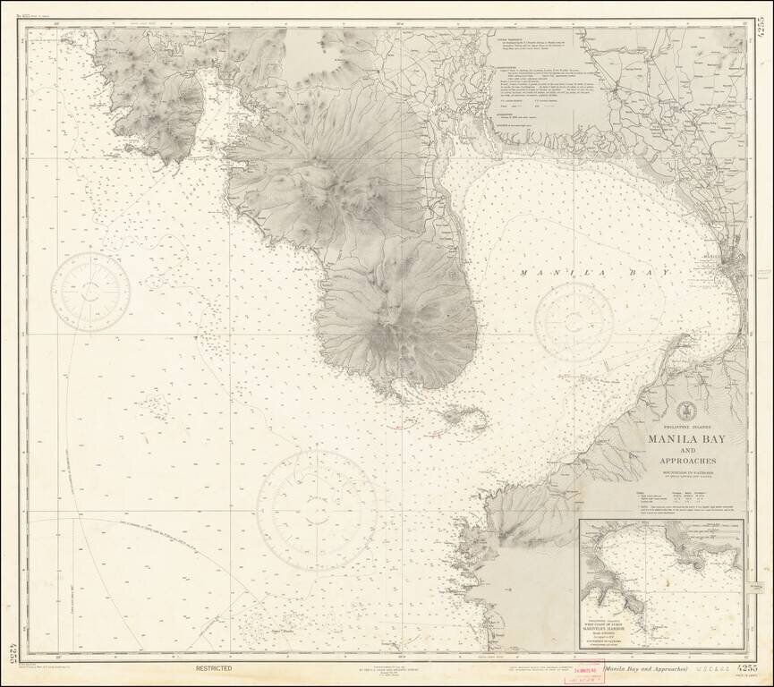
"RESTRICTED" World War II Map of Manila. Detailed chart U.S. Coast and Geodetic Survey (Philippine Divison) of Manila Bay, including Corregidor Island, originally published before the Japanese takeover during the early stages of the Second World War...