Anthony Finley (1784-1836) was an American map publisher. Little is known about his life. He is presumed to have been born in Philadelphia, where he also died. A publisher, Finley was also involved in several Philadelphia civic and professional societies such as the Philadelphia Apprentices’ Library. He may have been in business as early as 1809 and his first publication dates from ca. 1811.
His first maps also date from this year, with two maps in Daniel Edward Clarke’s Travels in Various Countries of Europe, Asia, and Africa. The first atlas published by Finley appeared in 1818, the Atlas classica, or, Select maps of ancient geography, both sacred and profane, for the use of colleges and schools in the United States. He is best known for his A New General Atlas Comprising a Complete Set of Maps (1824), which was a bestseller. There were two editions in 1824, with annual editions until 1834.
Finley was part of the first generation of American publishers who produced high quality, precise maps on American soil. He was in competition with other Philadelphia publishers, for example Henry S. Tanner. Finley’s A New American Atlas Designed Principally to Illustrate the Geography of the United States of America (1826) closely mirrors Tanner’s A New American Atlas Containing Maps of the Several States of the North American Union, with similar groupings of maps; the main difference is the smaller scale of Finley’s maps. Finley printed two editions of this atlas.
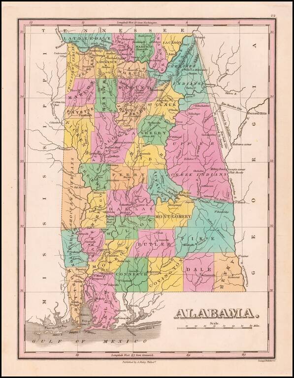
Nice example of Anthony Finley's early map of Alabama from an early edition of Finley's General Atlas, one of the earliest obtainable separate maps of Alabama. The map is hand colored by counties and showing towns, roads, rivers, mountains and other...
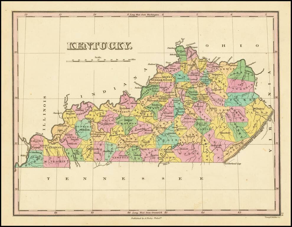
Striking map of Kentucky from Finley's General Atlas. The map is colored by counties and showing towns, roads, rivers, mountains and other geographical features.
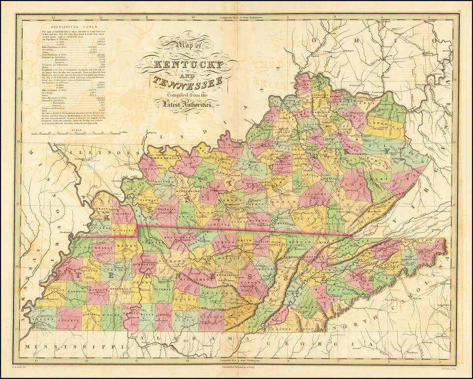
Fine early map of Kentucky and Tennessee, from Finley's New American Atlas. Includes a statistical table, roads and other early details. While the map occasionally appears on the market in pocket map form, it is especially desirable in this atlas...
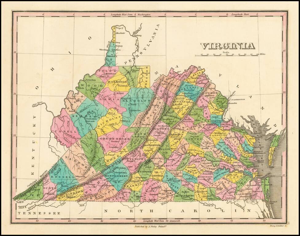
First edition of this early map of the state of Virginia from Finley's atlas. The map is hand colored by counties and shows towns, roads, rivers, mountains and other geographical features. The western portion of the state lacks a number of Counties,...
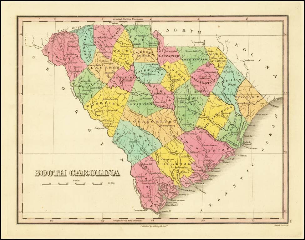
First edition of Anthony Finley's map of South Carolina from Finley's atlas. The map is hand colored by counties and shows towns, roads, rivers, mountains and other geographical features. Early county configurations.
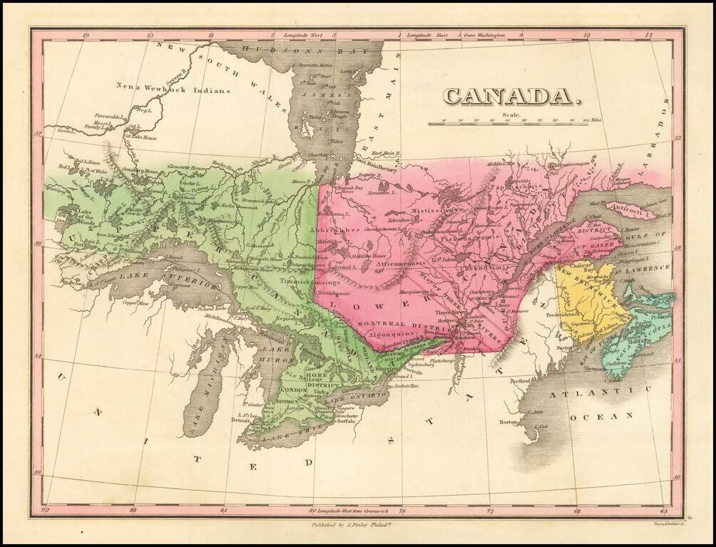
Detailed map of the Great Lakes and Eastern Canada, colored by regions and showing towns, rivers, lakes, islands, bays ,etc. Early roads are also shown.
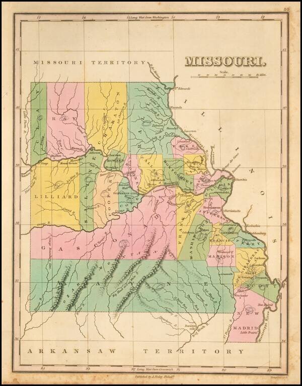
Nice example of the first state of Finley's map of Missouri, first published in 1824. The map is hand colored by counties and shows towns, rivers, mountains and other geographical features. One of the earliest obtainable maps of Missouri, with...
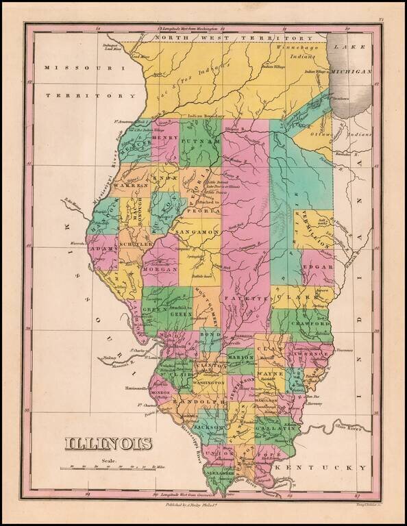
Great example of this early state of Finley's map of Illinois, hand colored by counties, with much of the northern lands still dominated by Indians. Includes a number of oversized counties and several unnamed counties. Cook County is not yet shown. A...
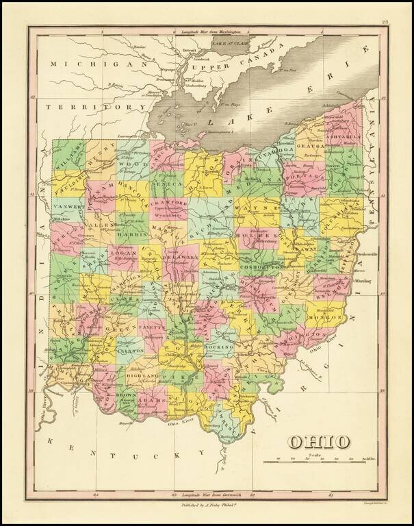
Nice map of Ohio from an early edition of Finley's New General Atlas, colored by counties and showing towns, roads, rivers, mountains and other geographical features. The western portion of the state lacks several counties. One of the best maps of the...
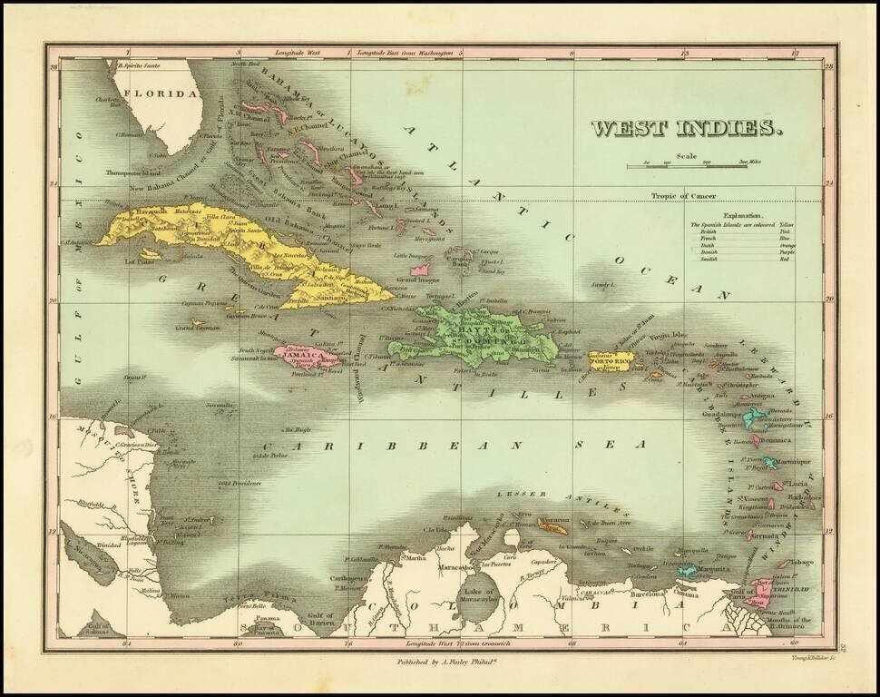
First edition of this early American map of the West Indies, from Finley's New General Atlas. Includes table of Colonial possessions.
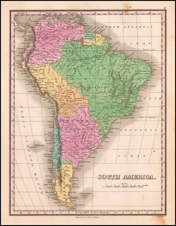
Decorative and detailed map of South America, from a rare late edition of Finley's New General Atlas. Wonderful color.
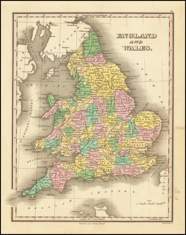
Decorative and detailed map of England and Wales, published in Philadelphia by Anthony Finley. The map is colored by counties.
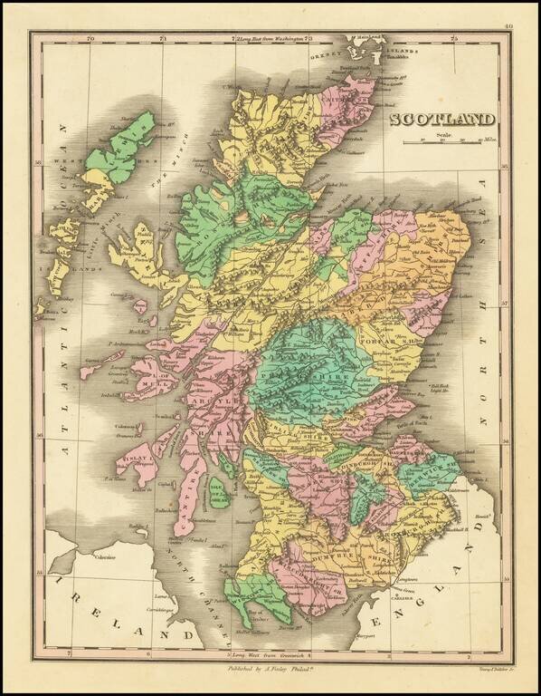
Decorative and detailed map of Scotland, colored by Counties, from Finley's New General Atlas. Wonderful color.
![Italy [shows Corsica, Sardinia, Sicily and Malta]](/map/small/67057.jpg)
Detailed map of Italy, Corsica, Sardinia, Sicily and Malta, colored by Kingdoms. The map appeared in an early edition of Finley's New General Atlas.
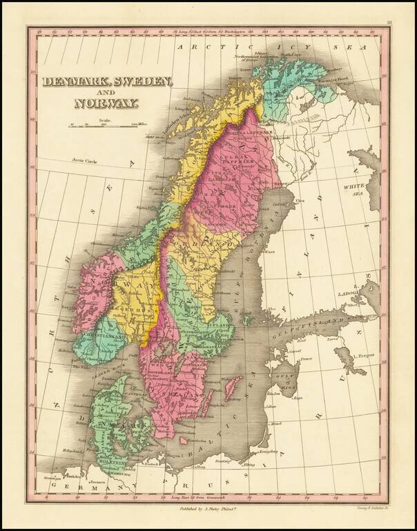
Decorative and detailed map of Scandinavia, colored by provinces, from Finley's New General Atlas. Wonderful color.
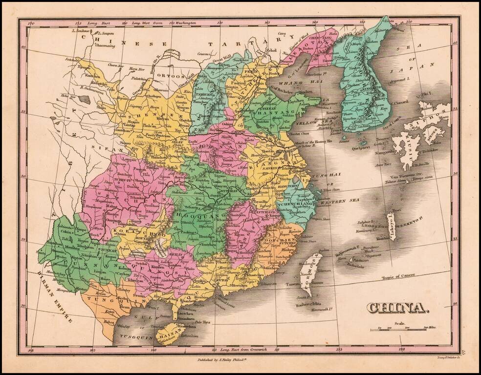
First edition of Finley's map of China (including Formosa) and Corea, colored by provinces, from his New General Atlas.