Adam Friedrich Zürner (15 August 1679 – 18 December 1742) was a German Protestant priest, cartographer and the head of construction of the Kursächsische Postmeilensäulen in Saxony.
Zurner's first project of note was a map of Saxony, for which he was retained by August III, King of Poland, in 1711.
Zurner was appointed Geographer of Poland and the Electorate of Saxony, a position in which he served until 1732. In this time period, he reportedly traveled nearly 18,000 miles and created over 900 maps.
In 1721, he was tasked with establishing a postal road system in Saxony and marking the distances with stone posts.
His work resulted in the Atlas Augusteus Sauronicus (40 maps plus key sheet), which remained incomplete until after Zurner's death, but was ultimately sold to Pieter Schenk in Amsterdam in about 1745. Schenk's completed work (49 maps, published in Amsterdam and Leipzig) was issued without reference to Zurner's name, under the title Atlas Saxonicus.
Despite his prolific work product, none of Zurner's original manuscript maps seem to survive.

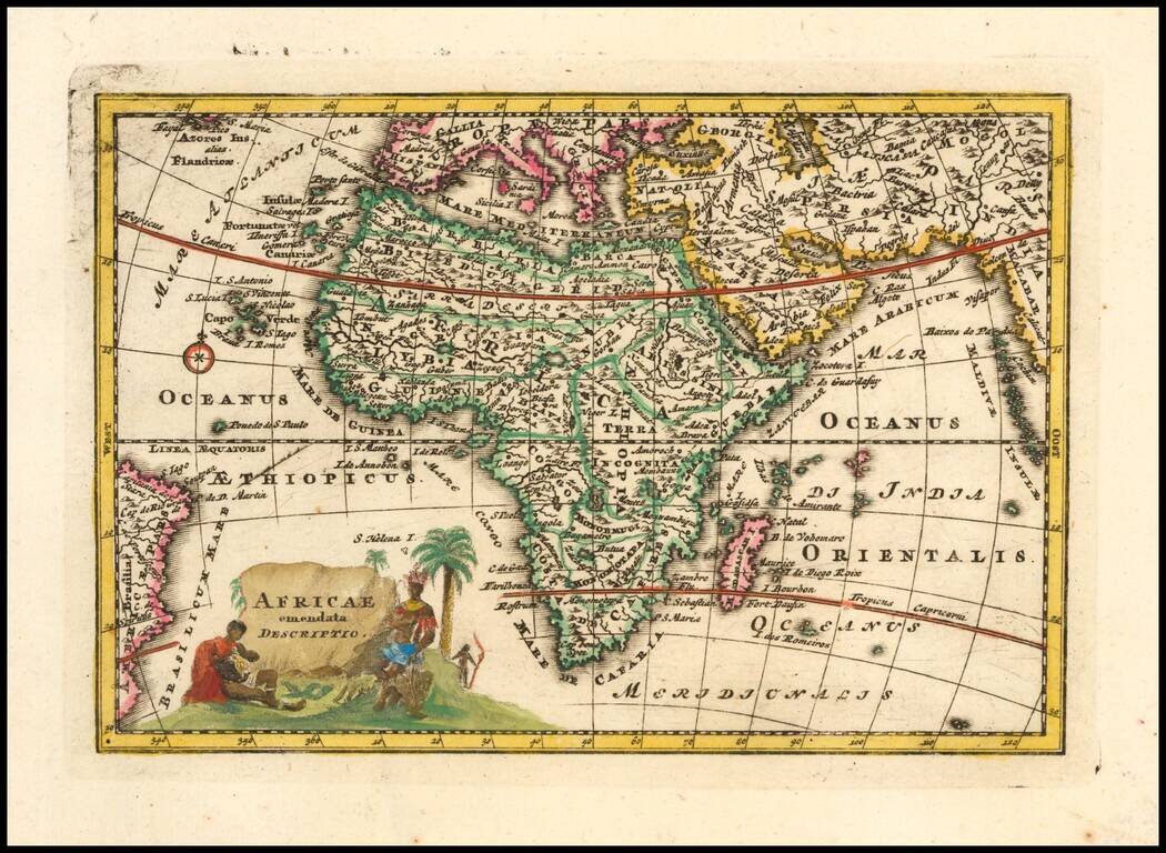
Decorative map from a scarce A.F. Zurner atlas. Full original color. Decorative armillary sphere with unique representations of the world below. A very unusual image, which we have never previously seen. A scarce decorative map.
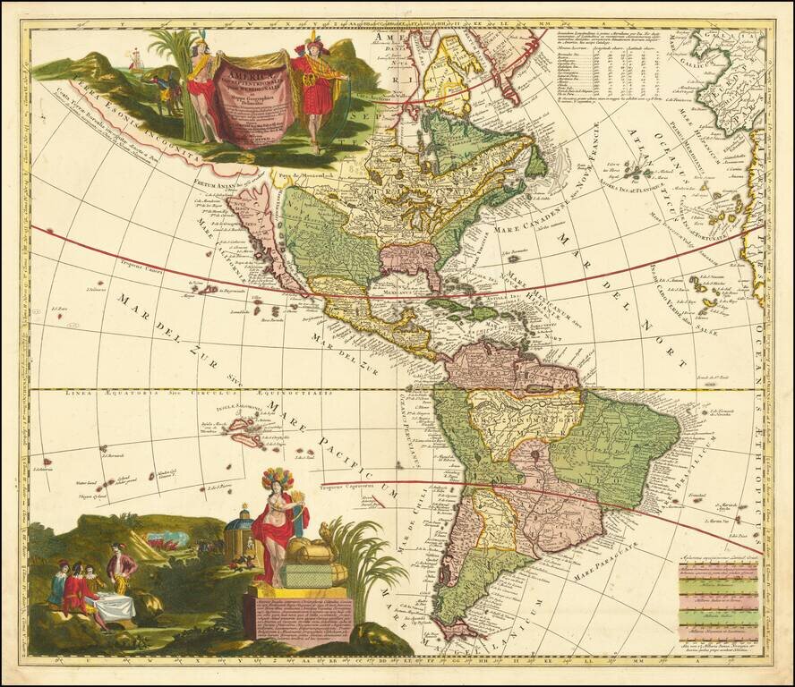
Scarce Zurner Map of America -- California shown as an Island. Fine old color example of this scarce map of America, showing California as an island, published by Zurner and engraved by Pieter Schenk. Zurner's map is a fascinating compilation of up...
![Americae Aucta Delineatio [California as an Island]](/map/small/67220.jpg)
Decorative map from a scarce A.F. Zurner atlas. Full original color. Shows a unique projection of California as an island, and marvelous Terra Iesso, running from Fretum Anian to Japan. Bits of Australia are shown as Quiri Regio. A nice scarce map.
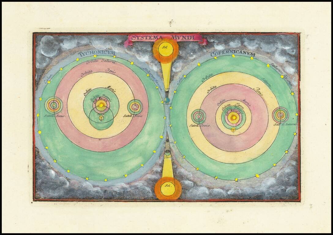
Finely colored example of Zurner's models of the Solar System. A fascinating pair of maps of the solar system, based upon the models of Copernicus and Tycho Brahe.
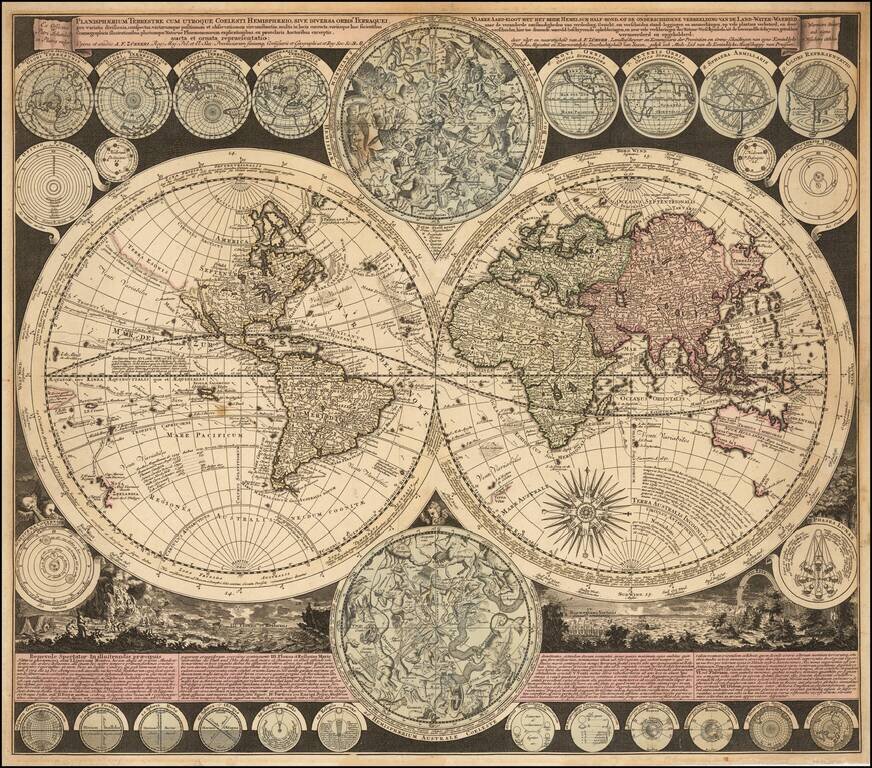
Visually Striking Double Hemisphere Map of the World Fine example of Adam Freidrich Zürner's complex and informative double hemisphere map of the world, artfully embellished with a multitude of decorative scenes and projections of celestial bodies....
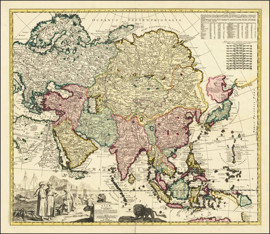
Scarce of map of Asia, published in Amsterdam. The map bears the additional names of Peter Schenk and Nicholas Visscher. The northeast coastline is shown with Witsen's information on Siberia. Hokkaido and Honshu (Terra Yedso) are joined together by a...
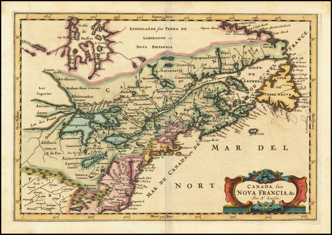
First state of the Frankfurt edition of Nicolas Sanson's map of Canada and the Great Lakes (first issued in Paris in 1657), which would influence regional cartography for the next 100 years. Along with Sanson's larger map issued in 1656, this map...