Henricus Hondius (1597-1651) was a Dutch engraver and mapmaker, a member of a prominent cartographic family. His father, Jodocus Hondius, was also an engraver and geographer. While working with his father, Henricus was instrumental in the expansion and republishing of Mercator’s atlas, first published in 1595 and republished by Hondius in 1606.
Upon his father’s death in 1612, Henricus and his brother, Jodocus the Younger, took over the business. He set up his own shop in 1621, where he continued to release new editions of the Mercator atlas. Later, he partnered with his brother-in-law, Jan Janssonius, in continuing to expand and publish Mercator’s atlas, which would become known as the Mercator-Hondius-Janssonius atlas. Born and based in Amsterdam, he died there in 1651.
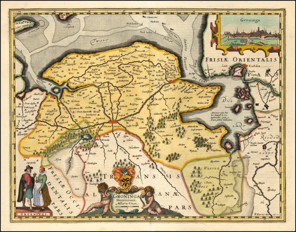
A fine early map of the the Groningen region, which appeared in Petrus Kaerius's (Peter Van der Keere) Germaniae Inferior id est, XVII Provinciarum ejus novae et exactae Tabulae Geographicae, first published in Amsterdam in 1617. Van der Keere's atlas...
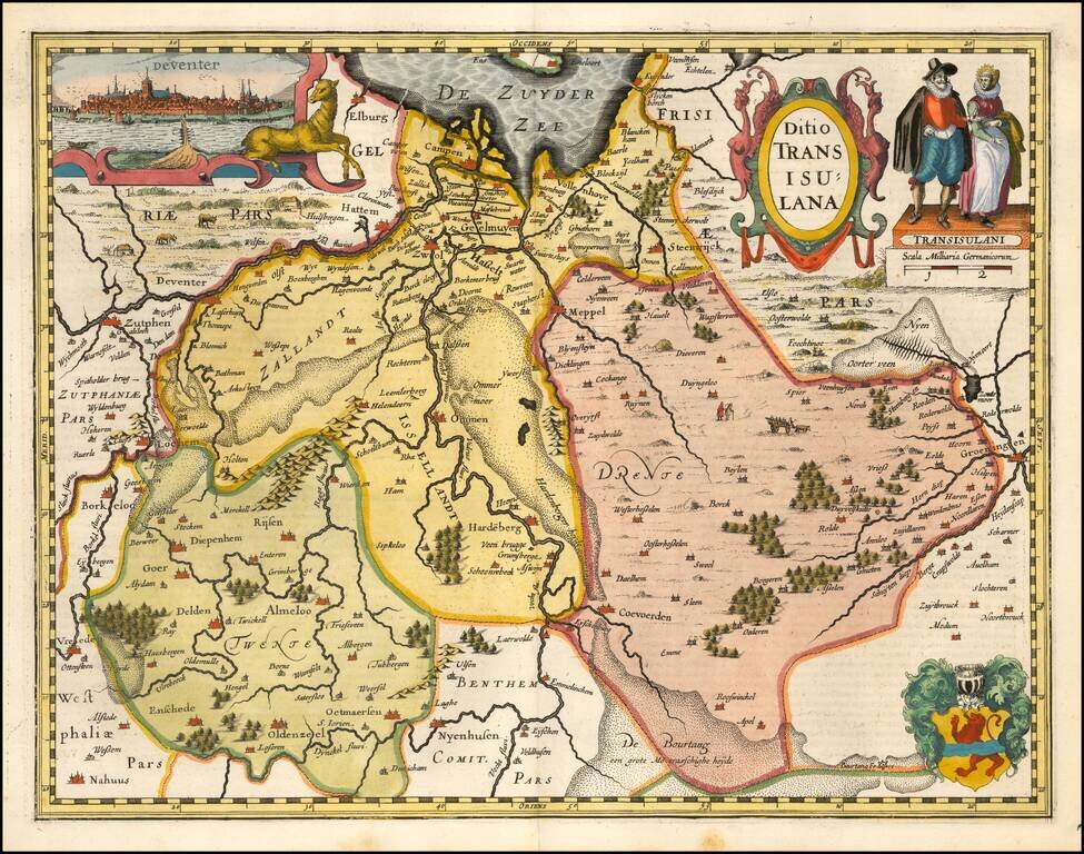
A fine early map of the Deventer region, which appeared in Petrus Kaerius's (Peter Van der Keere) Germaniae Inferior id est, XVII Provinciarum ejus novae et exactae Tabulae Geographicae, first published in Amsterdam in 1617. Van der Keere's atlas was...
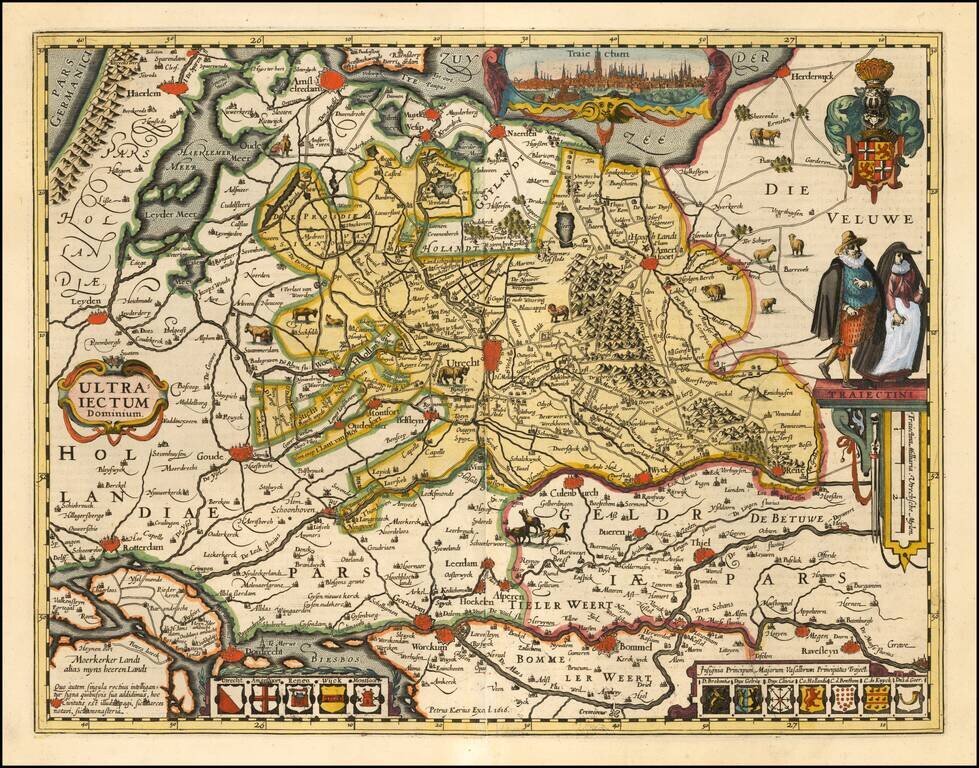
A fine early map of the Utrecht region, which appeared in Petrus Kaerius's (Peter Van der Keere) Germaniae Inferior id est, XVII Provinciarum ejus novae et exactae Tabulae Geographicae, first published in Amsterdam in 1617. Van der Keere's atlas was...
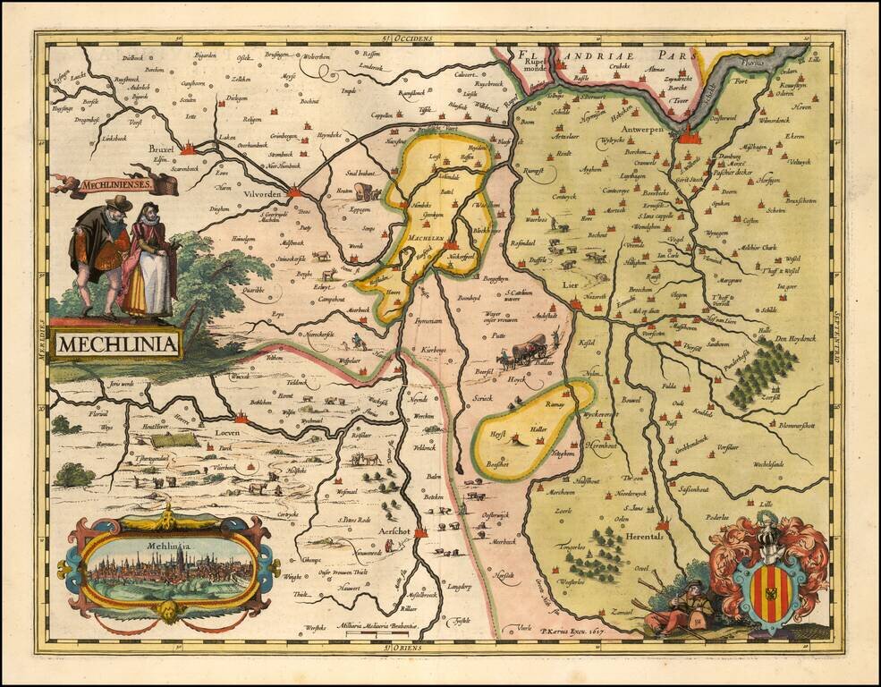
A fine early map of the the Mechelen region, which appeared in Petrus Kaerius's (Peter Van der Keere) Germaniae Inferior id est, XVII Provinciarum ejus novae et exactae Tabulae Geographicae, first published in Amsterdam in 1617. Van der Keere's atlas...
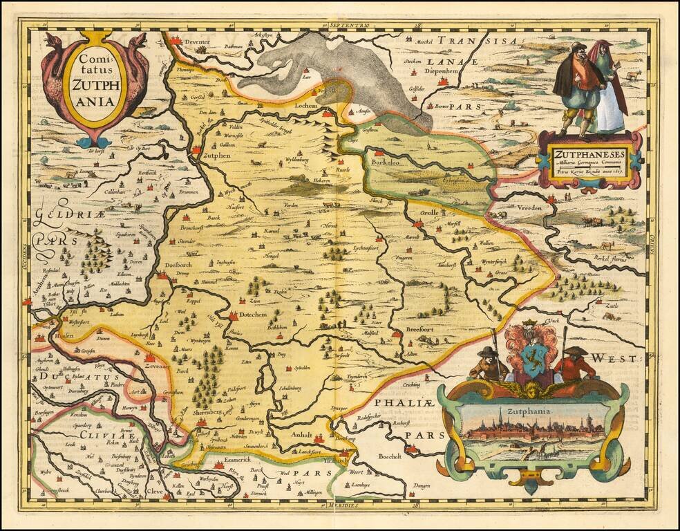
A fine early map of the part of Gelderland, in the region then controlled by the Counts of Zuthpen, which appeared in Petrus Kaerius's (Peter Van der Keere) Germaniae Inferior id est, XVII Provinciarum ejus novae et exactae Tabulae Geographicae, first...
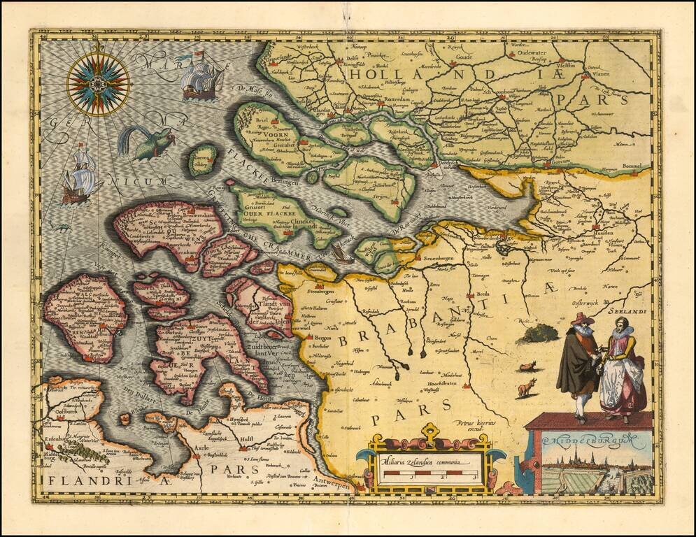
A fine early map of Middelburg which appeared in Petrus Kaerius's (Peter Van der Keere) Germaniae Inferior id est, XVII Provinciarum ejus novae et exactae Tabulae Geographicae, first published in Amsterdam in 1617. Van der Keere's atlas was the first...
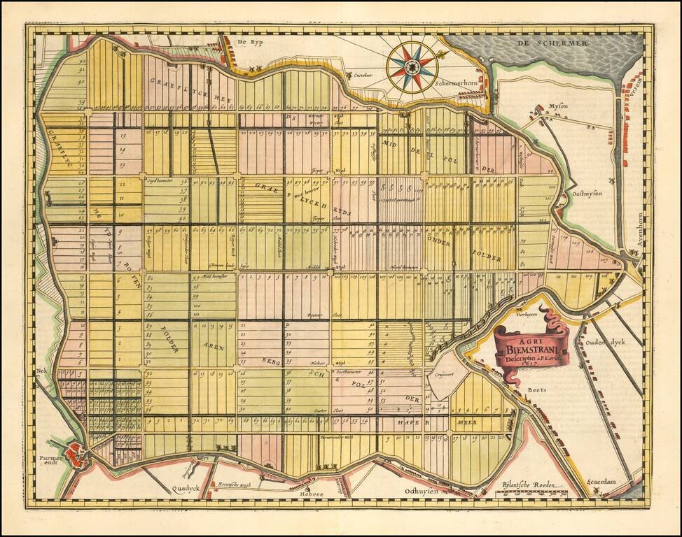
The Oldest Area in the Netherlands Reclaimed from the Sea. Fine map of the polder Beemster in Noord Holland, including the towns of Purmerend, De Ryp, Oudendijk, etc. The map appeared in the first separately issued atlas of the Low Countries which...
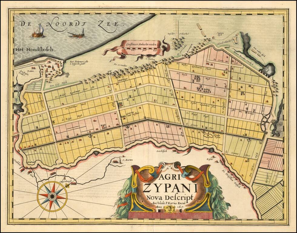
A fine early map of the Zijpe region of North Holland, which appeared in Petrus Kaerius's (Peter Van der Keere) Germaniae Inferior id est, XVII Provinciarum ejus novae et exactae Tabulae Geographicae, first published in Amsterdam in 1617. Van der...
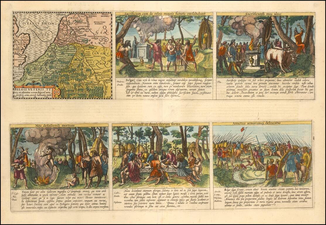
Daily Lives of Ancient Celts Nice example of the Peter van der Keere (Petrus Kaerius) map of the Low Countries in Ancient Times. The map is augmented with scenes showing the daily lives of ancient Belgian Celtic Tribes. The additional images show...
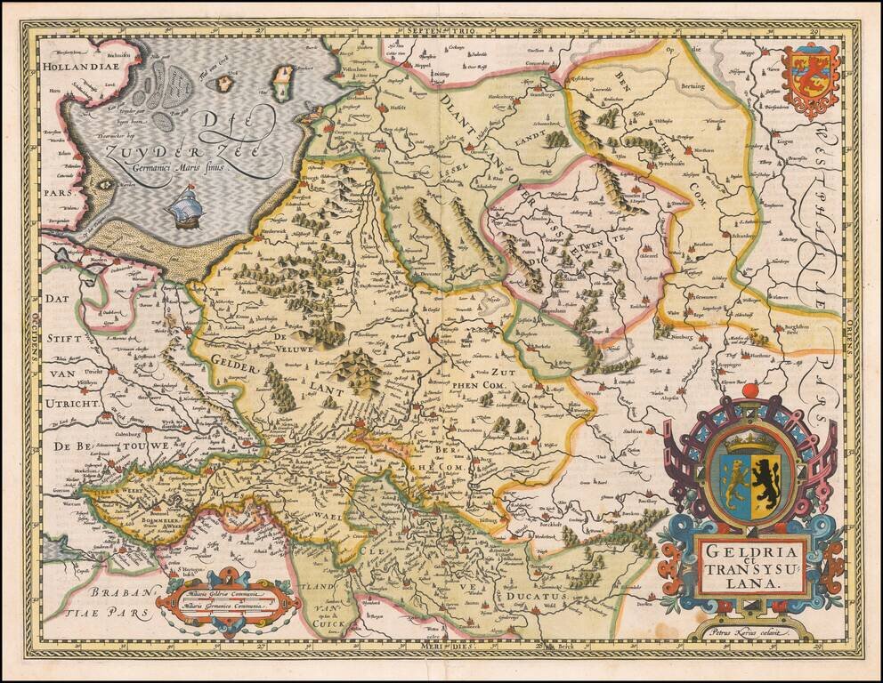
A fine early map of the Gelderland, Overijssel and adjoining regions, which appeared in Petrus Kaerius's (Peter Van der Keere) Germaniae Inferior id est, XVII Provinciarum ejus novae et exactae Tabulae Geographicae, first published in Amsterdam in...
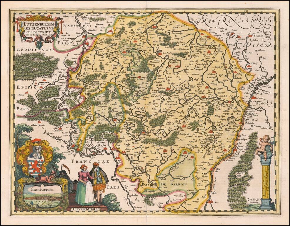
A fine early map of Luxembourg which appeared in Petrus Kaerius's (Peter Van der Keere) Germaniae Inferior id est, XVII Provinciarum ejus novae et exactae Tabulae Geographicae, first published in Amsterdam in 1617. The map includes a view of the City...
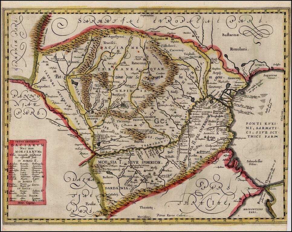
Extremely rare proof state of Jan Jansson's map of Romania, pre-dating the addition of the putti and decorations around the title box. The proof state is known in only a few examples and was mentioned by Peter Van der Krogt in the new edition of...
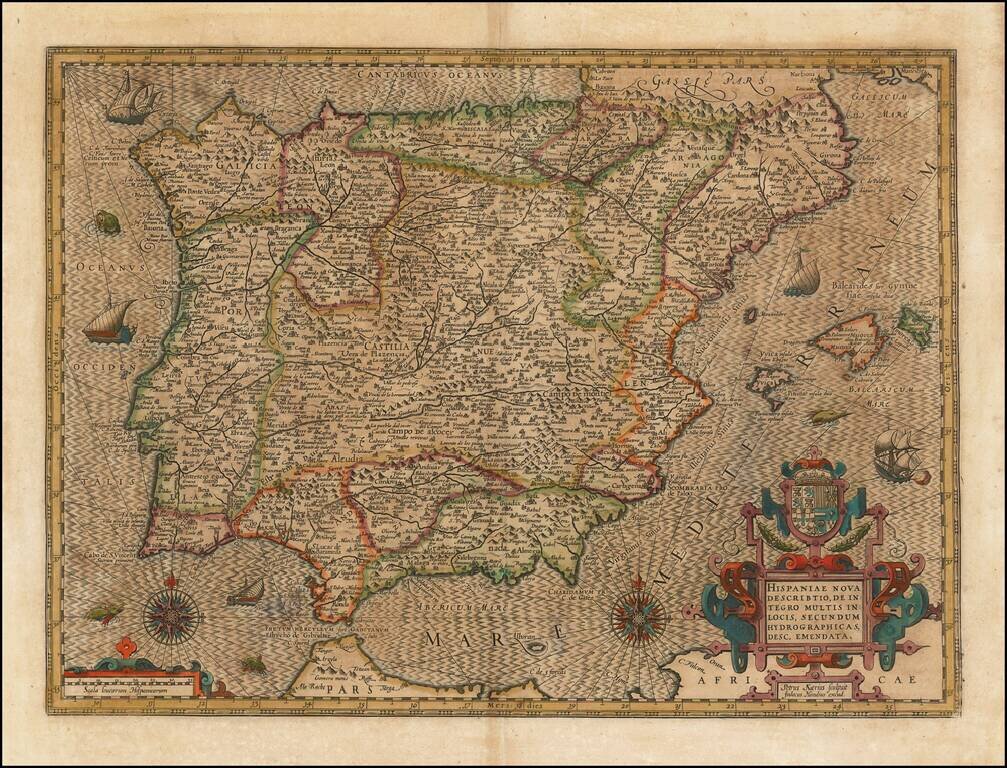
Striking example of the Kaerius-Hondius map of Spain and Portugal. The map includes a striking coat of arms, 2 compass roses, sailing ships and sea monsters, along with Hondius' unique style for engraving the ocean. A gorgeous dark impression of this...