Schraembl was born and worked in Vienna, where he was a mapmaker in the latter half of the eighteenth century. He began his business in 1787, partnering with Franz Johann Joseph von Reilly. He is best known for his large format atlas, the Allgemeiner Grosser Atlas. The atlas was finished in 1800, after twenty years of compilation and composition--it was the first Austrian world atlas. While a notable work, the atlas did not sell well, plunging Schraembl into financial difficulty. In response, Schraembl expanded his offerings to include literature and art. Upon his death, Schraembl's firm was taken over by his widow, Johanna, and her brother, Karl Robert Schindelmayer. From 1825, it was run by Franz Anton's son, Eduard.
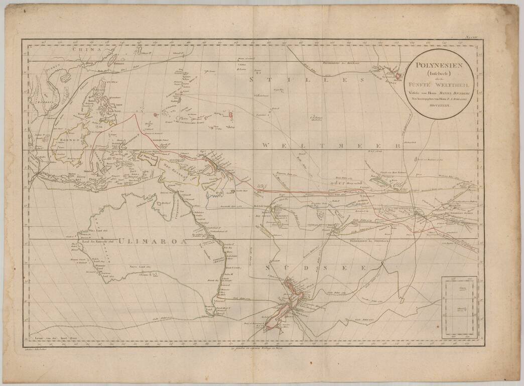
Rare map of the South Pacific, from Australia (Ulimaroa) to Hawaii. The map is one of the only maps to refer to Australia by its native name (Ulimaroa) and is also noteworthy for its fine treatment of New Zealand and extensive depiction of the routes...
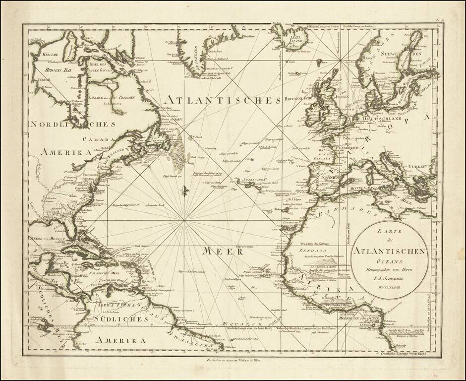
A detailed antique map of the North Atlantic from just south of the equator to southern Greenland. The map shows coastal settlements, geopolitical boundaries, navigational features, and more. Names are given either in German or in their local...
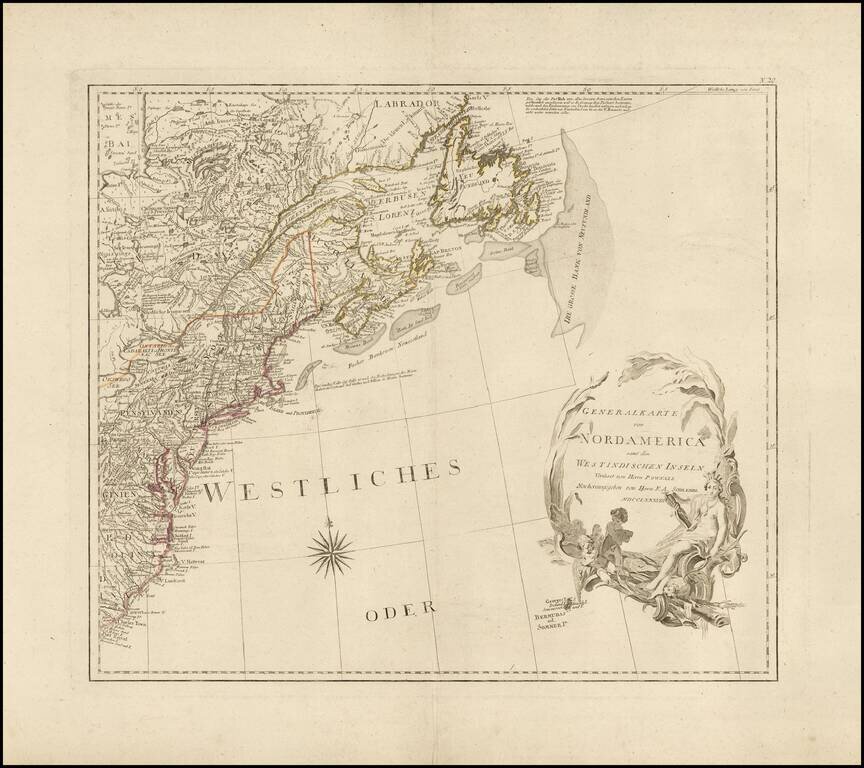
Wide margined example of the northeastern sheet of F.A. Schraebl's 4 sheet wall map of North America, published in 1788. The map extends from Charleston and Hilton Head, South Carolina in the south to Hudson's Bay and Newfoundland, centered on the...

Fine example of this German edition of Cook's explorations along the northwest coast of America and northeast coast of Asia, based upon the original work by Lieutenant Henry Roberts. Excellent detail in the Behring Straits, including extensive notes...
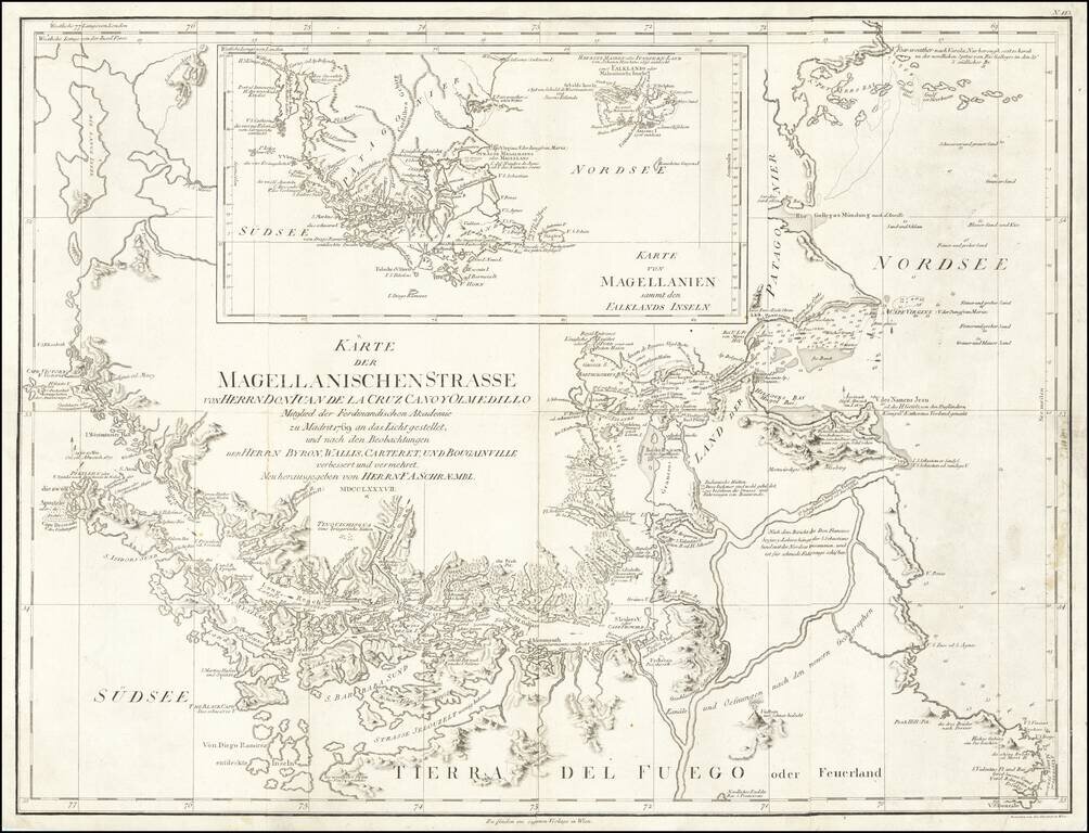
Navigating Magellan's Strait at the End of the Eighteenth Century Sharply-detailed map of the Strait of Magellan, published in Vienna by F.A. Schraembl. The map provides a fine depiction of the Strait, with a large inset showing the wider region of...
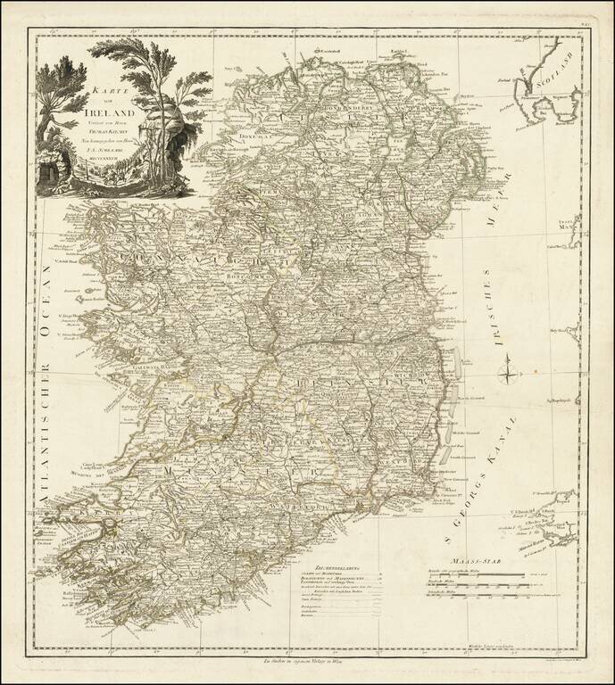
Fine large format map of Ireland, based upon the maps of Thomas Kitchin and John Rocque, published by Schraembl in Vienna in 1787.
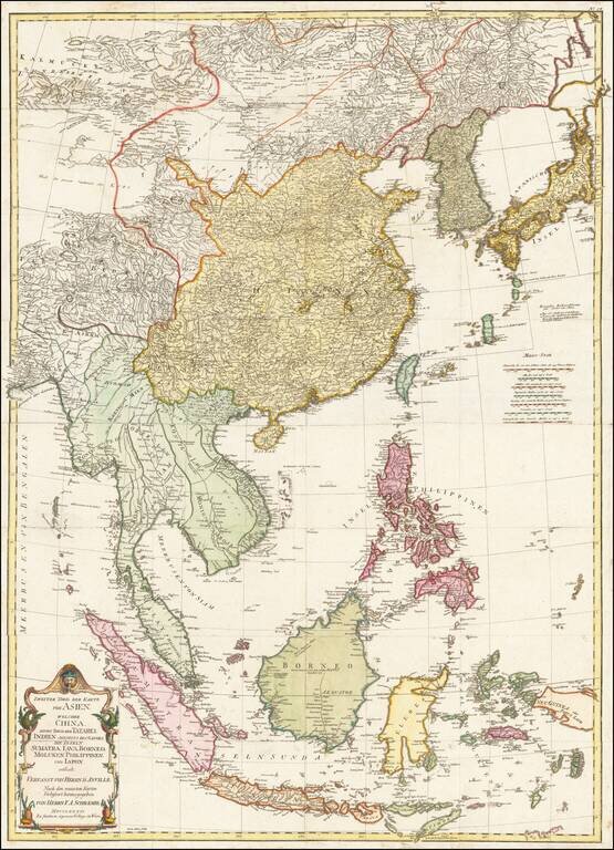
Detailed map of East Asia, extending from China and Korea to Java, published in Vienna in 1786. The map is centered on the Philippine Islands and provides a nice detailed overview of the region.