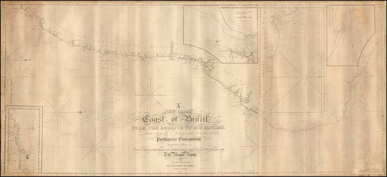
Exceedingly rare and finely executed "blue-back" sea chart of the Brazilian coastline between Cabo Frío and Céara, published in New York by William Hooker and copyrighted 5th day of Jany. 1825. The main chart extends from the mouth of the Amazon...
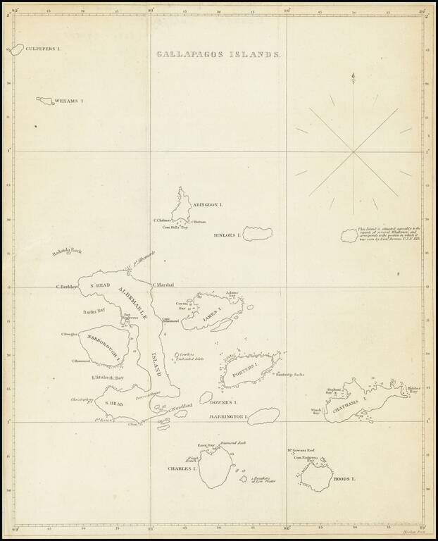
The First American Map of the Galapagos Islands Scarce early 19th Century map showing the Galapagos Islands in detail. An unnamed island (the modern Genovesa) is shown with a note that it "is situated agreably to the report of several Whalemen and...