Robert Sayer (ca. 1724-1794) was a prominent London map publisher. Robert’s father was a lawyer, but his older brother married Mary Overton, the widow of prominent mapmaker Philip Overton and the proprietor of his shop after his death. Mary continued the business for roughly a year after her marriage and then, in early 1748, it passed to Robert. Robert became a freeman of the Stationers’ Company later that year; his first advertisement as an independent publisher was released in December.
Sayer benefited from Overton’s considerable stock, which included the plates of John Senex. In the 1750s, Sayer specialized in design books and topographical prints, as well as comic mezzotints. In 1753, he, along with John Roque, published a new edition of Thomas Read’s Small British Atlas, the first of several county atlases that Sayer would publish.
Sayer’s business continued to grow. In 1760 he moved further down Fleet Street to larger premises at 53 Fleet Street. In 1766, he acquired Thomas Jefferys’ stock when the latter went bankrupt. In 1774, he entered into a partnership with John Bennett, his former apprentice. The pair specialized in American atlases, based on the work of Jefferys. They also began publishing navigational charts in the 1780s and quickly became the largest supplier of British charts in the trade.
Bennett’s mental health declined, and the partnership ended in 1784. As Sayer aged, he relied on his employees Robert Laurie and James Whittle, who eventually succeeded him. He spent more and more time at his house in Richmond. In 1794, he died in Bath.
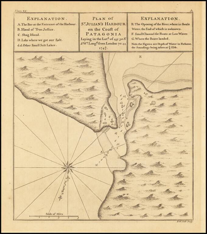
A view of the entrance to St Julian's Harbour in Patagonia in the Santa Cruz Province of Argentina. The map was named by the Portuguese explorer Ferdinand Magellan who arrived and wintered there in early 1520.
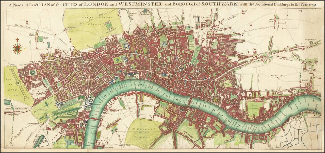
Scarce map of the London, published by Seale. Extends west to Hyde Park, South to Lambeth, north to Hackney Road and Islington and Hoxton, and east to Rotherhithe and Stepney. Only London Bridge and Westminster Bridge are shown crossing the Thames...
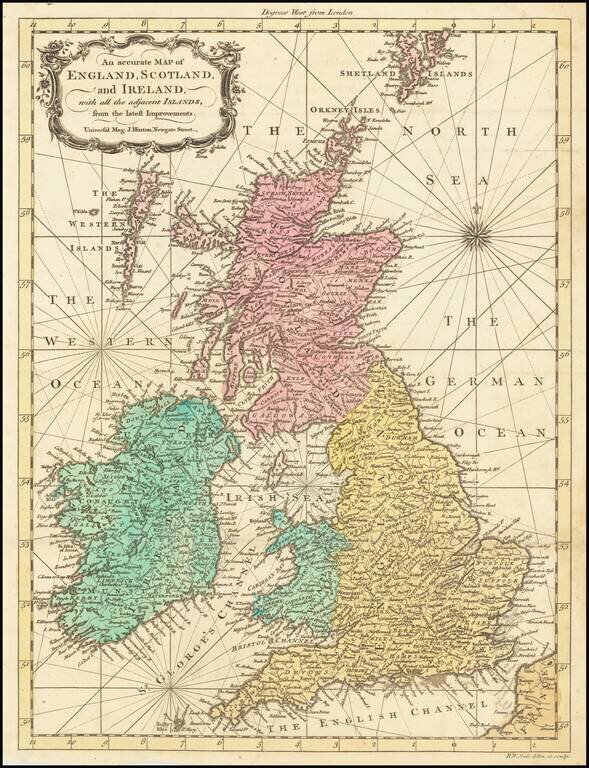
Scarce old color example of R.W. Seale's map of Great Britain, which appeared in the Universal Magazine in 1762. The map incorporate rhumb lines, a feature typical of working sea charts of the 18th Century.
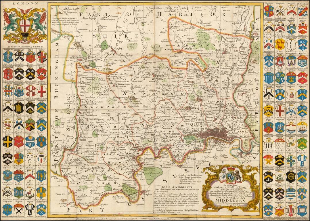
Fine large format map of the County of Middlesex, with London in the lower right corner. Includes 92 small coats of arms of the Free Companies in the county, and two larger decorative cartouches. A large and decorative 18th century map of Middlesex...
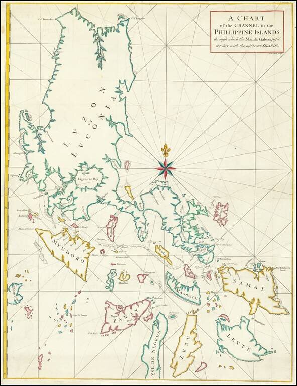
Chart of Philippines from Anson’s Voyage round the World, Part of His Plan to Capture a Spanish Treasure Galleon Nicely colored example of George Anson's chart of the Philippine Islands, showing the area from Luzon to Leyte, Zebu and Ysle De...
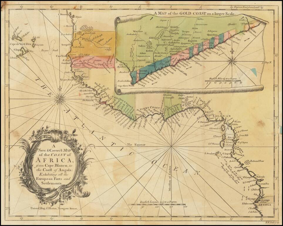
Detailed map of the of the West African Coastline, with a large inset of the Gold Coast, from an early edition of the Universal Magazine. These early Universal Magazine maps are quite rare on the market.