Benjamin P. Ward was an American publisher. He was best known for his partnership with A. J. Johnson. In 1860, the Johnson firm published its first significant work, the Johnson’s New Illustrated (Steel Plate) Family Atlas. The first edition of the Atlas bears imprints in both New York and Richmond, VA. In 1861, however, following the outbreak of the American Civil War, the Johnson & Browning firm abandoned their Richmond location. Browning seems to have remained in Virginia to pursue other ventures and, in 1861, Browning’s portion of the firm was purchased by Ward. The 1863 issue of the Atlas was one of the most unusual, it being a compilation of older Johnson and Browning maps, updated 1862 Johnson and Ward maps, and newer 1863 maps with a revised border design. The 1864 issue of the Atlas is the first true Johnson and Ward atlas. Johnson published one more edition in partnership with Ward in 1865, after which Johnson becomes the sole publisher.
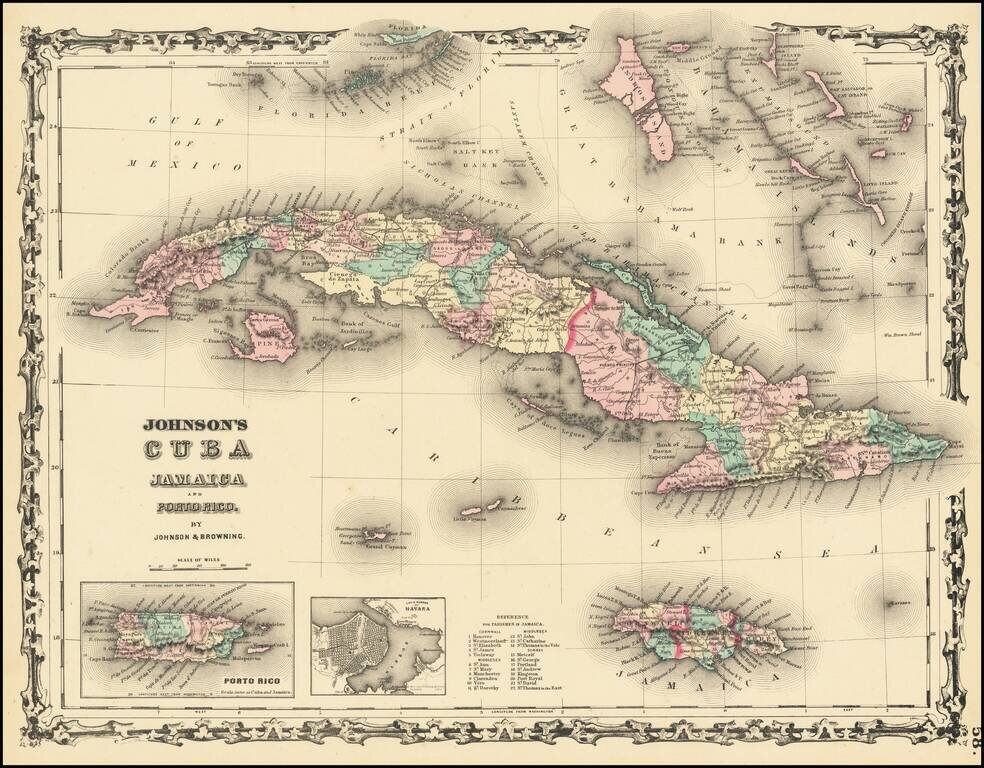
Attractive map of Cuba, the Florida Keys, the Bahamas, Jamaica, and the Caymans. Shows towns, rivers, mountains, etc. Inset maps of Havana and Puerto Rico.
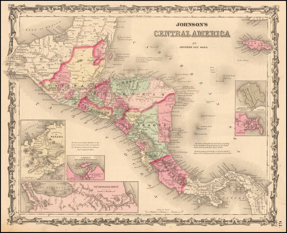
Detailed map of Central America, colored by provinces. Includes towns, roads, rivers, lakes, mountains, islands, etc. Includes insets showing the Isthmus of Panama, Harbor of San Juan De Nicaragua, The Nicaragua Rute, Manzanilla I. Aspinwall City Navy...
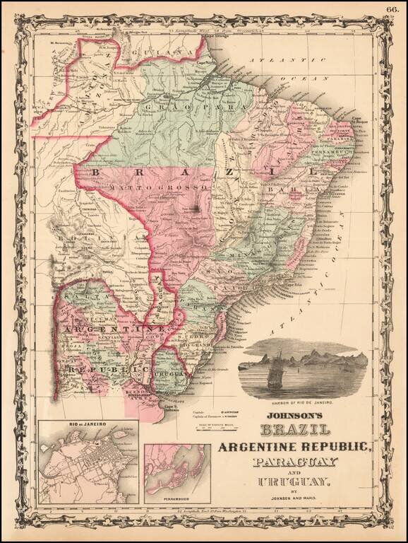
Attractive regional map, colored by provinces and showing towns, mountains, rivers, bays, etc. Large vignette of the harbor of Rio De Janeiro and insets of Rio and Pernambuco.
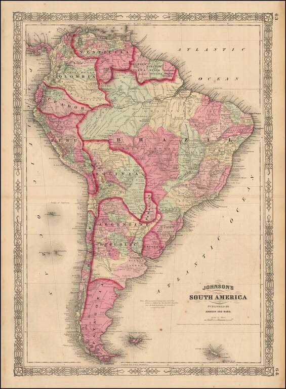
Attractive map of South America, colored by country or state. Extends south to the South Shetland Islands and north to the Gulf of Mexico. Includes notes of numerous 18th century voygages, including Columbus, inset of Cape Horn and other interesting...
![Johnson's Ireland [with] Johnson's Scotland](/map/small/71010.jpg)
Detailed maps of Scotland and Ireland, each hand colored by counties, with decorative borders. Shows towns, rivers, lakes, islands, roads, railroads, etc.
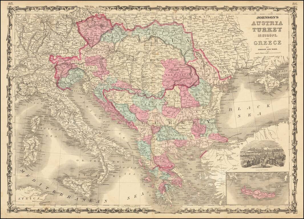
Marvelous map showing Greece, Turkey and a very large Austrian Empire, including all of Hungary, Transylvania, Galitzia, Bohemia, Moravia, etc. Excellent delineation of the Balkans states, at a time when they all had their current names. Plus, a few...
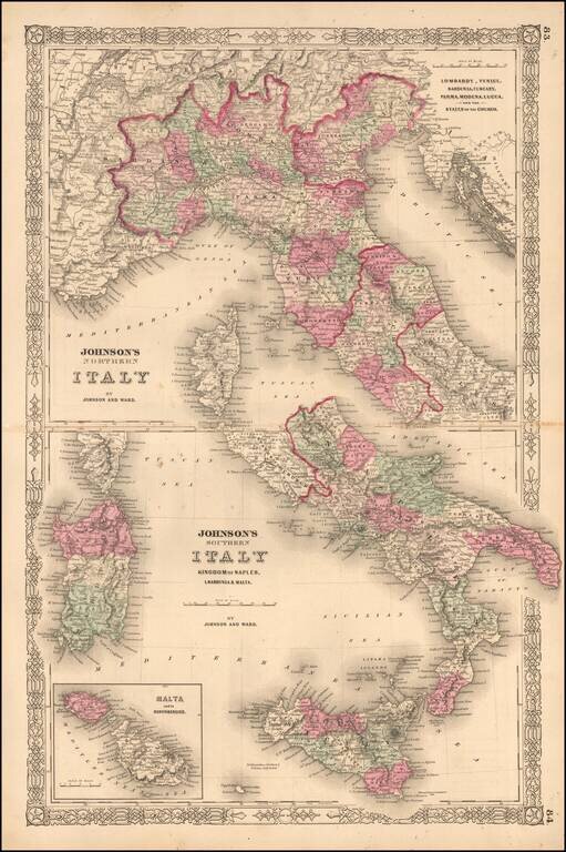
Interesting map of Italy, which appeared in the later editions of Johnson's New Family Atlas of the World. Shows early railroads, among other details.
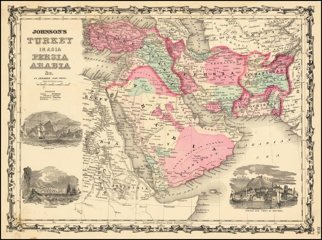
Decorative map of Turkey, Persia, Arabia, Afghanistan, Beloochistan and contiguous regions, with large inset views of Smyrna, Trebisond and Muscat. Shows excellent detail, including towns, rivers, mountains, deserts, roads, etc.
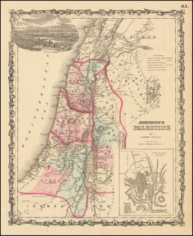
Attractive map of the Holyland, based upon the 12 tribes and contemporary (to mid-19th Century) borders. Insets of view of Damascus and town plan of Jerusalem. Shows towns, roads, rivers, lakes, mountains, etc. Includes biblical, classical and...