![Patriarchatus Antiocheni Geographica Descriptio . . . [shows Cyprus]](/map/small/54177.jpg)
The Cradle of Civilization Rare and highly decorative map of the region bounded by Cyprus and the Holy Land in the west and Sinus Persicus and Susiana in the east. Toward the center is the confluence of the Tigris and Euphrates rivers.
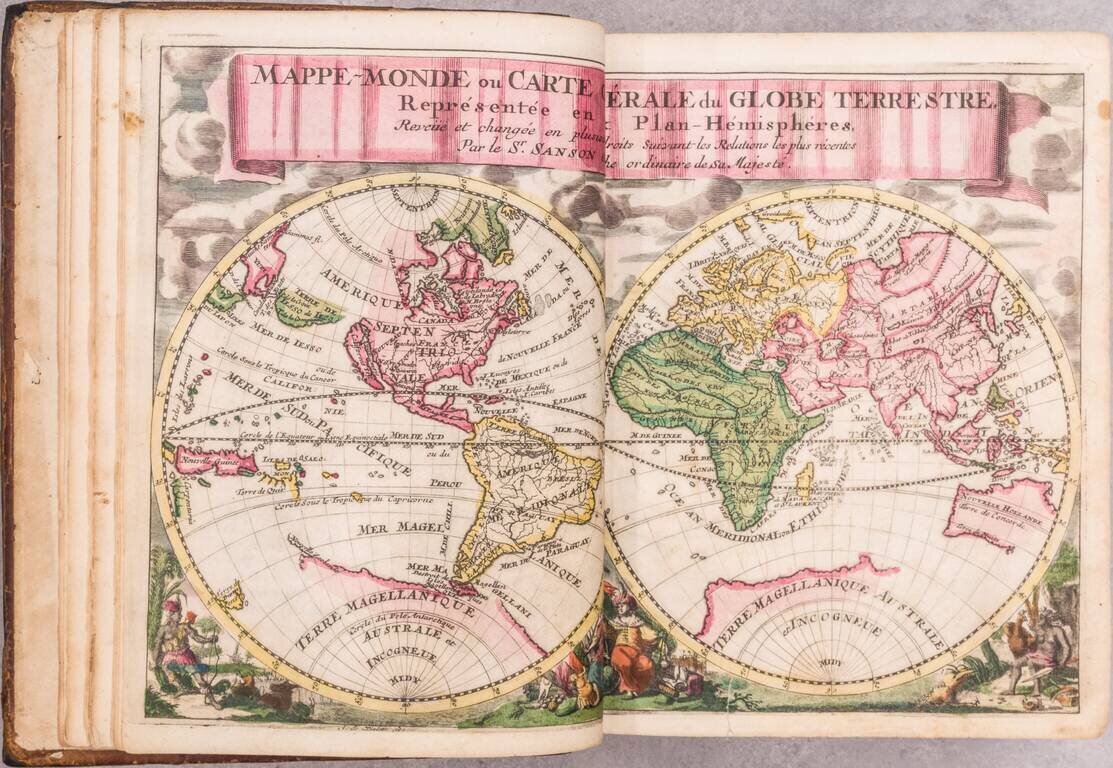
A beautiful miniature Halma edition of a Sanson gentleman's pocket atlas in exquisite full contemporary Dutch color. The volume includes Sanson's pocket atlas, with Bion's useful work on globes. Although this atlas is always listed under Nicolas...
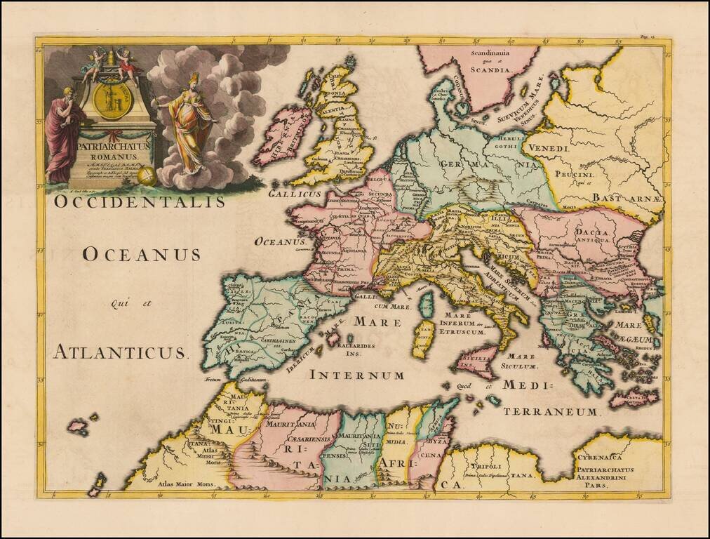
Fine example of Francois Halma's map of the Roman Empire. The map shows regional sub-divisions within the Roman Empire. A striking example of this decorative map.
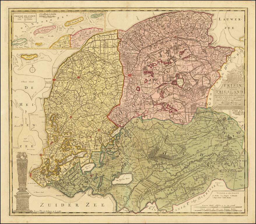
Antique Map of Friesland, in the Netherlands Fine old color example of this rare Halma map of Friesland. Detailed map of Friesland, Groningen and Drenthe, the northeast provinces of the Netherlands, with armorial cartouche, scale of miles, vignette...
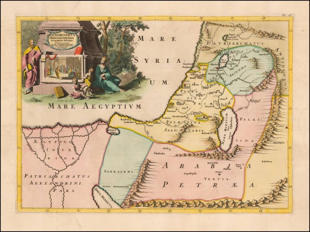
Fine example of Francois Halma's map of the Latin Patriarchate of Jerusalem. Latin Patriarchate of Jerusalem is the title of the see of Roman Catholic Archbishop of Jerusalem. It was originally established in 1099 with the Kingdom of Jerusalem...