logo

Samuel Holland

Samuel Holland


1

1775 - ( Prince Edward Island ) A Map of the Island of St. John In the Gulf of St. Laurence Divided Into Counties & Parishes And the Lots as granted by Government, to which is added The Soundings round the Coast & Harbours Improved from the late Survey of Capta

  • $14.99

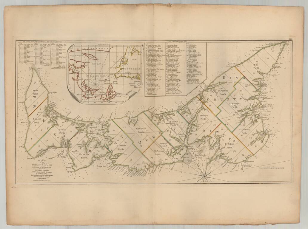
Important early map of St. Johns Island, published by Thomas Jefferys in the American Atlas. The map provides a finely detailed treatment of the island and environs, including a list of 67 lots and the proprietors of each lot, including Samuel Holland...