![[Eastern Siberia and Alaska]. ‘Vostochnaya Chast Irtkutskoi Gubernii s prilezhashhimi ostrovami i zapadnom beregom Ameriki’ (‘The Eastern Part of the Irkutsk Province with the adjacent islands and the West Coast of America’).](/map/small/38895.jpg)
Fine example of this rare Russian map of the northwest coast of America and northeastern parts of Russia, published by Wilbrecht in his rare 1792 atlas entitled Ross'iiskoi Atlas iz soroka chetyrekh kart sostaiashch'ii I na sorok na dva...
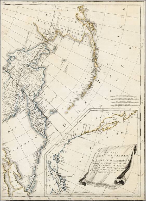
Eastern sheet Wilbrecht's a rare 3-sheet map of the Russian Empire, depicting Alaska, the Northwest Coast of America and the West Coast of Canada, prior to the discovery of Vancouver Island, along with Kamchatka, Northeast Russia and Iezo. The map is...
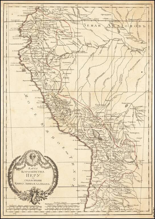
Russian-language antique map of the "Kingdom of Peru" from Ecuador to Chile on the western coast of South America. The map was created by Alexander Wilbrecht in Saint Petersburg in 1793, and was based on Janvier's Carte Du Perou ou se trouvent les...
![[Map of the Kiev Region] КАРТА КІЕВСКАГО НАМѢСТНИЧЕСТВА](/map/small/57871.jpg)
19th-century photo-lithographed facsimile of a map of the Kiev region from Alexander Wilbrecht's famous 1792 Atlas of the Russian Empire (Российский атлас). Pale of Settlement The map is interesting for many reasons, not least of which...