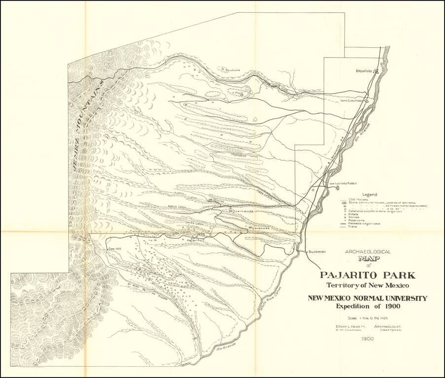
Highly detailed map of what is now Bandelier National Monument bounded on the northwest by the Jemez Mountains and on the east and south by the Rio Grande. On the northeast are Espanola and Santa Clara Pueblo. This map shows topography, names all the...
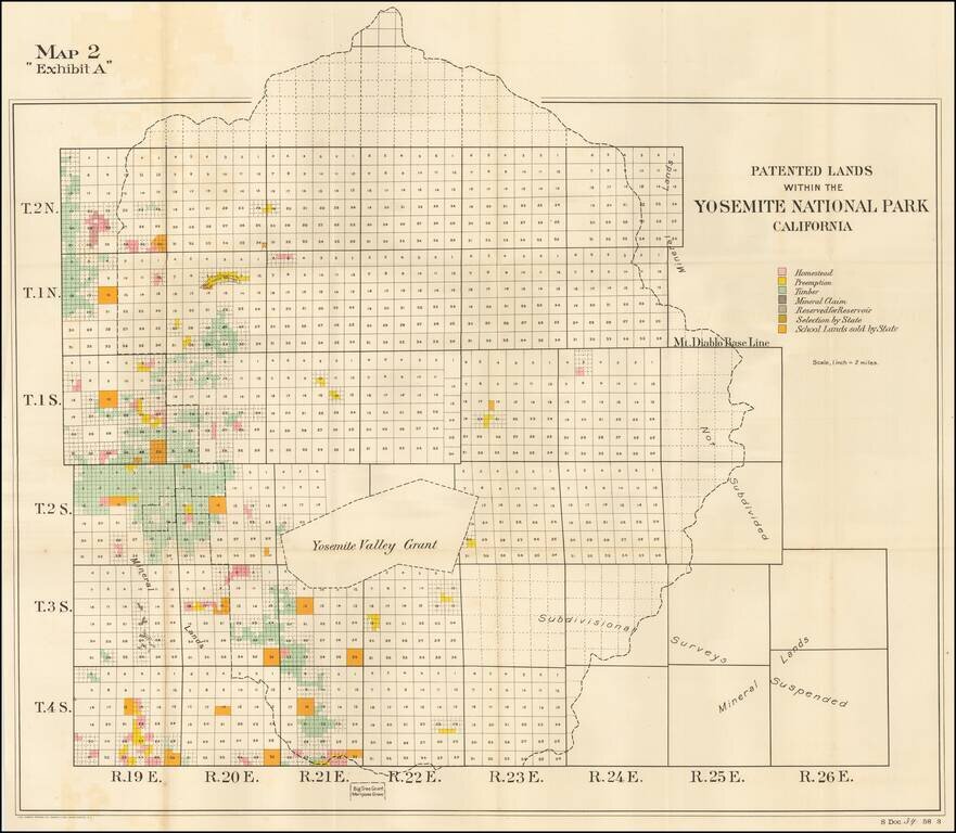
Detailed map of the Patented Lands within Yosemite Valley, published for the US Senate in 1904. Shows township and section lines, undivided lands, homesteads, preempted lands, timber holdings, mineral claims, lands reserved for reservoir use,...
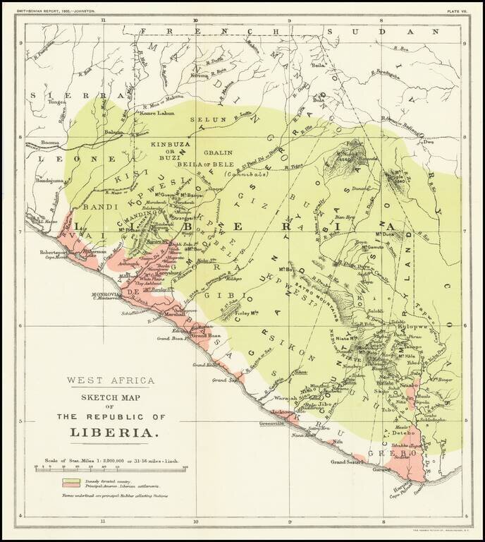
Mapping The Freed American Slave Efforts -- Republic of Liberia Scarce map of the Republic of Liberia, which illustrated an article by Sir Harry Johnston on Liberia, which was read at the Royal Geographical Society on March 27, 1905 and appeared in...