
Rare 1876 edition of Bancroft's map of California & the Southwest. The map is hand colored by counties and shows tremendous detail, one of the best maps of the Western United States published West of the Mississippi during the period. Early roads,...
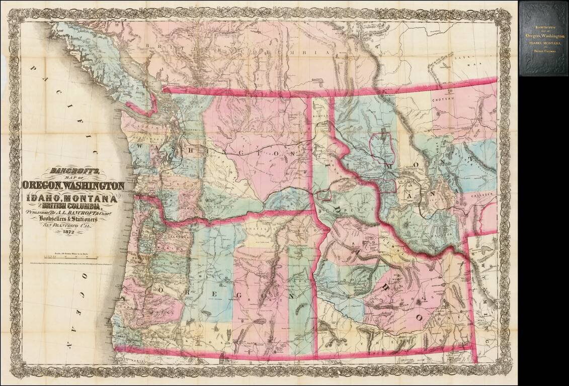
Rare separately issued map of the northwestern United States and British Columbia, issued in 1872 by A.L. Bancroft & Co. in San Francisco. Bancroft's map was first issued by HH Bancroft in 1868. The map was drawn from a section of Bancroft's...
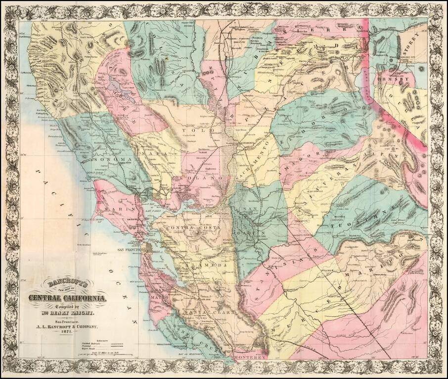
A Handsome Separately-Issued California Map Rare separately issued map of Central California and the Virginia City-Comstock Mining Region, compiled by William Knight and published by the San Francisco firm of A. L. Bancroft & Co. William Knight's...
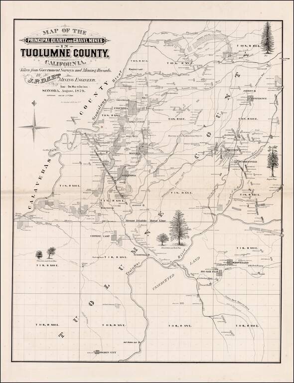
Scarce large format map of Tuolumne County. Includes extensive Mining and Government Survey Information and illustrations of the various types of Oak and Pine trees indigenous to the region. Shows towns, rivers, mining claims and other details. A...