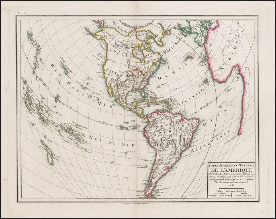
Detailed map of America, with the United States outlined in red, published in the Sixth Year of the First French Republic. The limited knowledge of the interior of North America and the Northwest Coast of America and Alaska are still quite evident....
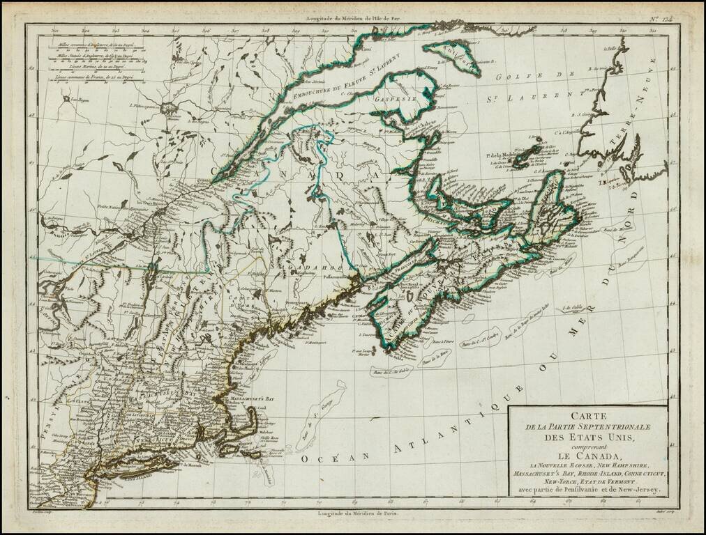
Finely detailed map of the Northeast extending from Philadelphia up the coast to Ile d'Anticosti and the mouth of the St. Laurence, published in Paris, shortly after the French Revolution. Extends inland to show part of Lake Ontario with fine detail...
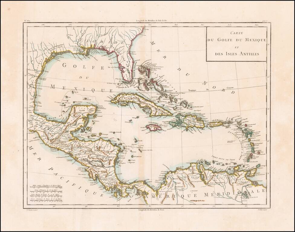
Scarce antique map of Florida, the Gulf Coast, and the Caribbean from Mentelle & Chanlaire's Atlas Universel…, engraved by Tardieu and drawn by Valet. Includes nice detail throughout the map.
![[9 Sheet Map of Iberian Peninsula] Carte D'Espagne et de Portugal en Neuf Feuilles . . .](/map/small/66894.jpg)
Fine large map of the Iberian Peninsula, from the period of the Anglo-Spanish War. The map is quite remarkable in its details, most notably its extensive treatment of roads and in some cases a curious number system which we could not decipher.