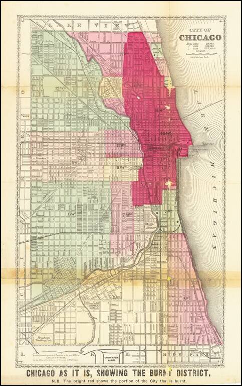
Detailed Plan of Chicago Showing the Area Ravaged by the Great Chicago Fire
Scarce map showing the area affected by the Chicago Fire of 1871, with the "Burnt District" colored in red.
The map has each street labeled, along with the rivers flowing...
antiquemaps.ru is sale. 12,000+ superb pieces of vintage collectible printable 300dpi maps - total 300GB high resolution rare and antique old map archive!
antiquemaps.ru website use cookies, local storage and other similar technologies. This is necessary to ensure the full functionality of our services. Using our services and sites after reading this notice means that you have given your consent to their use in your browser. Click "OK" to confirm your agreement