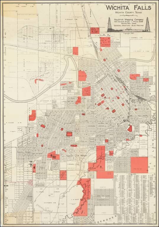
Large folding map of Wichita Falls, Texas, published in Wichita Falls in 1940 by the Heydrick Mapping Company. In the south the map extends below what is now Midwestern State University. In the north, the map extends about as far as the Highway 44-287...