logo

Henry Mouzon

Henry Mouzon


1

1775 - An Accurate Map of North and South Carolina With Their Indian Frontiers, Shewing in a distinct manner all the Mountains, Rivers, Swamps, Marshes, Bays, Creek, Harbours, Sandbanks and Soundings on the Coast; With the Roads & Indian Paths . . . .

  • $29.99

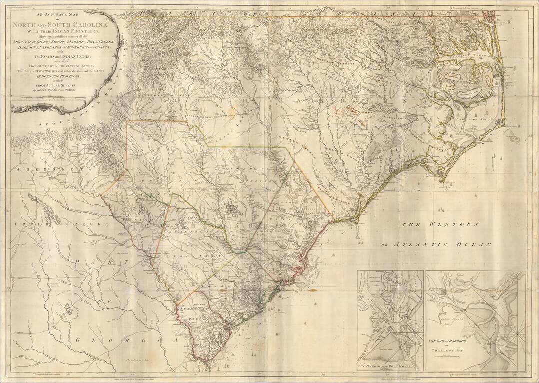
Second state of Henry Mouzon's landmark 4-sheet map of the Carolinas, the primary source for the geographical details of the Carolinas for the American, English and French armies during the American Revolution. Mouzon's map was unquestionably the most...


2

1777 - An Accurate Map of North and South Carolina With Their Indian Frontiers, Shewing in a distinct manner all the Mountains, Rivers, Swamps, Marshes, Bays, Creek, Harbours, Sandbanks and Soundings on the Coast; With the Roads & Indian Paths; as well as The Bo

  • $14.99

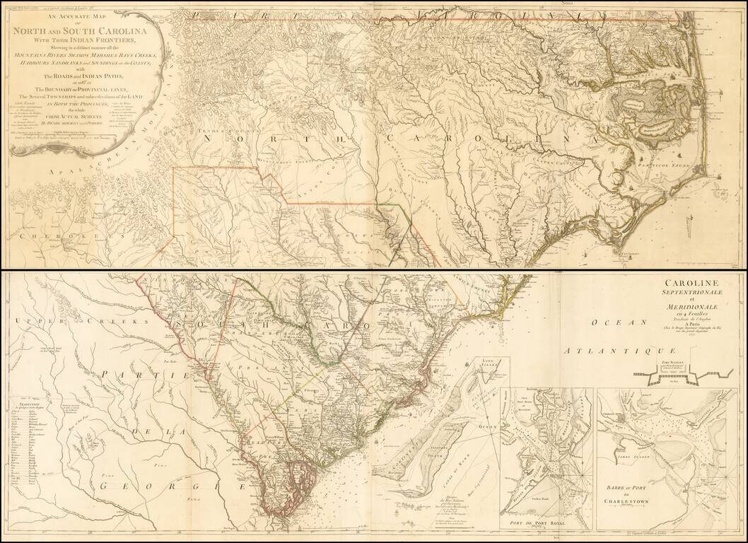
Second edition (first French Edition) of Henry Mouzon's landmark 4-sheet map of the Carolinas, the primary source for the geographical details of the Carolinas for the American, English and French armies during the American Revolution. Le Rouge...