Joseph Meyer (1796-1856) was a German publisher who released Meyers Konversations-Lexikon, a German-language encyclopedia in print from 1839 to 1984. Meyer was born in Gotha and educated as a merchant in Frankfurt, an important city in the book trade. He traveled in London in 1816 and was back in German in 1820, where he began to invest in textiles and railways. He opened his publishing operation, Bibliographisches Institut, in 1826. His publications each had a serial number, a new innovation at the time. He was best known for his atlases and the Meyers Universum (1833-1861), which featured steel-engravings of the world. The Universum stretched to 17 volumes in 12 languages and was subscribed to by 80,000 people all over Europe. Thanks to his publishing success, Meyer moved the Institut from Gotha to Hildburghausen in 1828. Meyer died in the latter city in 1856.
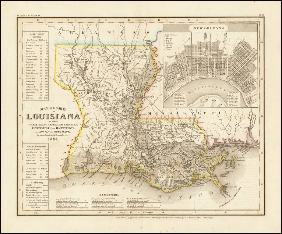
An elegantly engraved and highly detailed map of Louisiana, based upon Tanner's work in the early 1840s. Shows counties, towns, roads, canals, lakes, etc. Detailed inset town plan of New Orleans. While often referred to as the German Mitchell, this...
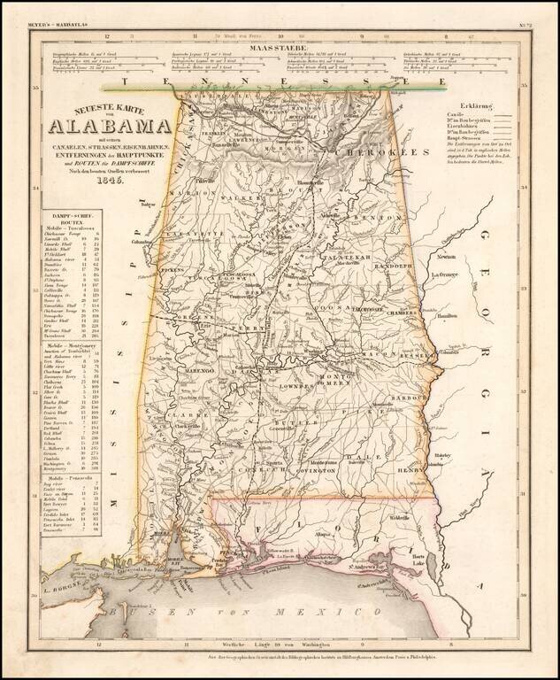
An elegantly engraved and highly detailed map of Alabama, based upon Tanner's work in the early 1840s. Shows counties, towns, roads, canals, lakes, etc. Detail includes western Florida. While often referred to as the German Mitchell, this...
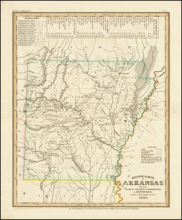
An elegantly engraved and highly detailed map or Arkansas, based upon Tanner's work in the early 1840's. Shows counties, towns, roads, canals, lakes, etc. While often referred to as the German Mitchell, this characterization is unfair, as the work...
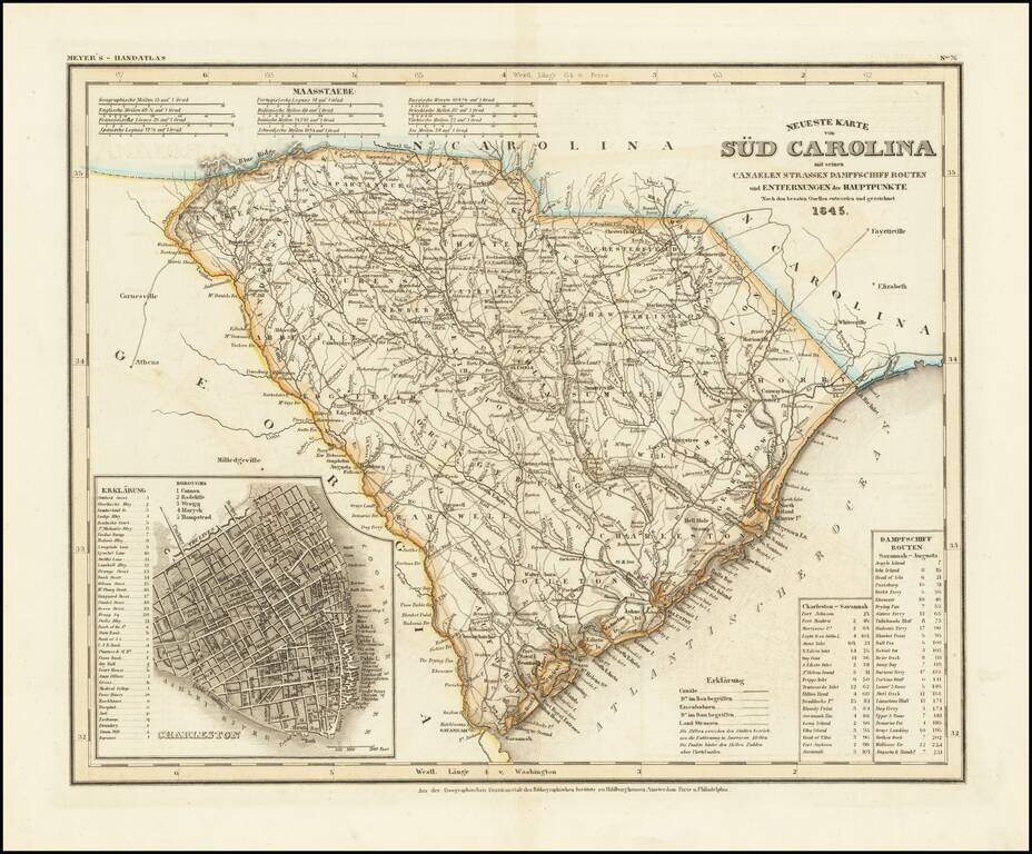
An antique map of South Carolina with German-language description based upon H. S. Tanner's map. The map purports to show the routes, railroads, and distances in the state, though it also locates various other features including rivers, canals, and...