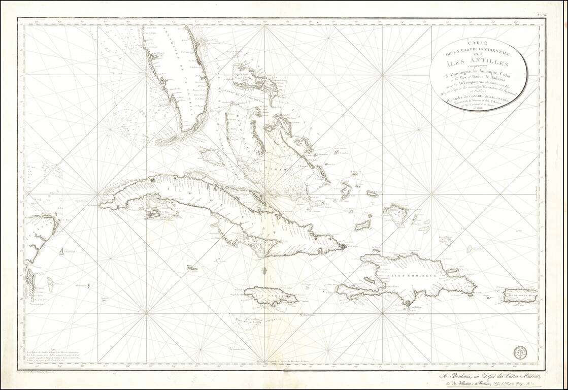
Detailed sea chart of South Florida, the Bahamas, Cuba, Jamaica, Cayman Islands, Puerto Rico, Santa Domingo and the part of the Yucatan Peninsula, published by the Depot De La Marine 1801. The chart is one of the most detailed maps of the region and...