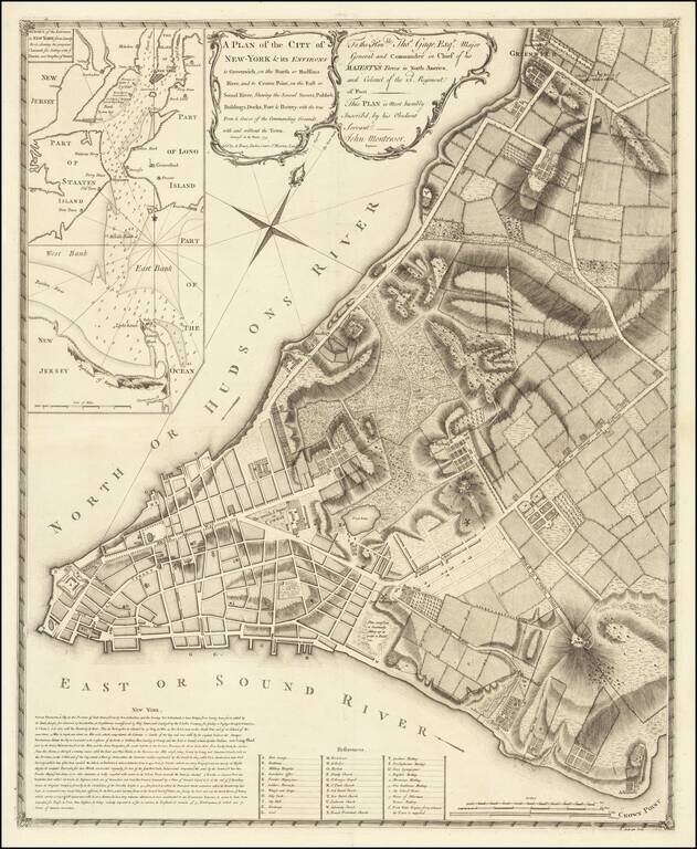
The First Large Scale Plan of New York City Fine example of John Montresor's map of lower Manhattan, the first large scale plan of New York City. Following the conclusion of the French & Indian War, the British introduced a number of measures in...
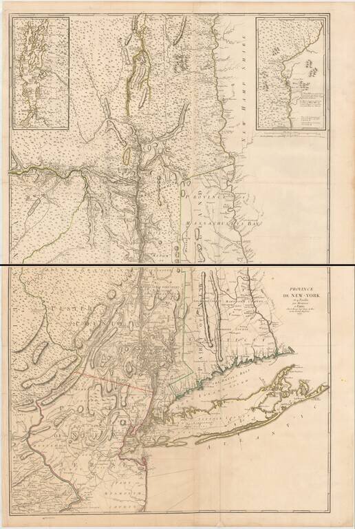
The Most Important Map of The British Colony of New York on the Eve of the American Revolution, With Revisions Added By The French For Use During the American Revolution. Fine example of the George Louis Le Rouge edition of John Montressor's...