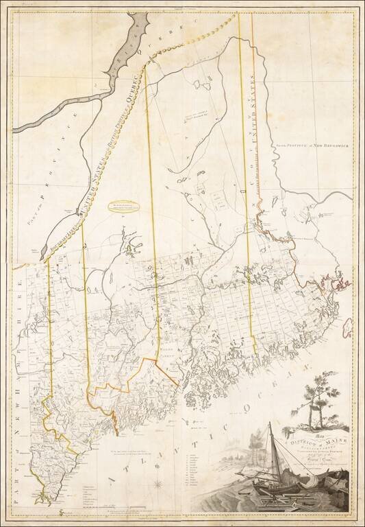
A Landmark Map of Maine Carleton's map of Maine is one of the most important early maps of the State. Drawn at a scale of 2.5 miles to the inch, the map illustrates in fine detail the intricate coastline and complex system of rivers, streams, lakes...
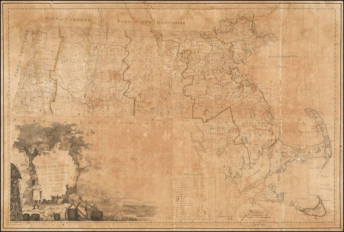
A Massachusetts Landmark Map -- The First Map Official Map of the State of Massachusetts Nice example of the first state of Osgood's Carleton's 1801 map of Massachusetts, the first officially sanctioned and sponsored map of the State. Based largely...