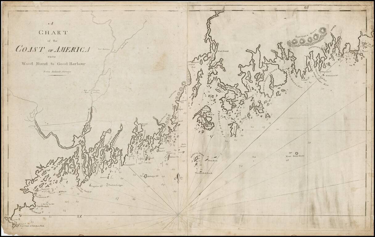
Important 2 sheet map of the coast of Maine, the second large format map of the region published in America. The map is exceptionally detailed for the period, with a wonderful primitive engraving style indicative of 18th Century American printing....
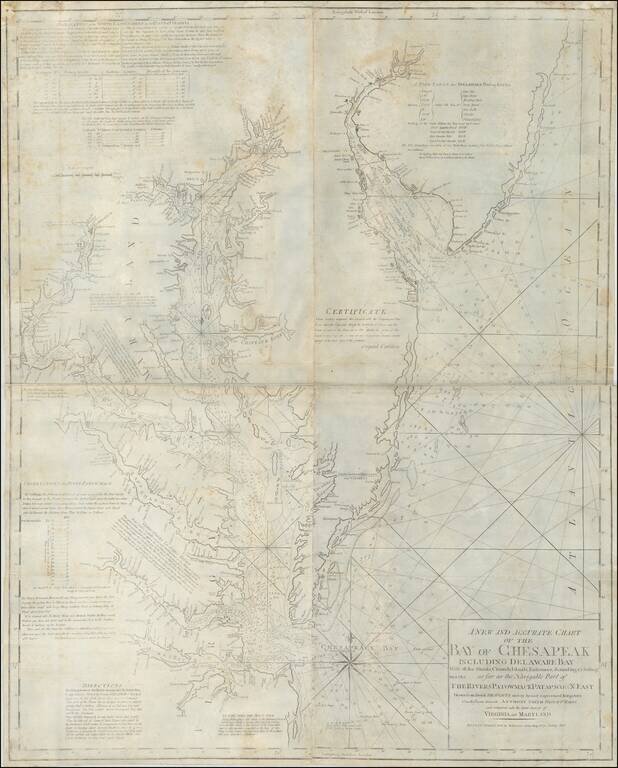
The First Large Format Sea Chart of the Chesapeake Published in America Fine large chart of the coastline from New Jersey south to Cape Henry, Virginia, published by William Norman in Boston. The chart includes a detailed treatment of the Chesapeake...