Cornelius de Wytfliet (ca.1550-ca. 1597) was a Flemish cartographer most famous for his Descriptionis Ptolemaicae Augmentum. The work was published in Louvain, Belgium, and had nineteen maps of the Americas.
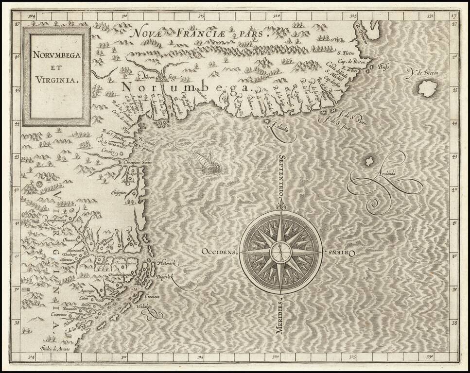
One of the Earliest Printed Maps of the East Coast of the United States. First state (left latitude written "30" instead of "39") of Cornelis van Wytfliet's Norumbega et Virginia, the highly important map of the Atlantic Seaboard of North America from...
![Limes Occidentis Quivira et Anian. 1597 [Pacific Northwest & Northwest Passage]](/map/small/71207.jpg)
The Second Printed Map of the Northwest of North America, including the Northwest Passage. This is a fine example of Wytfliet's map of the Northwest Coast of North America, the second printed map to focus on the region which would become Alaska and...
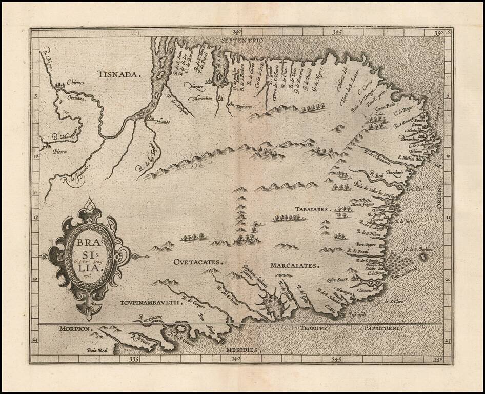
Wytfliet's map of Brazil is one of the earliest obtainable maps of the region. The map appeared in Wytfliet's Descriptionis Ptolemaicae Augmentum, the first atlas to focus on the mapping of the New World. In 1597 Cornelis van Wytfliet published his...