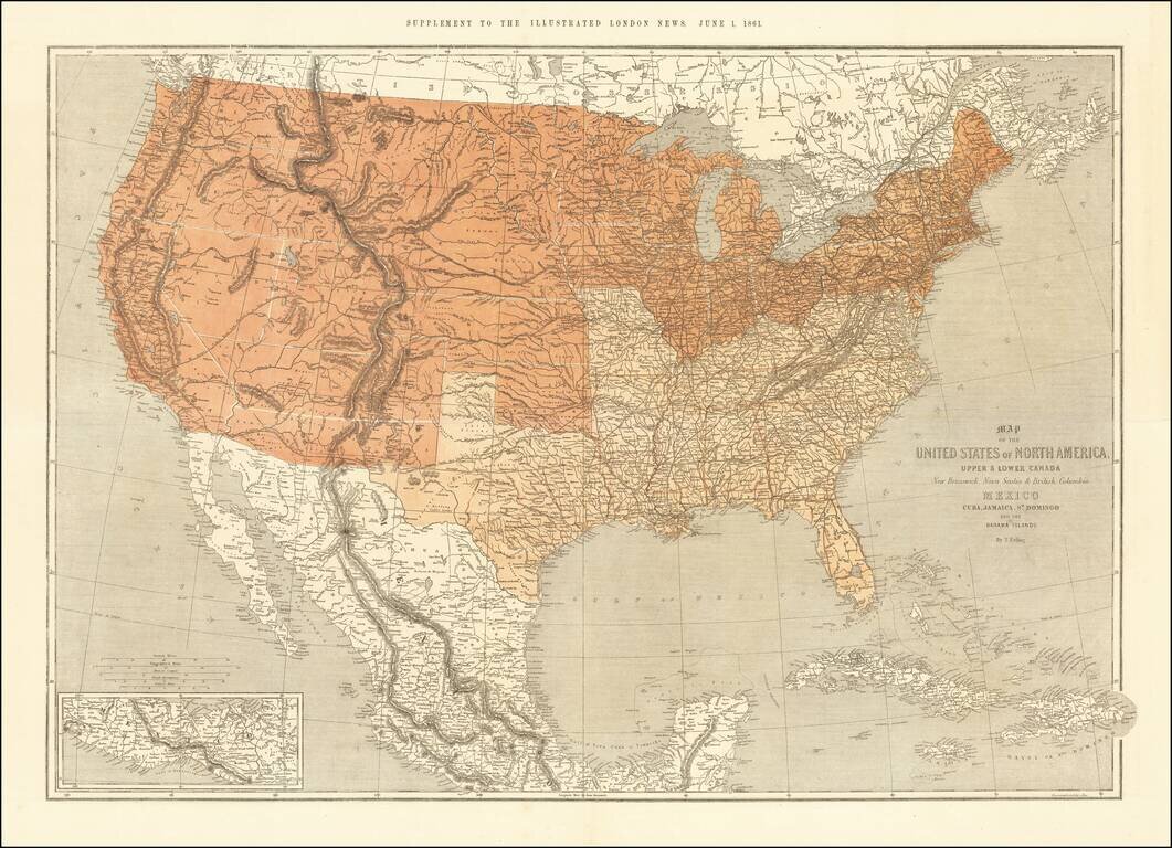
This is a scarce map of the United States, issued as a supplement to the Illustrated London News in 1861. The map is well detailed and shows the US split according to slave and free states. The map was clearly prepared in anticipation of the Civil War,...
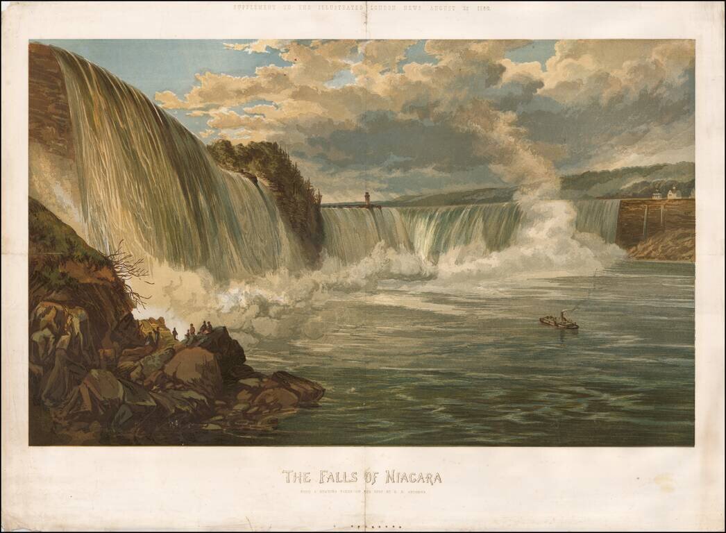
Rare color chromolithograph of Niagara Falls, with a small steamship in the center and several buildings visible at the top of the falls. The image was issued as a supplement to the Illustrated London News on August 25, 1860.
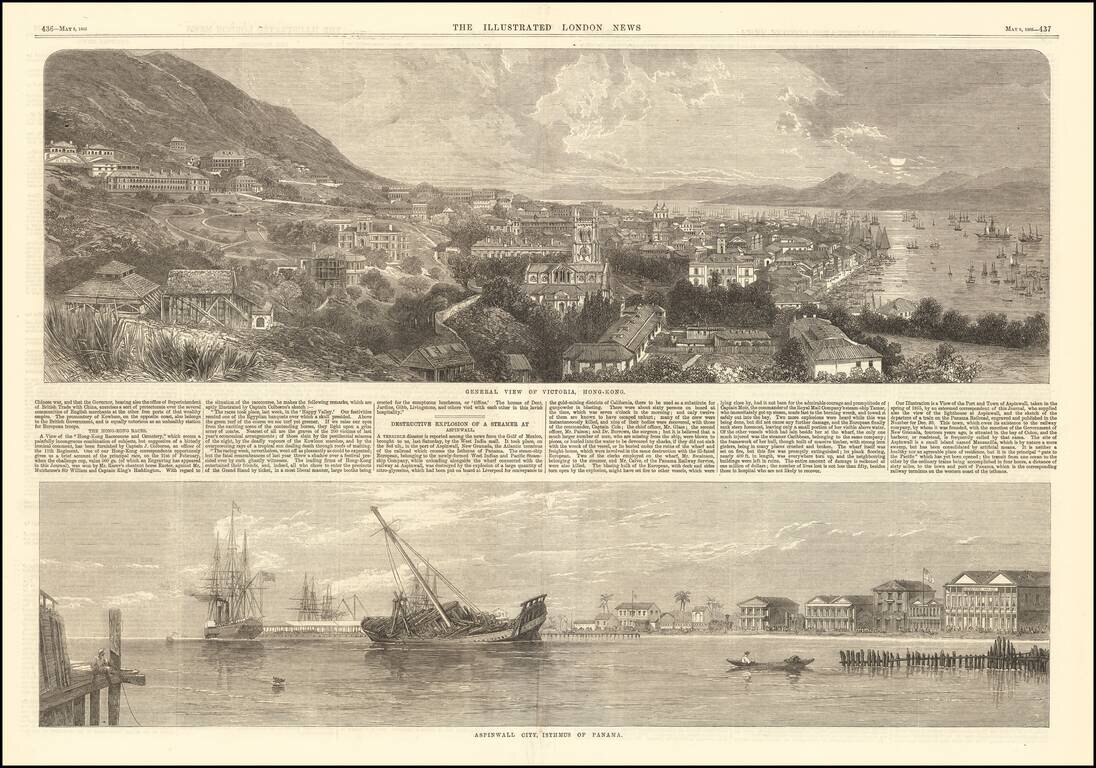
Fine early view of Victoria, Hong Kong, published by the Illustrated London News. The short article below notes that the view illustrates the Race Course and Cemetary, based upon an image furnished by Captain J. Colborne, an officer of the 11th...