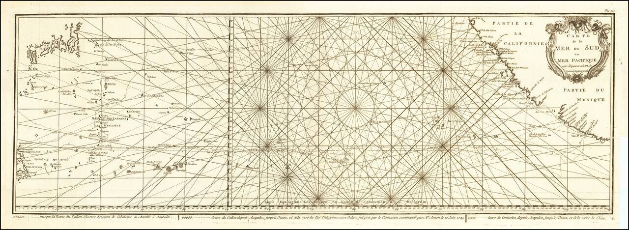
Impressive Chart of the Pacific Ocean Depicting a Thrilling Circumnavigation Dynamic chart of the mid-Pacific Ocean from the French-edition of Anson’s bestselling voyage account. It includes voyage tracks of Anson’s Centurion and the ship he...
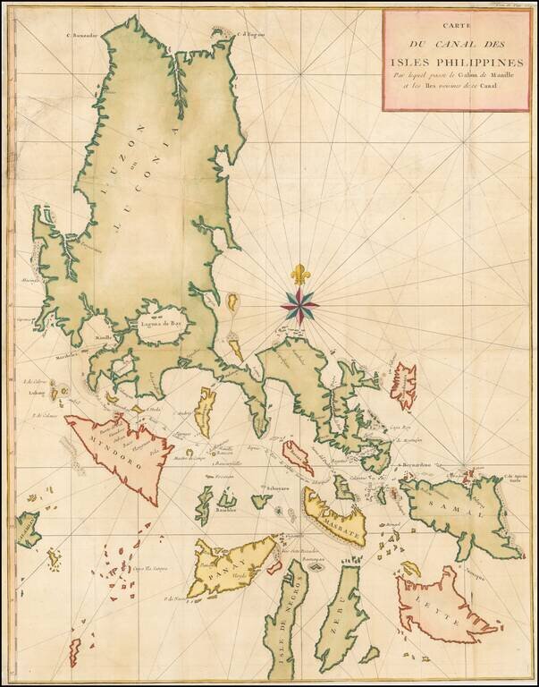
Large detailed chart of the Islands of the Philippines from the French edition of Anson's Voyages. One of the most detailed charts of the Philippines of the era. Shows Islands, bays, reefs, soundings tracks of the Manila Galleon route, etc. Includes a...
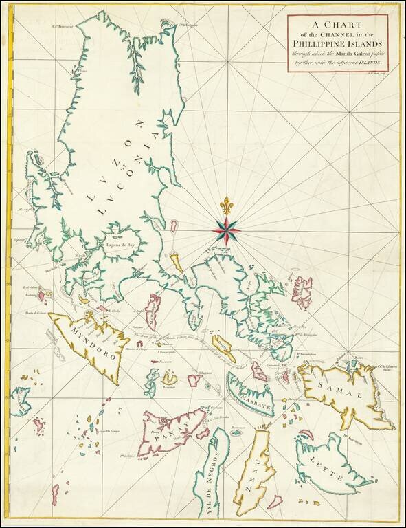
Chart of Philippines from Anson’s Voyage round the World, Part of His Plan to Capture a Spanish Treasure Galleon Nicely colored example of George Anson's chart of the Philippine Islands, showing the area from Luzon to Leyte, Zebu and Ysle De...
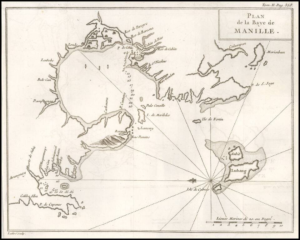
One of the Earliest Obtainable Plans of Manilla Bay. Detailed chart of Manilla Bay and environs, including placenames, soundings, etc. From a French edition of Anson's Voyages. One of the best maps of Manilla Bay from the period.