![[From the Library of Captain Louis Freycinet] Carte Hydrographique Des Partes Connues De La Terre Dressee sur la Projection de Mercator, Poar C.LO. Gressier , Ingenieur Hydrographe de la Marine . . . 1835 (with extensive manuscript annotations)](/map/small/58604.jpg)
Annotated Sea Chart of the World Presented To The Explorer Louis Freycinet In Support of A Report to the French Academy of Sciences on The Prevailing Winds At Sea. Finely-detailed, sea chart of the world with extensive manuscript annotations,...
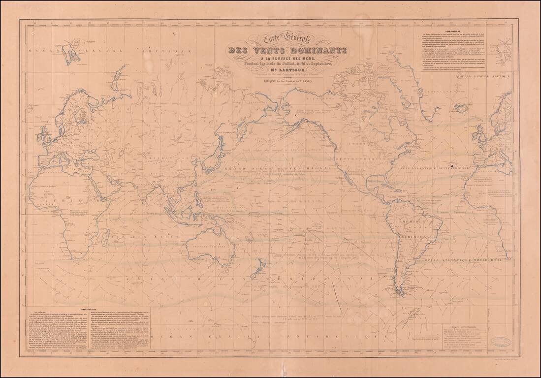
Extremely Rare Map of the World Showing Theory of the Winds Very rare map of the world showing the system of wind currents developed by French naval officer Joseph Lartigue. One of only two known examples and the only one in private hands, this world...