Jean-Claude Dezauche (fl. 1780-1838) was a French map publisher. He edited and reissued the maps of Guilluame De L’Isle and Philippe Buache, two of the most skilled mapmakers of the eighteenth century. He acquired the plates of these two men’s work in 1780 from Buache’s heir, Jean Nicholas Buache. Dezauche worked in the Depot de la Marine, as had the elder Buache.
![Mappemonde a l'usage de l'Instr.on. par Guillaume Delisle et Philippe Buache Premiers Geographes et de l'Academie des Sciences. Revue e Augmentee des Nlles. Decouvertes par Dezauche . . . [Shows Cook's Discoveries in the Pacific]](/map/small/61573.jpg)
Printed in the 9th Year of the French Revolution Interesting double hemisphere map of the World, revised by Dezauche to include the discoveries of Captain James Cook on his three voyages of exploration in the Pacific. Among the most noteworthy...
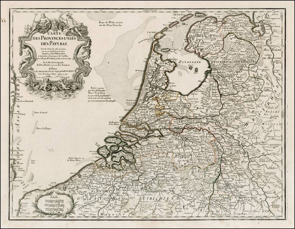
Detailed map of the Netherlands and Belgium, originally based upon the work of De L'Isle and Buache. Decorative Cartouche.
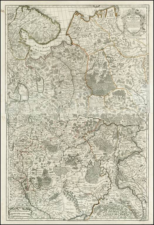
Detailed map of Russia and Ukraine, based upon an earlier map by Guillaume De L'Isle.
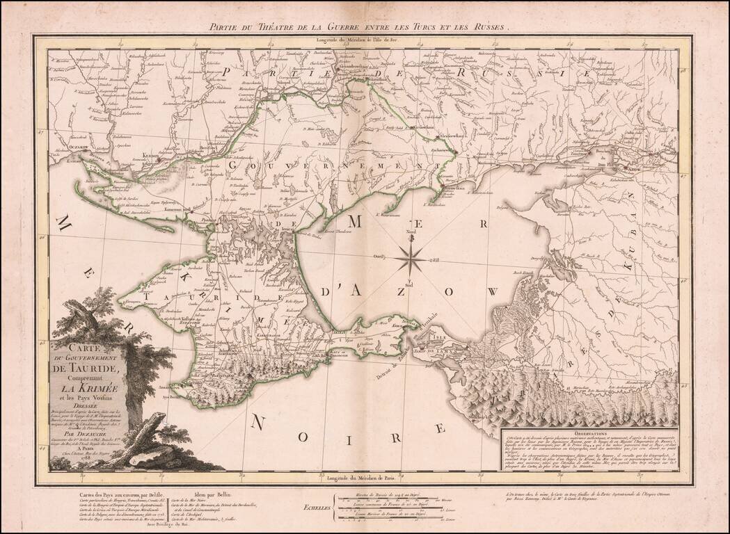
Dezauche's map illustrates the theater of the Russo-Turkish War that began in 1787, one year before the publication of the map. At the end of the previous Russo-Turkish War, Russia had annexed the Crimean Khanate, but the Ottomans sought to regain the...
![Carte de la Grece Dressee sur un grand nombre de memoires anciens et nouveaux, Sur ceux de Mrs. Whele et Tournefort . . . 1780 [includes Cyprus]](/map/small/24740.jpg)
Detailed map of Greece, Turkey and Cyprus, originally based upon the work of De L'Isle and Buache. Includes a substantial part of Cyprus.
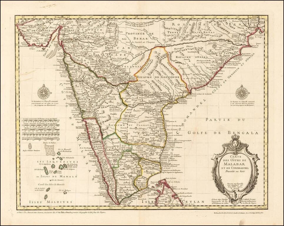
Finely Detailed Map of Southern India Emphasizing Trade Finely engraved map of the southern part of India, first issued in 1723 by acclaimed French mapmaker Guillaume De L’Isle. It focuses on trade routes within India, as well as the Coromandel and...