De Wit (1629 ca.-1706) was a mapmaker and mapseller who was born in Gouda but who worked and died in Amsterdam. He moved to the city in 1648, where he opened a printing operation under the name of The Three Crabs; later, he changed the name of his shop to The White Chart. From the 1660s onward, he published atlases with a variety of maps; he is best known for these atlases and his Dutch town maps. After Frederik’s death in 1706, his wife Maria ran the shop for four years before selling it. Their son, Franciscus, was a stockfish merchant and had no interest in the map shop. At the auction to liquidate the de Wit stock, most of the plates went to Pieter Mortier, whose firm eventually became Covens & Mortier, one of the biggest cartography houses of the eighteenth century.
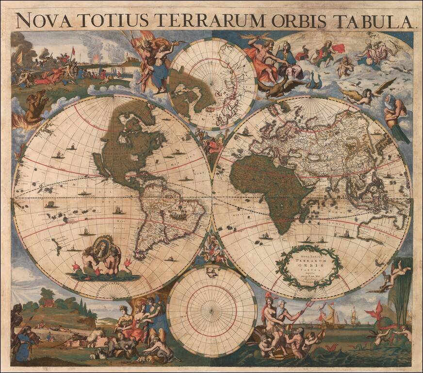
Unrecorded 17th Century Wall Map of the World By Cornelis Danckerts Old color example of this unrecorded 4-sheet wall map of the World, published in Amsterdam by Cornelis Danckets. The present example is an extraordinary survival, being the earliest...
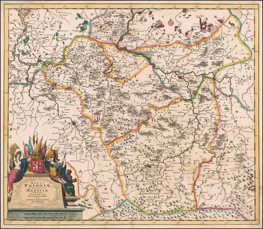
Fine old color example of this rare map of Poland Lithuania and Ukraine, etc., published in Amsterdam by Cornelis Danckerts and engraved by A. Schut. The map was later issued by Reiner & Josua Ottens during the first part of the 18th Century. The...
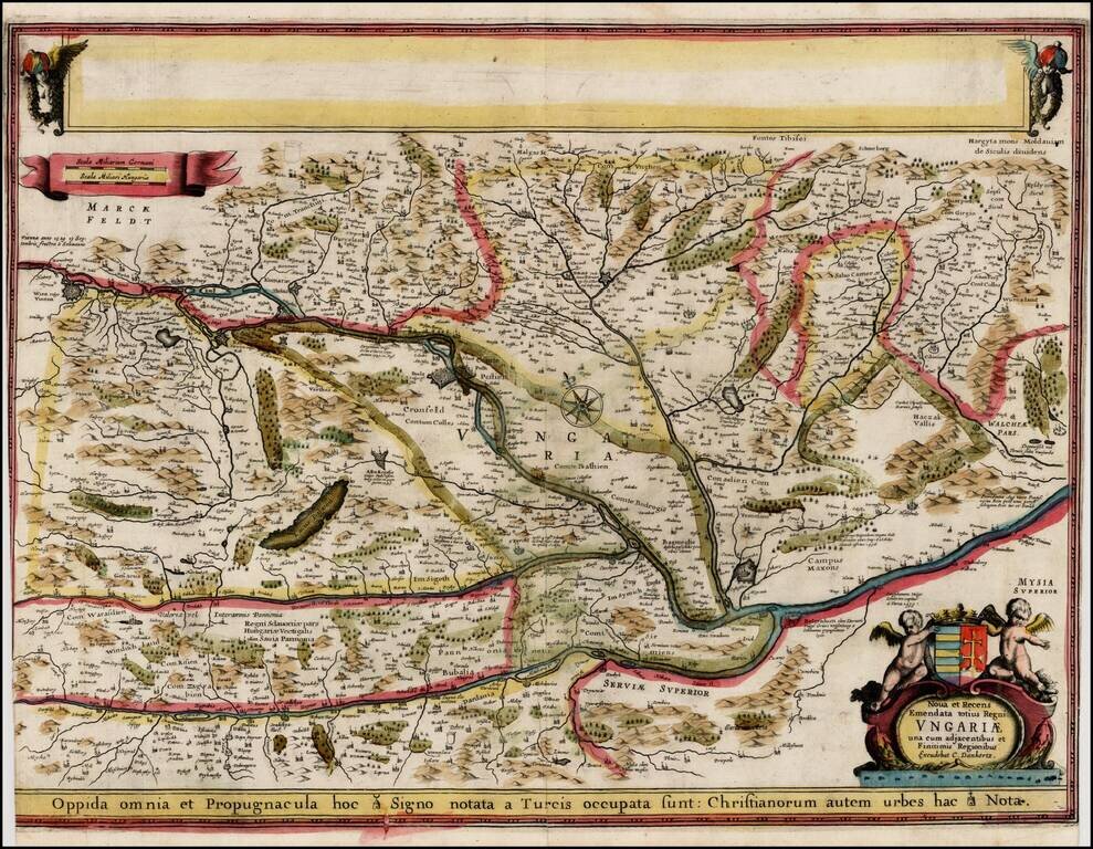
Extremely rare proof state of Danckert's map of Hungary, pre-dating the addition of 2 views in the upper blank box and the only edition to bear the name Cornelis Danckerts. The proof state is known in only a few examples, one of which is in the...
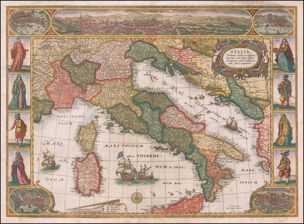
Rare decorative map of Italy, published in Amsterdam by Cornelis Danckerts. Striking example of State 3 of Willem Blaeu's rare carte-a-figures map of Italy, first published in 1606. The map is based on the Mercator map of 1589. The map is embellished...
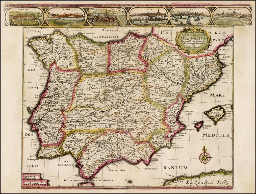
Rare separately issued map of the Iberian Peninsula, published in Amsterdam by Cornelis Danckerts in 1640. Includes views of Barcelona, Madrid, Escorial Palace, Sevilla, Lisbone and Valladolid. Rarely seen map, in early English Color. Side panels...
![Nova Persiae Armeniae Natoliae et Arabiae [shows Cyprus]](/map/small/70383.jpg)
Rare Cornelis Danckerts edition of this decorative and highly desirable map of the region bounded by the Saudi Peninsula, Red Sea, Nile River, Cyprus, Asia Minor, the Gulf of Aden, Indian Ocean, Armenia, the Caspian Sea, Afghanistan and the Indian...