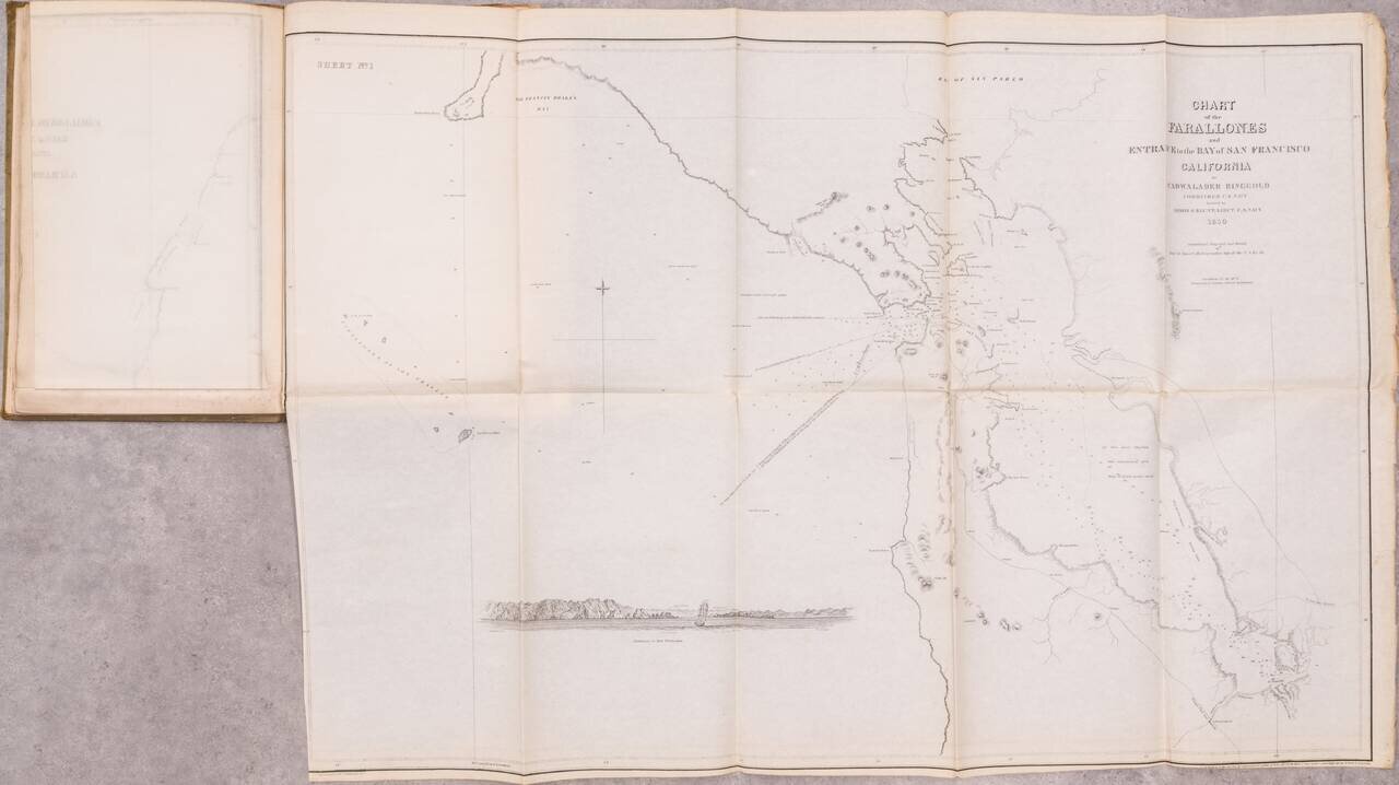
The First Set of Published Charts Focusing on California This is the fourth edition of Cadwalader Ringgold's A Series of charts, and the second to include Ringgold's San Francisco Bay surveys. The work has the distinction of being the first set of...
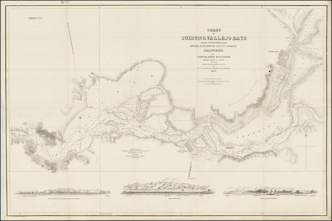
The Earliest Map of the Lower Sacramento River and San Joaquin River (Sacramento Delta) One of the earliest obtainable privately issued California charts, tracking the lower Sacramento and San Joaquin Rivers as they leave the Gold Regions of...
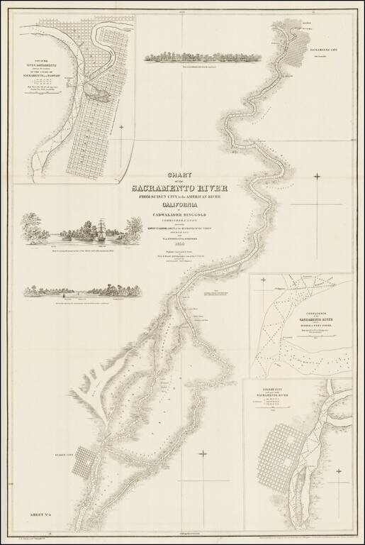
Fine example of Ringgold's map of the Sacramento River, from Suisun City and Brannan Island in the South, to Sacramento City, Boston and the American River. The map includes 3 profile views from the Sacramento River, each showing large sailing vessels...
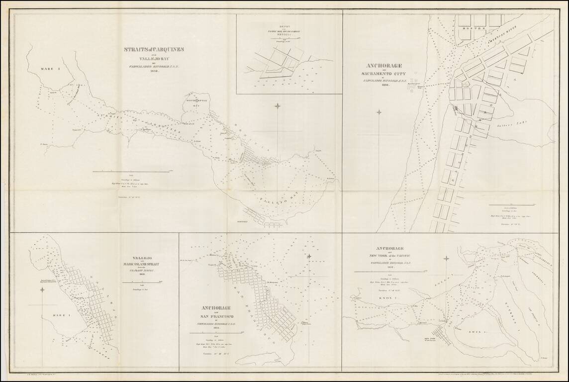
Nice example of Ringgold's chart of harbors and anchorages from San Francisco to Sacramento. The chart shows the primary anchorages in San Francisco Bay and environs at the outset of the 1849 California Gold Rush. Cadwalader Ringgold was a US Navy...