
One of the Most Detailed and Important Map of the Americas made by a Scandalous Geographer This is a nice example of the 1775 edition of this important six sheet chart of North and South America, originally compiled by John Green (a.k.a. Bradock...
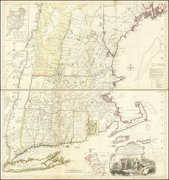
Rare separately issued example of the first edition, second state of Bradock Mead's remarkable large format map of New England & Long Island, the most important general map of the region issued during the French & Indian War. Bradock Mead's...
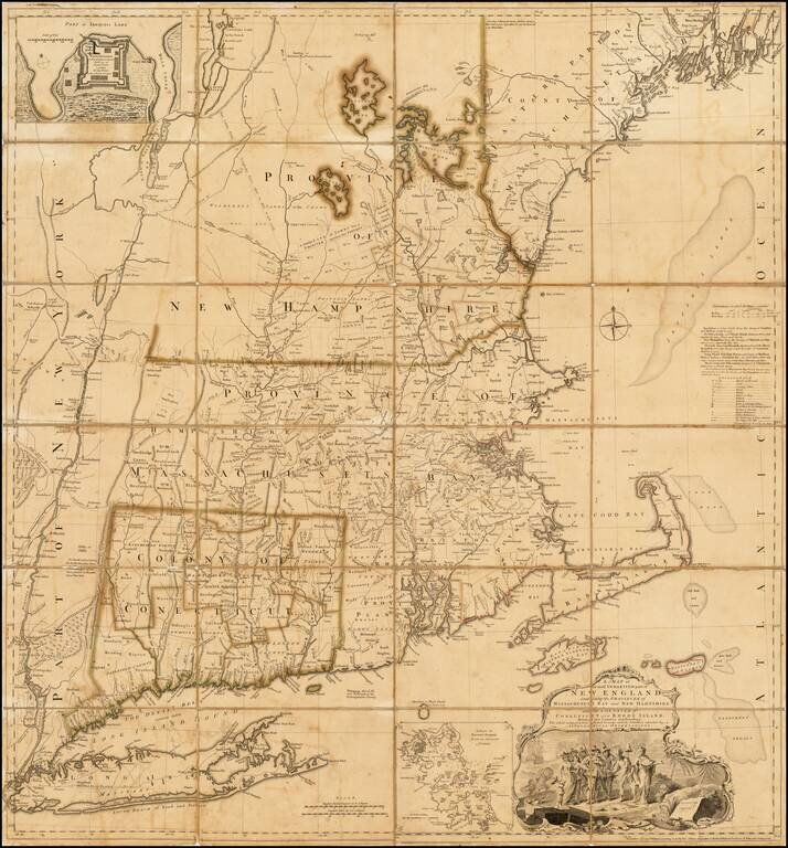
The Most Important Map of New England At The Time of the American Revolution Nice example of Bradock Mead's remarkable large format map of New England & Long Island, the most important general map of the region at the commencement of the...
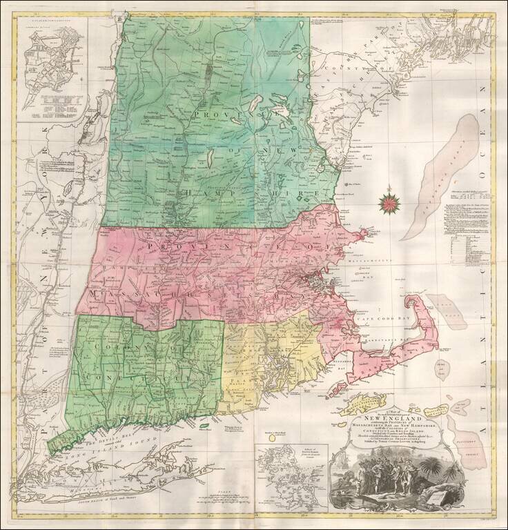
T.C. Lotter Edition of The Most Important Map of New England At The Time of the American Revolution. Fine old color example of the T.C. Lotter edition of Bradock Mead's 4-sheet map of New England & Long Island, the most important general map of...