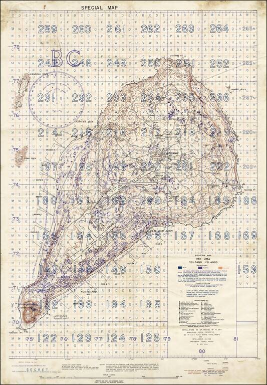
"SECRET" Situation Map of Iwo Jima Detailing the Minutiae of the Japanese Defense of the Island. A rare "Secret" situation map of Iwo Jima prepared in anticipation of the 19 February 1945 U.S. invasion of the island. The map shows the landing zones on...
![(Second World War - Iwo Jima) Beach Diagram Southwestern Beaches, Iwo Jima Information Taken from Aerial Photographs of 4 July 1944... [with] Becah Diagram Southeastern Beaches, Iwo Jima Beach Information taken from Aerial Photographs of 4 July 1944...](/map/small/62967.jpg)
"SECRET" Beach Diagrams used for Planning and Executing the American Landings on Iwo Jima. Two very rare color-printed views of the southern beaches of Iwo Jima, the southwestern section of which served as a potential landing area for the U.S. Marine...