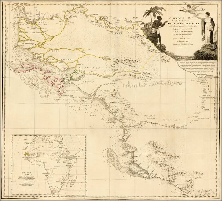
Detailed map of the region bounded by the Gambia River in the north and Cape Mezurado (Liberia) in the south, covering the countries of Gambia, Guinea, Sierra Leone and part of Gambia, which appeared in Captain Philip Beaver's A frican Memoranda:...
antiquemaps.ru is sale. 12,000+ superb pieces of vintage collectible printable 300dpi maps - total 300GB high resolution rare and antique old map archive!
antiquemaps.ru website use cookies, local storage and other similar technologies. This is necessary to ensure the full functionality of our services. Using our services and sites after reading this notice means that you have given your consent to their use in your browser. Click "OK" to confirm your agreement